Washington
Trip Reports in Washington (On Map)
| Purple Paddle - Successful climb/canyon non winter & non technical | Blue Paddle - Successful peak climb in winter months (December - April) | Green Starred Paddle - Successful technical ascent | Red Stop Paddle - Worthy, but unsuccessful attempt | Hiker - Hiking trip |
Trip Reports in Washington (List)
|
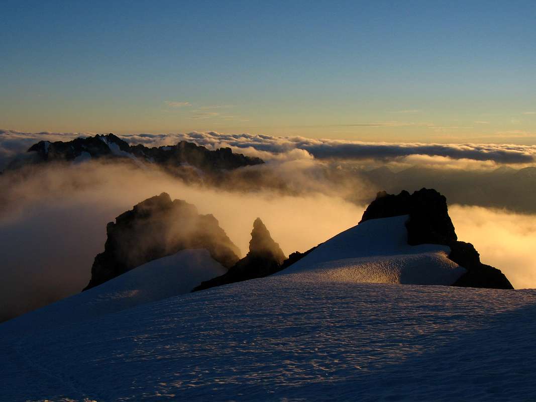
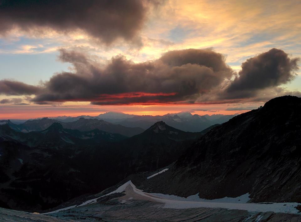
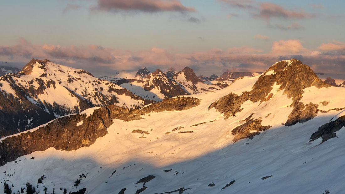
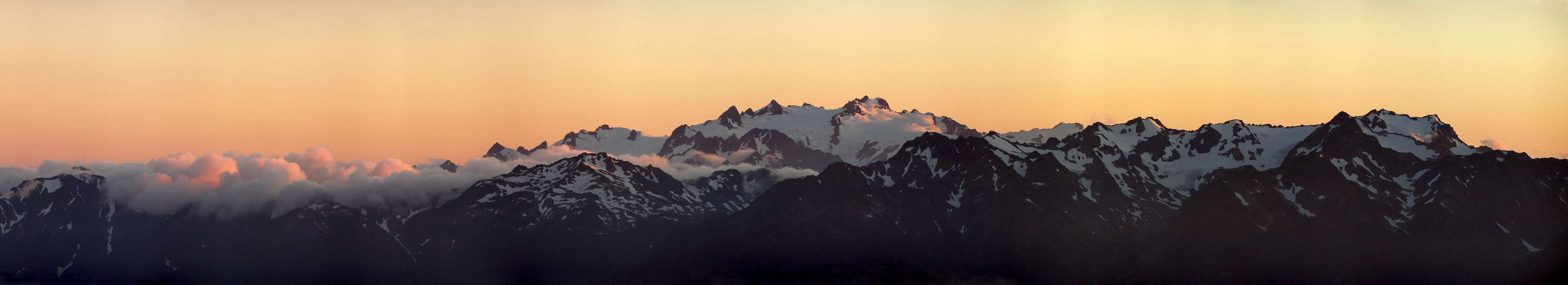
Sunset from Sahale Glacier
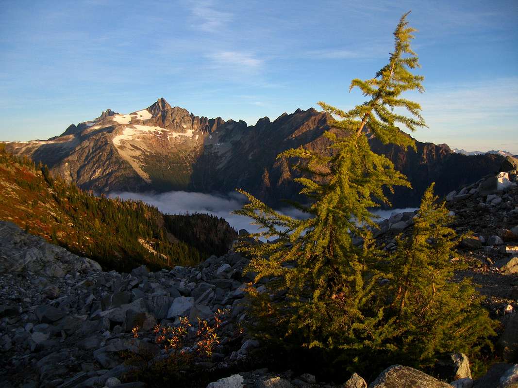
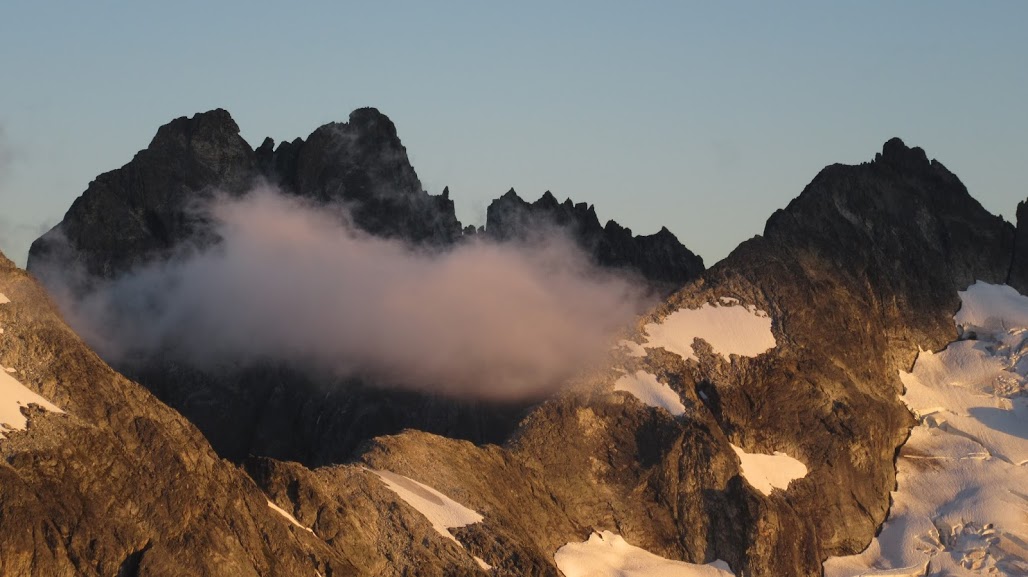
Snowfield Peak
Josh Rappelling Forbidden Peak
Primus Peak Sunrise
Sunrise on Lincoln Peak
Reynolds Peak
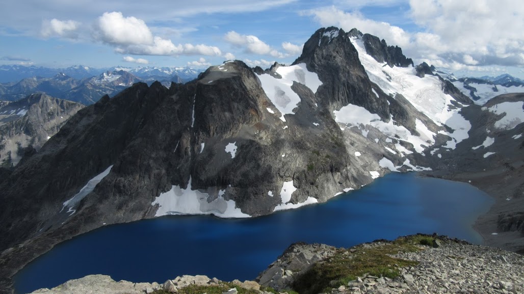
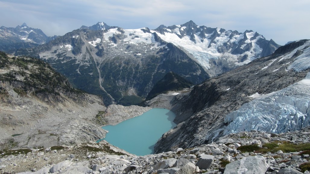
Mount Spickard and Silver Lake
Sunset on the Mox Spires
Dorado Needle at Dusk
Klawatti Lake
Sunset from the Inspiration Traverse
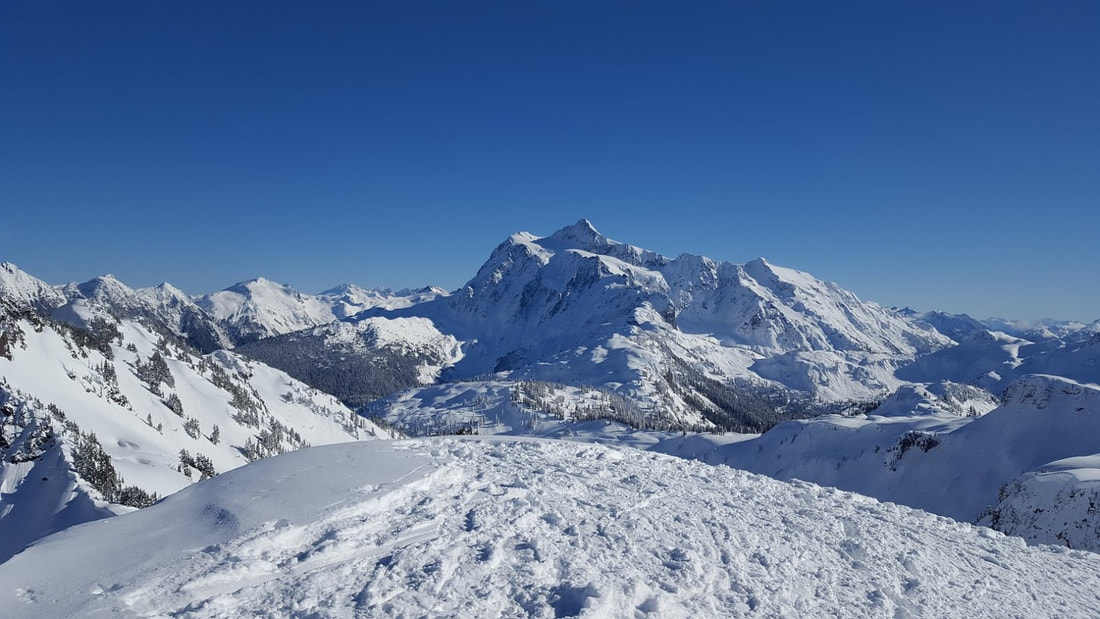
Shuksan from Mazama Dome
Snowking Mountain
Camp on Ptarmigan Ridge
|


Brief Overview
|
Glacier Peak Wilderness
Shi Shi Beach on the Pacific Coast
Dungeness River - Olympic Rainforests
Sunrise from Jack Mountain
|
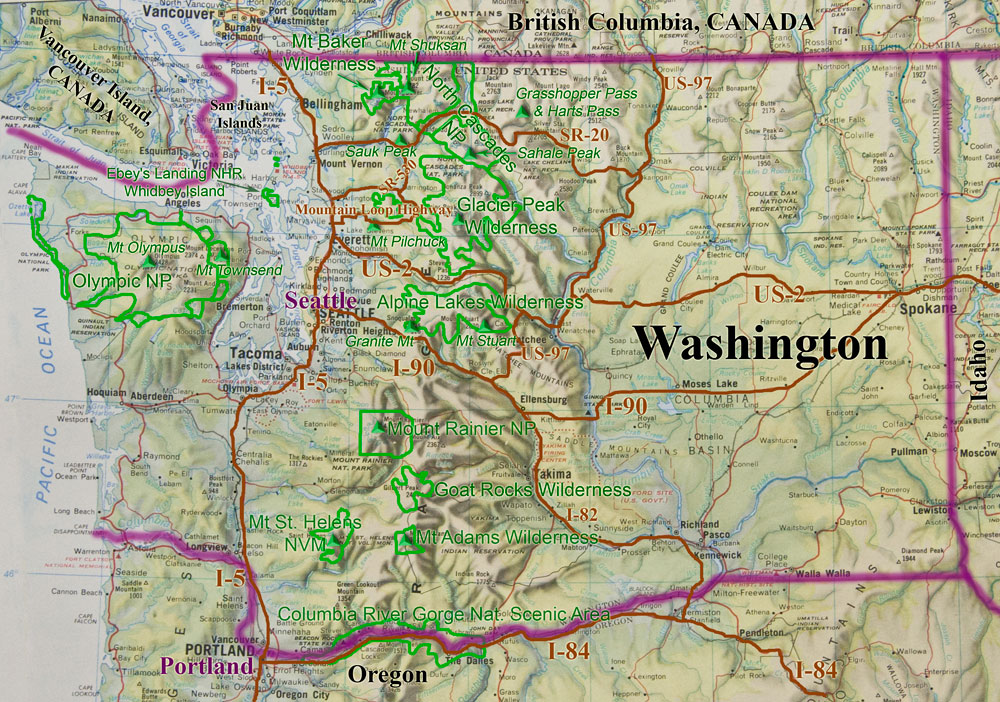
The state of Washington is a very unique and diverse place. One can almost argue you can split the state in half and no one would notice. The western half is very wet and mild while the eastern half has more of a continental climate and is drier. Two great mountain ranges are found here, the Olympics and the Cascades. The main industrial of Seattle and the Puget Sound lowlands lie between these two ranges. On the Olympic Peninsula west of Seattle, Olympic National Park protects the only temperate rain forest in North America. The Olympic Mountains is a very diverse area with all ecosystems ranging from rain forest to glacier capped alpine mountains. The radial drainage pattern of these mountains is quite unique and Mount Olympus at the center is the highest in the range lies at 7,995 feet in elevation. Further west, Washington has an entire coastline of rugged Pacific beaches protected by the National Park. This area is also where much of the rich native american history can be found. This area gets very active around the 4th of July.Further east, on the other side of the Puget Lowlands is the mighty Cascade Range which is broken down mainly politically rather than geologically. First off, the Cascade Crest and areas to the west are much wetter and far more glaciated than the mountains slightly to the east. There are three distinct regions fitting this description. The North Cascades National Park is far and away the most mountainous, rugged and remote area in the Washington Cascades. Giant glaciers like the Boston Glacier, Chikamin Glacier and the Inspiration Glacier stretch all the way down below 6,000 feet in places. Further south lies the Glacier Peak Wilderness, one of the nations largest wilderness areas which is centered around Glacier Peak. This mountain is one of the five volcanoes in the state and is a very long trek to get to. The Alpine Lakes Wilderness expands from Highway 2 at the north to I-90 at the south marks the southern end of the Washington Cascades west of the crest. However the Stuart lies considerably east of the crest and the area around Leavenworth is one of the best in the state for rock climbing, ice climbing and hiking. East of the Cascade Crest the scenery is much different. The mountains receive much less snowfall and the forests are thinner. Alpine and Western larch trees are abundant which turn brilliant yellow and gold during the fall. Generally these areas are more accessible but also less rugged and include the Pasayten Wilderness at the northern end, and the Chelan Sawtooth Wilderness just east of the Glacier Peak Wilderness. Even though these areas get less moisture and are less rugged, they are typically higher in elevation. The effect the rain shadow has is very dramatic. Eastern Washington on the other hand can easily be mistaken for the great plains. Vast areas of farmlands line the flat landscape for as far as you can see. Nearly the entire eastern half of the state has basalt at the surface from the Columbia River Basalt flows. Only the northeastern corner has some lower mountains surrounding Omak. Spokane is the main population center for the entire area. Now the southern Cascades south of I-90 are mainly foothills with three dominant features. These are the three monster volcanoes of Mount Rainier, Mount Adams and Mount St. Helens. At 14,411 feet, Mount Rainier is by far the highest point in the state and is an icon for the state. Most people when they think of Washington they think of only three things: Mount Rainier, the Space Needle and Rain.
|


Washington "Bulgers" Top 100 Peaks
| #01 |  |
Mt. Rainier | 14,411 ft (13211P) |
| #02 |  |
Mt. Adams | 12,276 ft (8116P) |
| #03 |  |
Little Tahoma | 11,138 ft (858P) |
| #04 |  |
Mt. Baker | 10,781 ft (8881P) |
| #05 |  |
Glacier Peak | 10,520+ ft (7480P) |
| #06 | 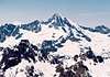 |
Bonanza Peak | 9,511 ft (3711P) |
| #07 | 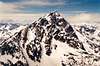 |
Mt. Stuart | 9,415 ft (5335P) |
| #08 | 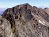 |
Mt. Fernow | 9,249 ft (2809P) |
| #09 | 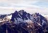 |
Goode Mountain | 9,200+ ft (3800P) |
| #10 |  |
Mt. Shuksan | 9,131 ft (4411P) |
| #11 | 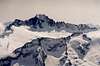 |
Mt. Buckner | 9,112 ft (3032P) |
| #12 | 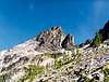 |
Seven Fingered Jack | 9,100 ft (380P) |
| #13 | 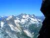 |
Mt. Logan | 9,087 ft (1487P) |
| #14 |  |
Jack Mountain | 9,066 ft (4186P) |
| #15 |  |
Mt. Maude | 9,040+ ft (880P) |
| #16 |  |
Mt. Spickard | 8,979 ft (4779P) |
| #17 |  |
Black Peak | 8,970 ft (3450P) |
| #18 |  |
Mt. Redoubt | 8,969 ft (1649P) |
| #19 |  |
Copper Peak | 8,964 ft (484P) |
| #20 |  |
North Gardner Mountain | 8,956 ft (3996P) |
| #21 | 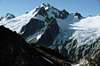 |
Dome Peak | 8,920+ ft (3040P) |
| #22 |  |
Gardner Mountain | 8,898 ft (698P) |
| #23 |  |
Boston Peak | 8,894 ft (854P) |
| #24 | 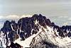 |
Silver Star Mountain | 8,876 ft (2436P) |
| #25 |  |
Eldorado Peak | 8,868 ft (2188P) |
| #26 | 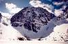 |
Dragontail Peak | 8,840+ ft (1760P) |
| #27 |  |
Forbidden Peak | 8,815 ft (1055P) |
| T28 |  |
Mesahchie Peak | 8,795 ft (2235P) |
| T28 |  |
Oval Peak | 8,795 ft (2715P) |
| #30 |  |
Fortress Mountain | 8,760+ ft (1680P) |
| #31 | 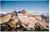 |
Mt. Lago | 8,745 ft (3265P) |
| #32 | 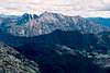 |
Robinson Mountain | 8,726 ft (1686P) |
| #33 |  |
Colchuck Peak | 8,705 ft (665P) |
| #34 | 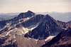 |
Star Peak | 8,690 ft (1170P) |
| #35 |  |
Remmel Mountain | 8,685 ft (4365P) |
| T36 |  |
Katsuk Peak | 8,680+ ft (440P) |
| T36 |  |
Sahale Mountain* | 8,680+ ft (80P) |
| #38 |  |
Cannon Mountain | 8,638 ft (838P) |
| #39 |  |
Mt. Custer | 8,630 ft (1230P) |
| #40 |  |
Ptarmigan Peak | 8,614 ft (894P) |
| #41 |  |
Sherpa Peak | 8,605 ft (405P) |
| #42 | 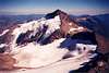 |
Clark Mountain | 8,602 ft (1522P) |
| #43 |  |
Cathedral Peak | 8,601 ft (961P) |
| #44 |  |
Kimtah Peak | 8,600+ ft (1040P) |
| #45 |  |
Mt. Carru | 8,595 ft (955P) |
| #46 | 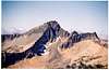 |
Monument Peak | 8,592 ft (1072P) |
| #47 |  |
Cardinal Peak | 8,590 ft (2070P) |
| #48 | 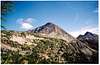 |
Osceola Peak | 8,587 ft (1147P) |
| #49 |  |
Raven Ridge | 8,580 ft (1100P) |
| #50 | 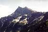 |
Buck Mountain | 8,528 ft (1888P) |
| T51 |  |
Storm King | 8,520+ ft (600P) |
| T51 |  |
Enchantment Peak | 8,520 ft (480P) |
| #53 | 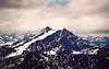 |
Reynolds Peak | 8,512 ft (2032P) |
| #54 | 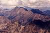 |
Martin Peak | 8,511 ft (2111P) |
| #55 |  |
Primus Peak | 8,508 ft (828P) |
| T56 | 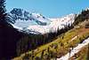 |
Dark Peak | 8,504 ft (264P) |
| T56 | 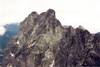 |
Mox Peaks, SE Spire | 8,504 ft (904P) |
| #58 | 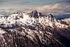 |
Cashmere Mountain | 8,501 ft (1581P) |
| #59 | 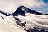 |
Klawatti Peak | 8,485 ft (685P) |
| T60 |  |
Mt. Rahm | 8,480+ ft (280P) |
| T60 |  |
Horseshoe Peak | 8,480+ ft (80P) |
| #62 | 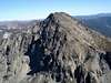 |
Big Craggy Peak | 8,470 ft (3070P) |
| T63 | 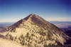 |
Hoodoo Peak | 8,464 ft (424P) |
| T63 | 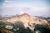 |
Lost Peak | 8,464 ft (1624P) |
| #65 |  |
Chiwawa Mountain | 8,459 ft (1219P) |
| #66 | 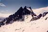 |
Argonaut Peak | 8,453 ft (733P) |
| #67 |  |
Tower Mountain | 8,444 ft (2884P) |
| T68 |  |
Mt. Bigelow | 8,440+ ft (760P) |
| T68 | 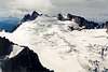 |
Dorado Needle | 8,440+ ft (760P) |
| T68 | 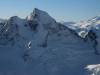 |
Sinister Peak | 8,440+ ft (840P) |
| T68 | 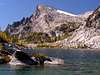 |
Little Annapurna | 8,440+ ft (280P) |
| #72 |  |
Emerald Peak | 8,422 ft (742P) |
| #73 | 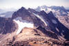 |
Dumbell Mountain | 8,421 ft (1261P) |
| #74 | 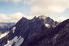 |
Greenwood Mountain | 8,415 ft (655P) |
| #75 |  |
Mox Peaks, NW Spire | 8,407 ft (527P) |
| #76 |  |
Saska Peak | 8,404 ft (644P) |
| T77 |  |
Pinnacle Mountain | 8,400+ ft (1720P) |
| T77 |  |
Azurite Peak | 8,400+ ft (1880P) |
| T77 | 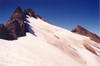 |
Luahna Peak | 8,400+ ft (720P) |
| #80 |  |
Blackcap Mountain | 8,397 ft (397P) |
| T81 |  |
Courtney Peak | 8,392 ft (792P) |
| T81 |  |
South Spectacle Butte | 8,392 ft (1072P) |
| #83 |  |
Martin Peak | 8,375 ft (855P) |
| #84 |  |
Lake Mountain | 8,371 ft (811P) |
| #85 | 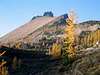 |
Golden Horn | 8,366 ft (1126P) |
| #86 |  |
West Craggy | 8,366 ft (686P) |
| #87 | 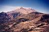 |
Mt. St. Helens | 8,365 ft (4605P) |
| #88 | 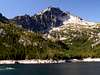 |
McClellan Peak | 8,364 ft (1244P) |
| #89 |  |
Devore Peak | 8,360+ ft (1720P) |
| #90 | 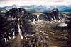 |
Amphitheater Mountain | 8,358 ft (758P) |
| #91 |  |
Snowfield Peak | 8,347 ft (2907P) |
| #92 |  |
Austera Peak | 8,334 ft (414P) |
| #93 | 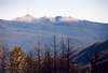 |
Windy Peak | 8,334 ft (1771P) |
| #94 |  |
Cosho Peak | 8,332 ft (492P) |
| #95 | 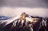 |
Big Snagtooth | 8,330 ft (570P) |
| #96 | 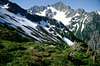 |
Mt. Formidable | 8,325 ft (1885P) |
| T97 | 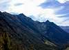 |
Abernathy Peak | 8,321 ft (441P) |
| T97 |  |
Switchback Peak | 8,321 ft (441P) |
| #99 |  |
Tupshin Peak | 8,320+ ft (1080P) |
| #100 |  |
Flora Mountain | 8,320+ ft (1800P) |
Map
-
{{#owner}}
-
{{#url}}
{{#avatarSrc}}
{{name}} {{/url}} {{^url}} {{#avatar}} {{& avatar}} {{/avatar}} {{name}} {{/url}} - {{/owner}} {{#created}}
- {{created}} {{/created}}