Mount Waddington
- Rock Climb
- Glacier Climb
Mount Waddington - 13186' - South Face
"Weissner Route" Class 5.8
July 2024
Shortly after returning from Alaska after successfully climbing Mount Fairweather, I got a text from Sarah saying the weather on Mount Waddington was potentially looking perfect for weeks. All we could do at the current time was hope the good weather continued, because we still had a full week before we were able to head back north into BC. To our total suprise, it did hold, and on the 10th of July I picked Sarah up from the Seattle airport and we drove north towards Tatla Lake. Our objectibe had been the same as the previous year, and the same as my previous 3 attempts to get into the Waddington Range...the southwestr face. This 50 classic route sees very few ascents, and has not been climbed since Mark and Janelle Smiley did the route back in June 2012. Our plan of attack would be different however. Similar to how we climbed Fairweather, we would go with a minimal base camp and carry up and over the mountain with ultralight bivy gear climbing the SW face, and descending the standard chimney route on the NE face, then wrap around the Angel Glacier back to the Dais. We determined two bivies made the most sense, one at the top of the Dais just below the base of the entry couloir at 10400 feet and a second one at the base of the standard route right after the rappelling is completed on the stroll before making the rest of the descent. This would ideally allow us to avoid any movement in the dark, or at least minimize it and for the most part, it went off without a hitch. The crux of the whole operation seemed to be getting flown in with White Saddle air. The previous year in 2023 they totally skunked us and due to constand forest fire fighting they didn't even try to fly us in. Now in 2024, with the best weather window in seemingly decades upon us, we were still uncertain whether they would fly us in. Still, we started the drive from Seattle to Tatla Lake with their "guarantee" they would be able to fly us in on Thursday morning the 11th.
We got bad news around midday when we reached Cache Creek that they were called out to Valemount immediately, and told us it was a no go for the following morning. We decided to just stop driving there and get a motel while we researched other heli operators around BC to make a backup plan. White Saddle never provided any details on how long they would be out, but it sounds like their contract with the Canadian Minister of Finance is all encompassing...basically they are at the whims of the MOF with virtually little say. So we waited. I made calls to other heli operators mainly on Vancouver Island, and got plenty of very nice people I spoke with. While they often were also called out to fight fires, I was informed they never would bail on a previously scheduled service with a client. My quote from West Coast helicopters was CAD 7000 round trip, which is more expensive than White Saddle just because the ride is longer. We ended up getting an email that White Saddle could fly us in on Friday the 12th at 8am, so we decided to go out on a whim and hope they wouldn't get called out again as it would have been a ton of driving to go all the way back around to Campbell River, plus an unknown wait for the ferry. We finished the drive from Cache Creek to Tatla Lake and stayed a lovely night at the Tatla Lake Manor and got all our gear packed and sorted.
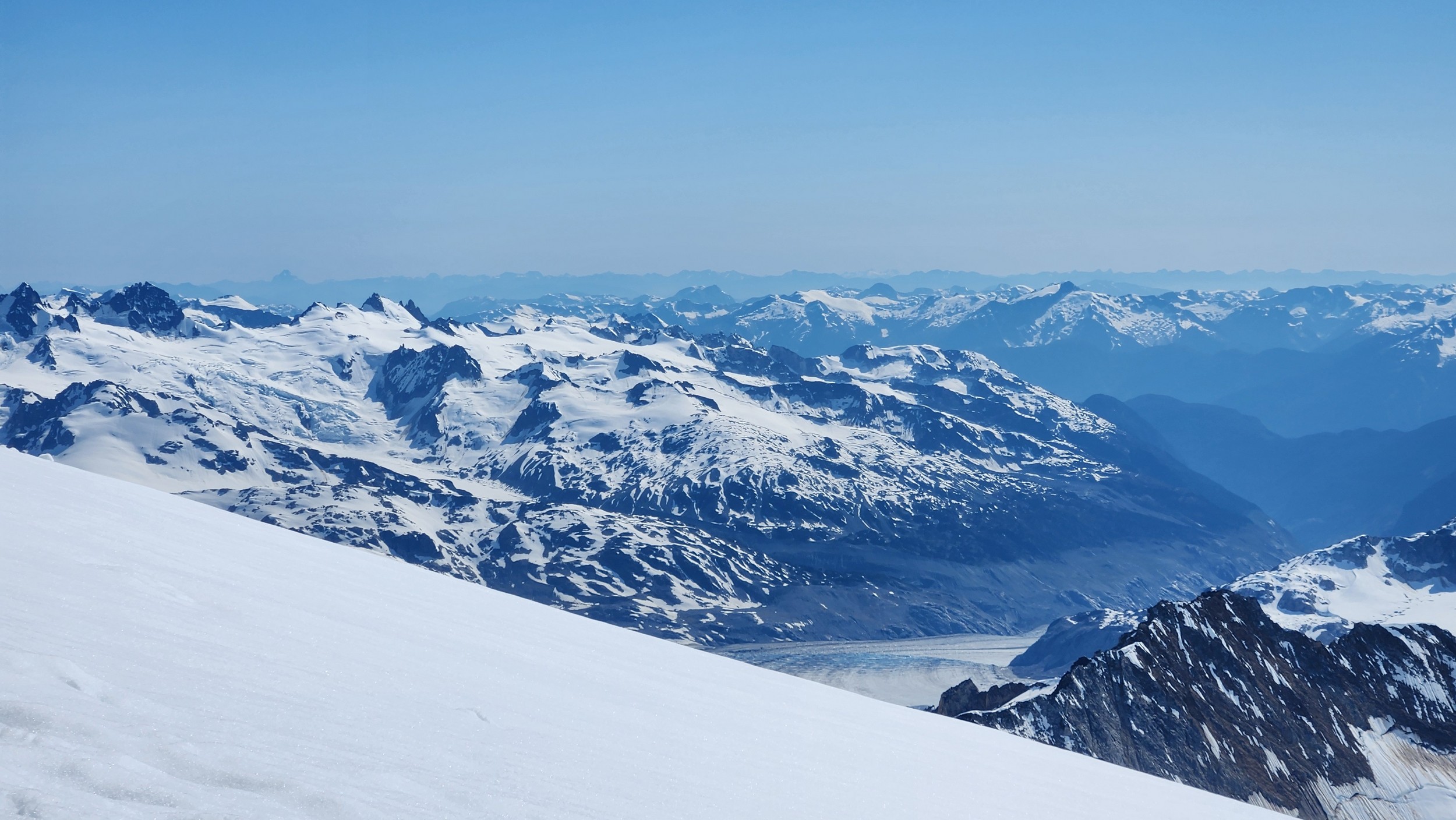
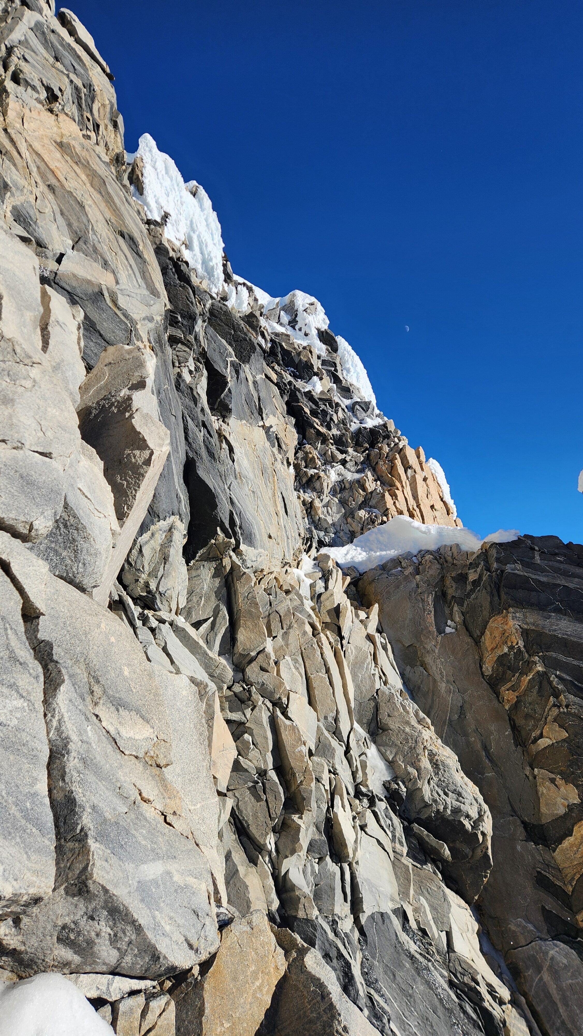
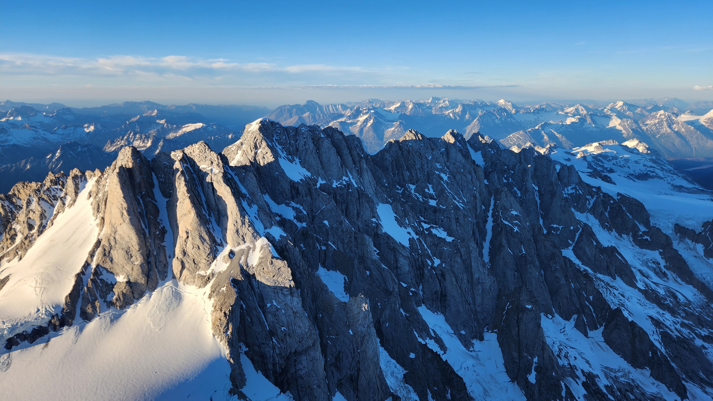
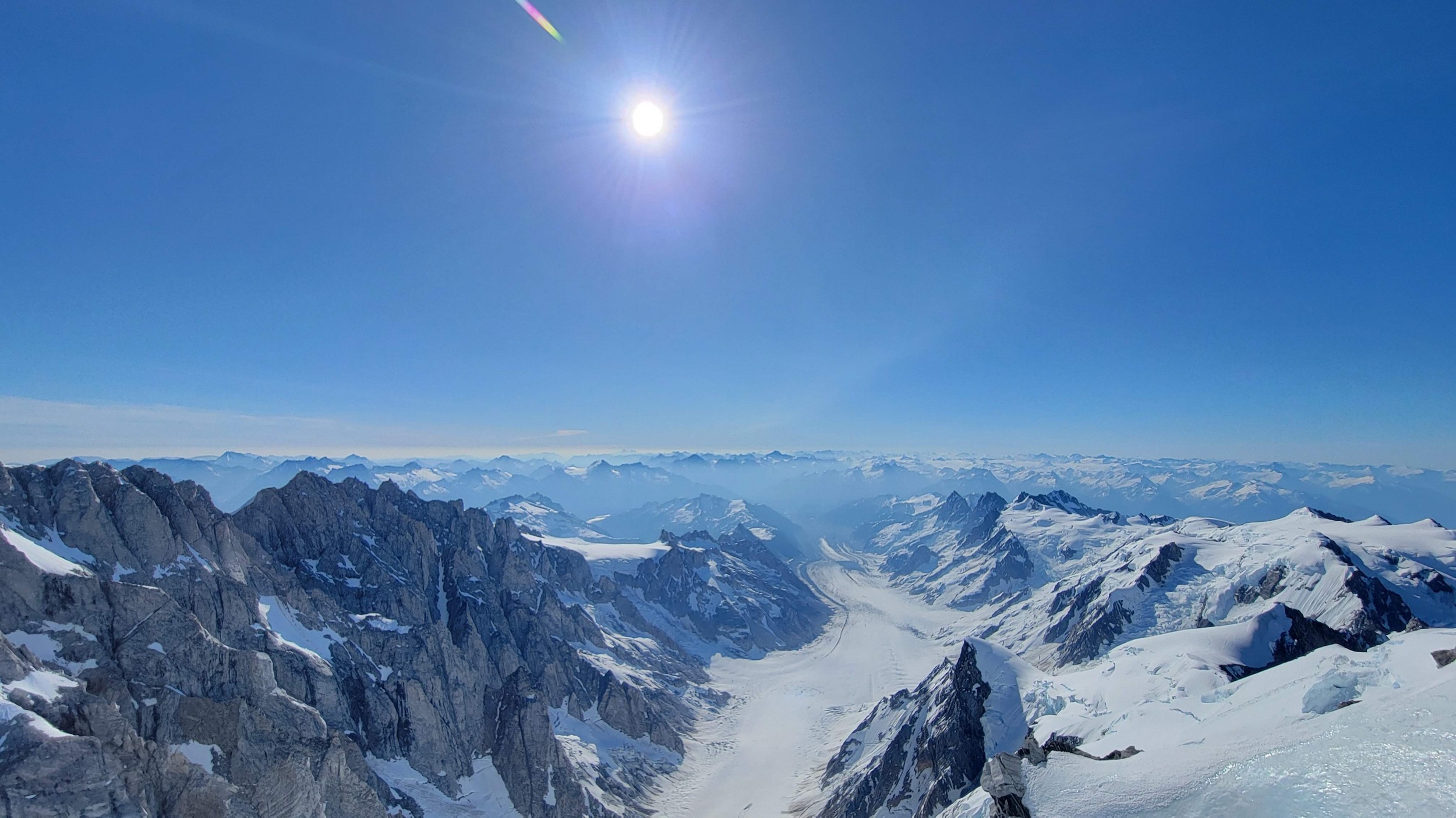
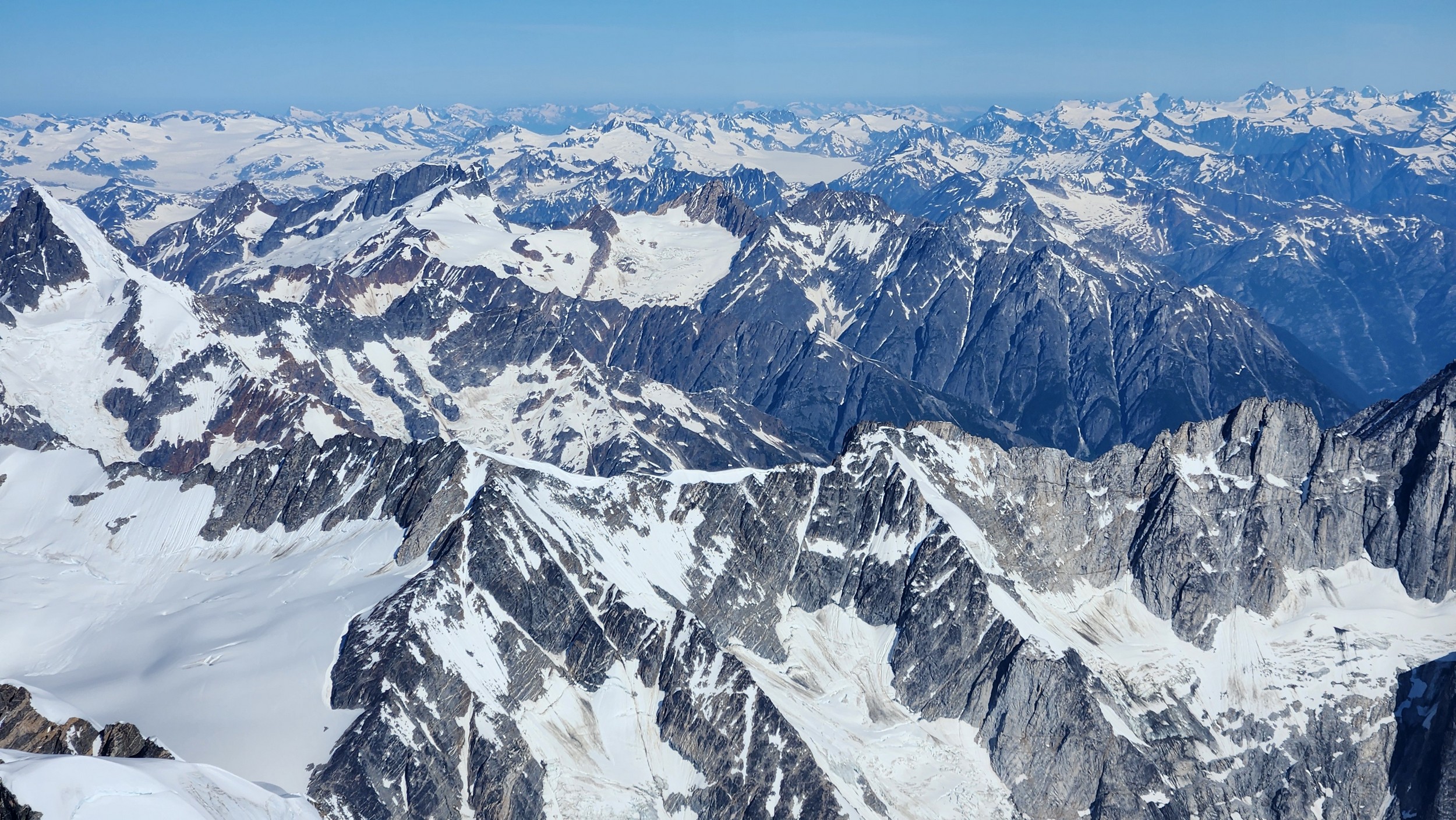
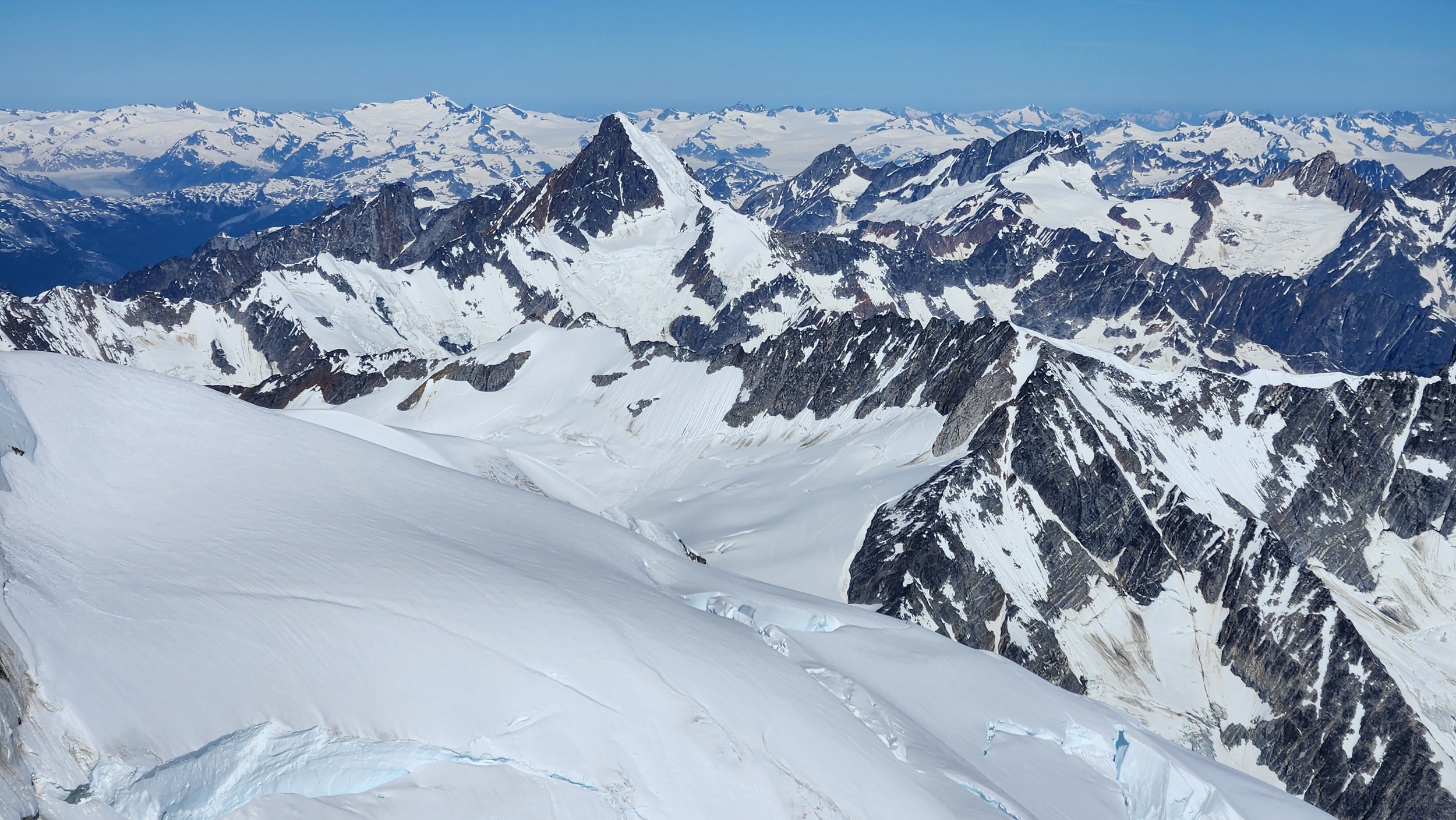
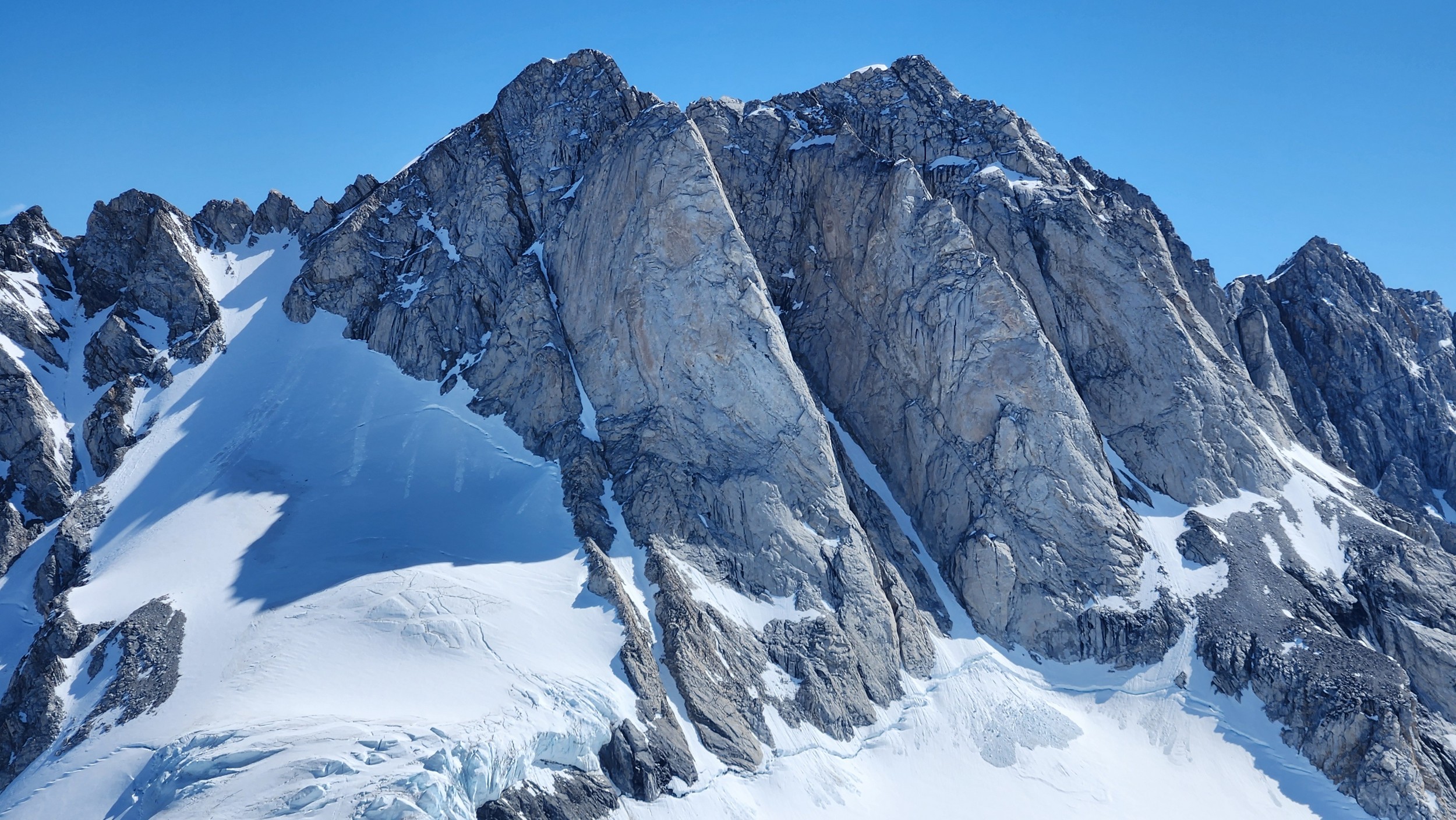
The thought that kept running through our minds was this was literally going to be the best time in our lives to climb this thing, and we might get skunked again due to fires and no available heli access. Seriously, I cannot think of a single other time at least since I have been actively climbing mountains that 3 weeks of stable weather hit the Waddington Range. I had often recalled a quote I heard Fred Beckey make in one of his talks I watched early in my mountaineering career that he believed Mount Waddington was the most important peak in North Amercia. Whether that had some bias on his end or not (if you have not read the Climbing magazine article about his monumental effort to get the second ascent of the mountain, definitely check it out), I can certainly understand where he came from with that statement. No other peak on the continent with such major prominence is more difficult to reach the summit. With 10,758 feet of prominence, Mount Waddington is one of only 17 peaks on the continent with over 3000 meters of prominence, but is without a doubt the most technical, and certainly has a feeling that you really are on a big scary mountain. Comparing to Fairweather, where we were for certain the only souls for dozens of miles in all directions, the feeling of vulnerability on the SW face of Waddington far surpassed anything I felt on Fairweather even though I heard another party on the summit just a few hours before we reached the top. There were other people merely a handful of meters away as we were high on the mountain, but it did not do much to curb the feeling we were totally alone.
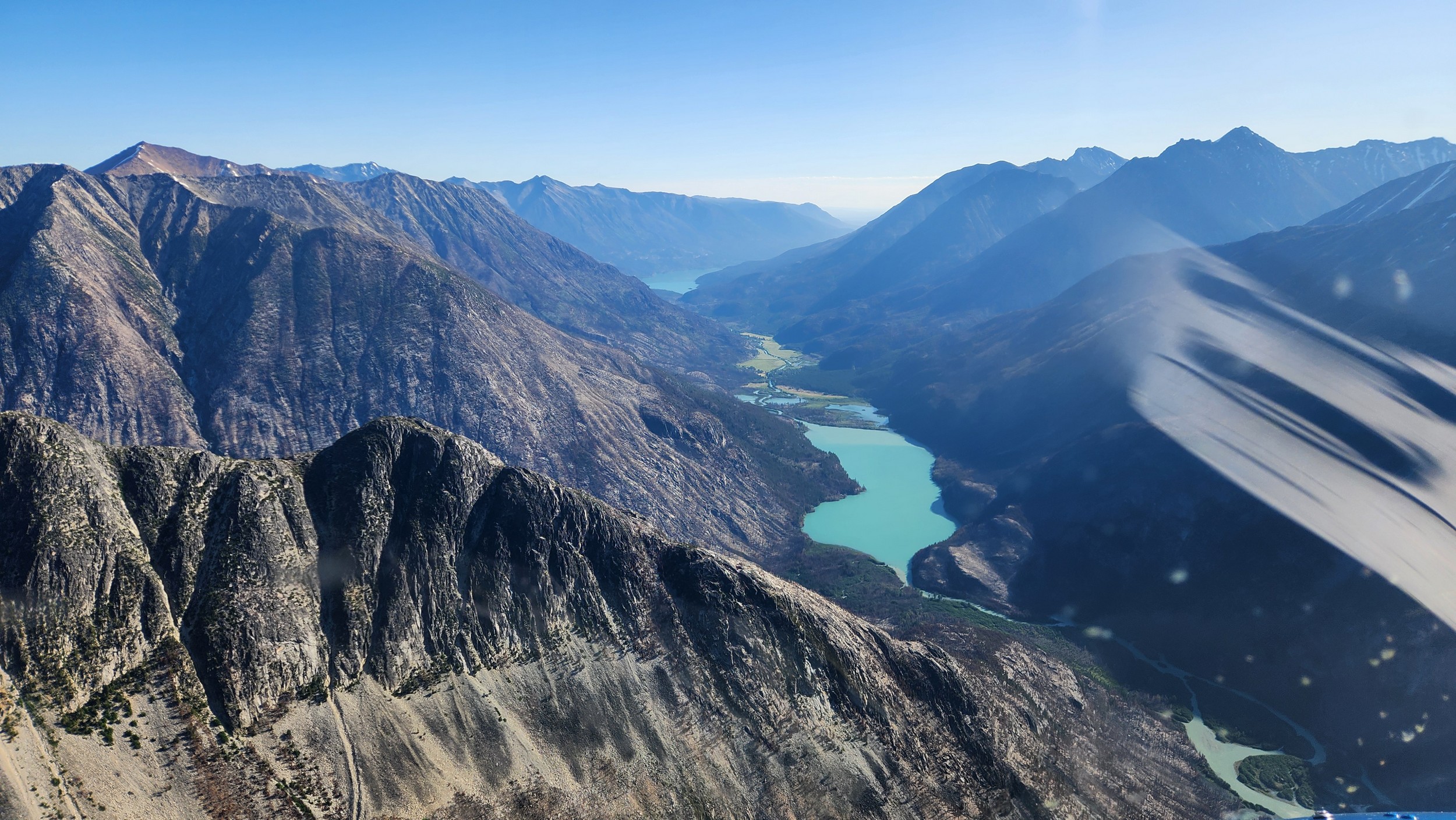
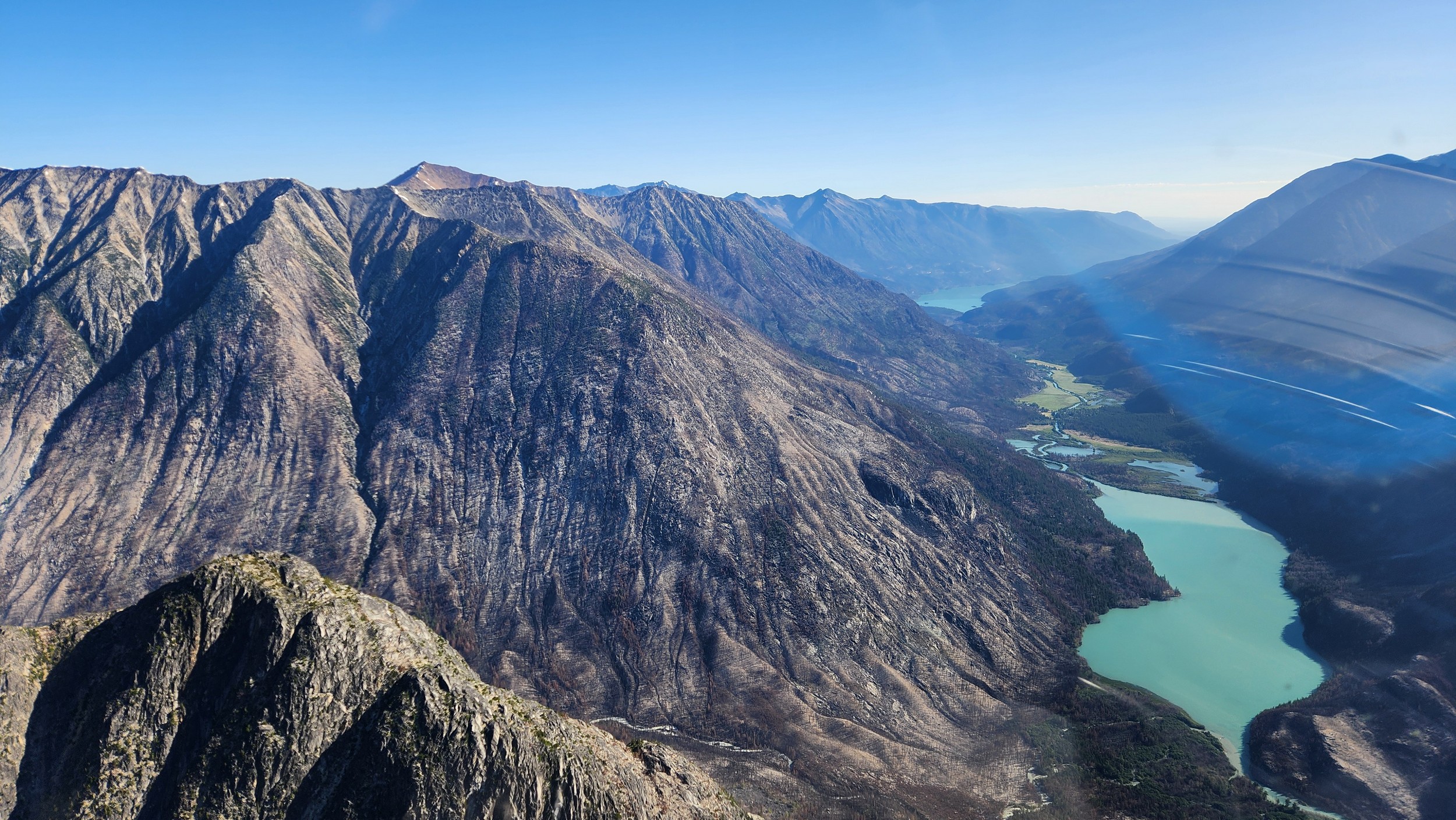
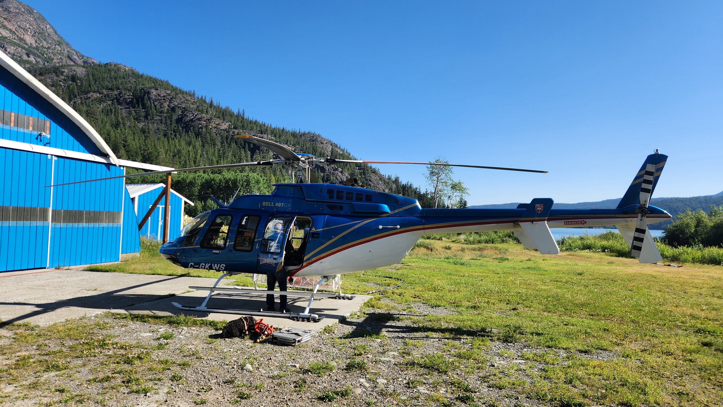
At 7am on the 12th, we loaded the car and finished the final 30 minute drive to Bluff Lake and thankfully saw the helicopter parked at the White Saddle hangar. Mike was there getting things ready and a sigh of relief came upon us. It was at this time we finally felt the summit was in the bag, and Sarah would be able to knock out her 40th 50 classic route...literally, the crux was over. We loaded up and Mike briefed us, and two young guys working on his new hangar also joined us for the flight into the Dais Glacier since they had never rode a chopper before. That is one cool thing Mike seems to do is let others get a free heli ride when it's already paid for. In early July 2019 myself and two friends camped out on the shore of Bluff Lake for week on Mike's property. We made plans to try the south face then, but the weather was such garbage that whole season we didn't bother flying in and eventually just left. Made that whole drive for nothing, but just before we left, Mike offered us a free ride as he was going in to resupply a NOLS group. Super cool. Looking back on it after completing the climb though it's for the best we didn't try the SW face with a team of 3 people.
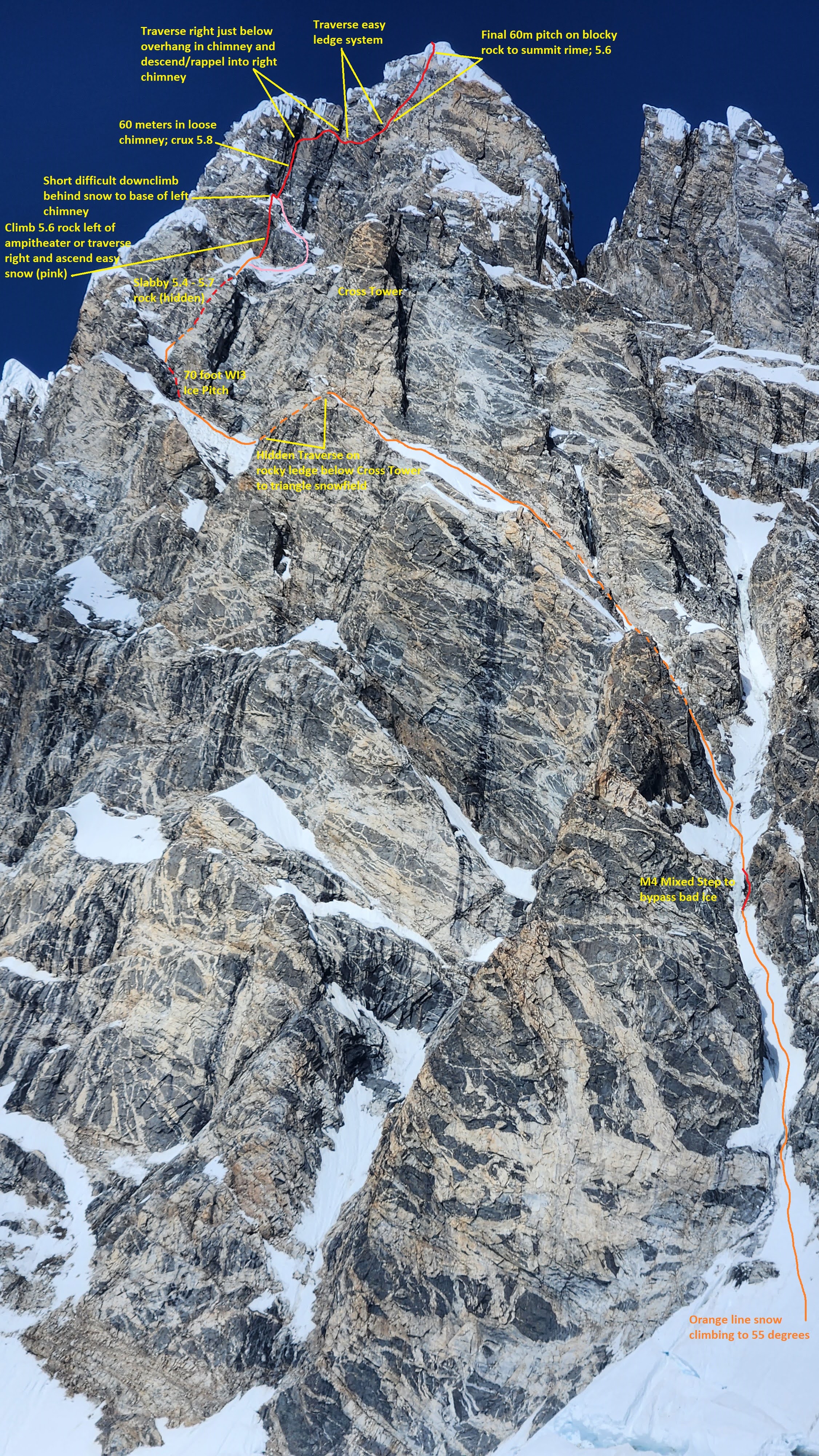
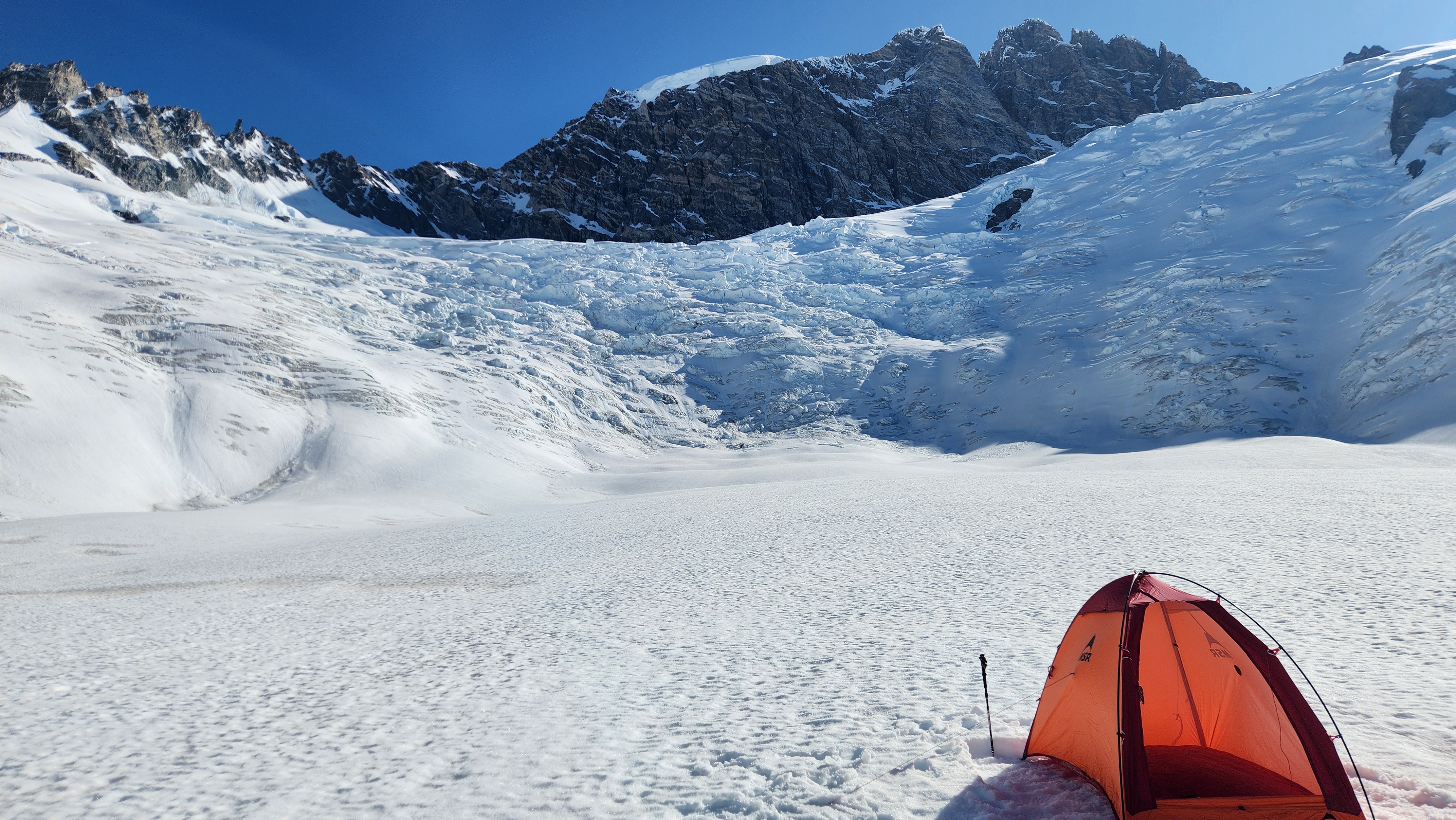
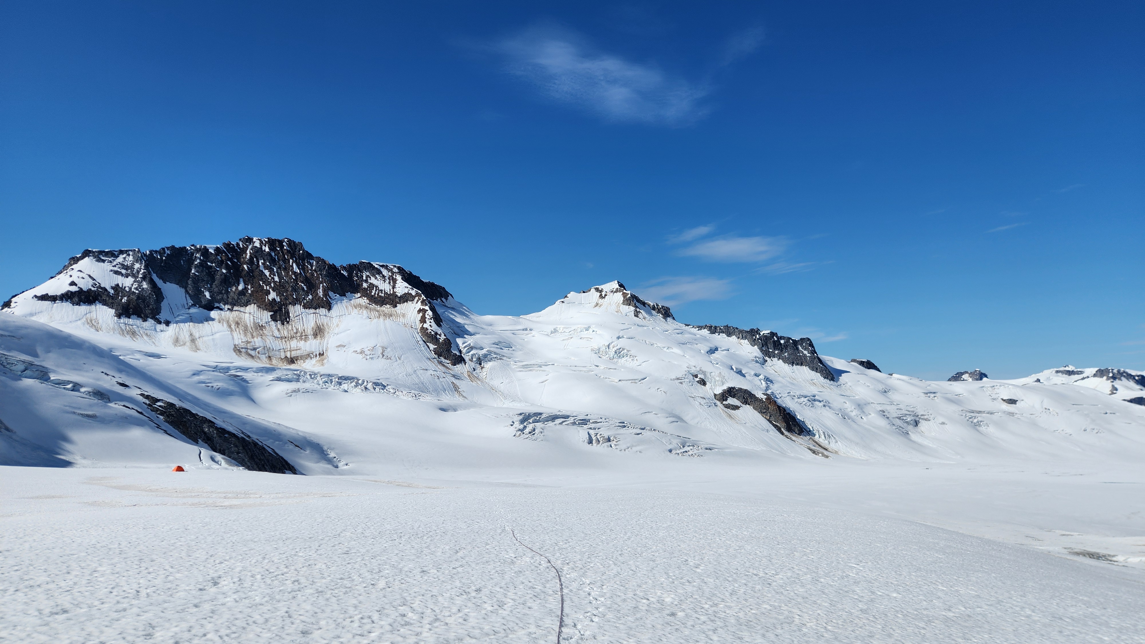
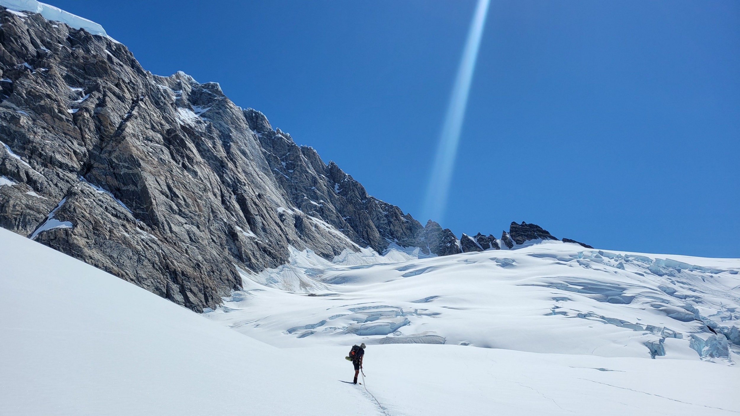
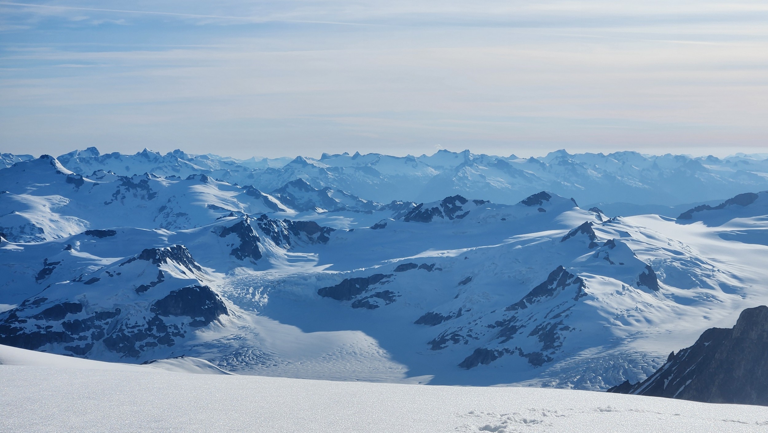
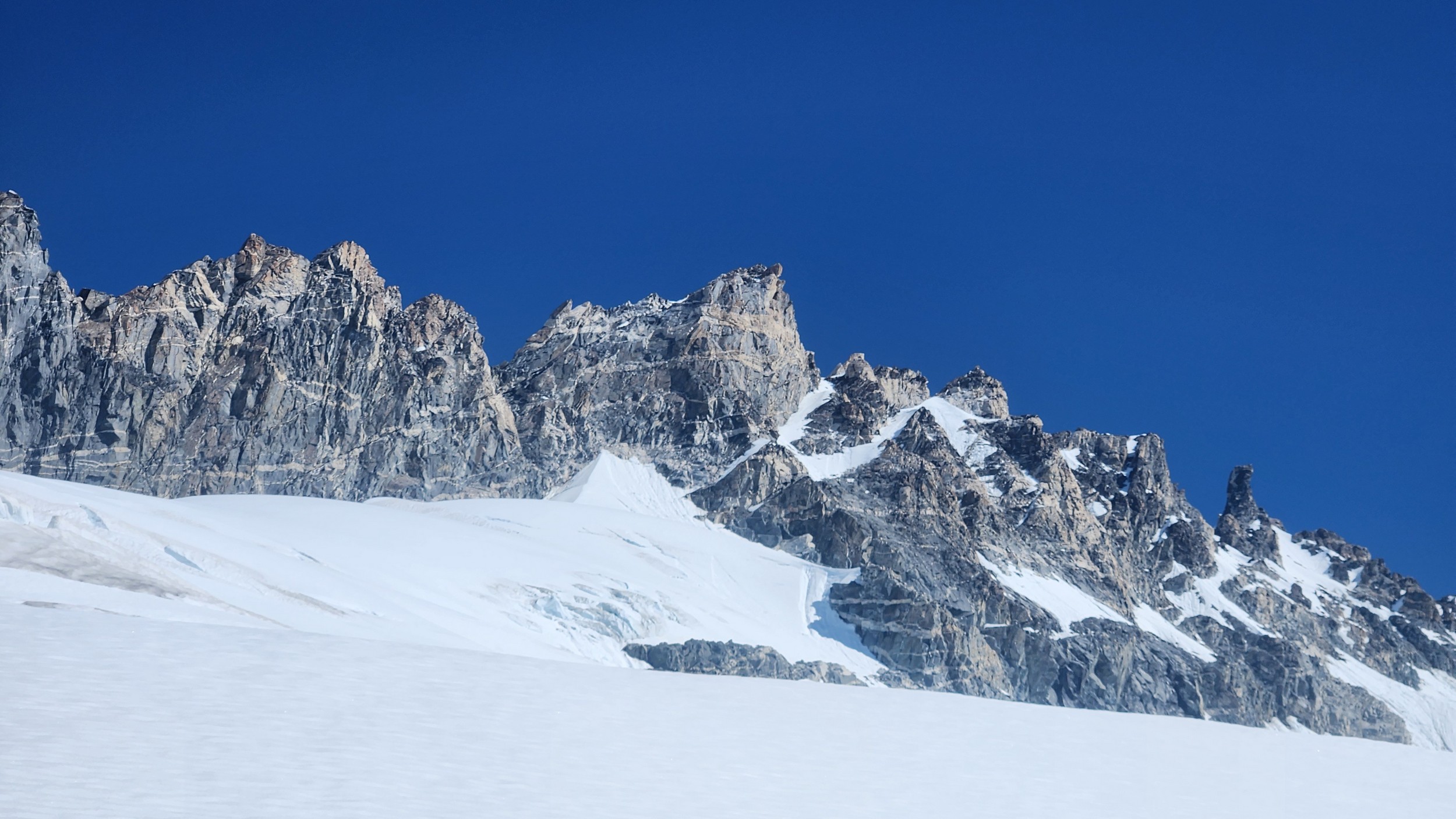
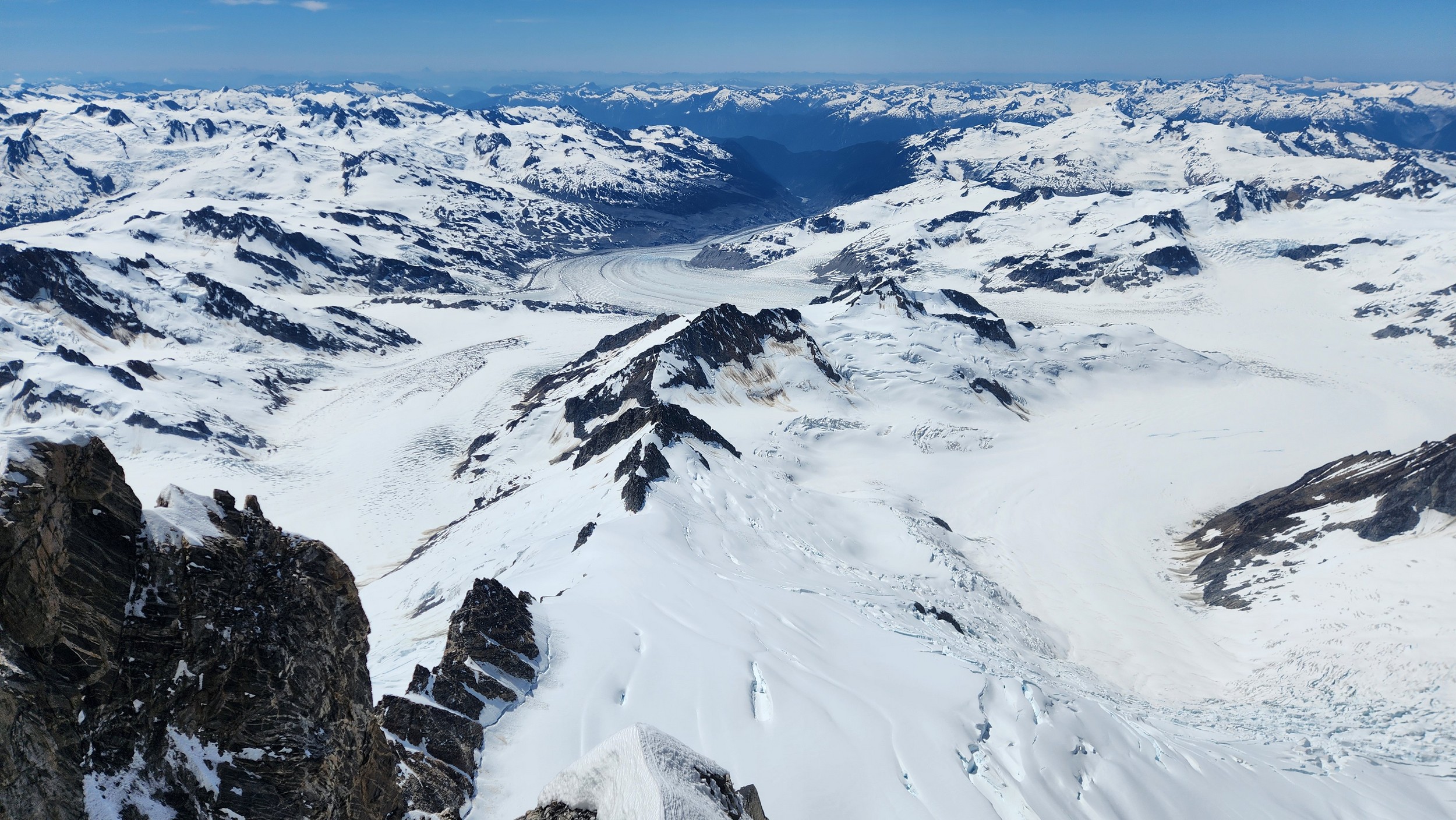
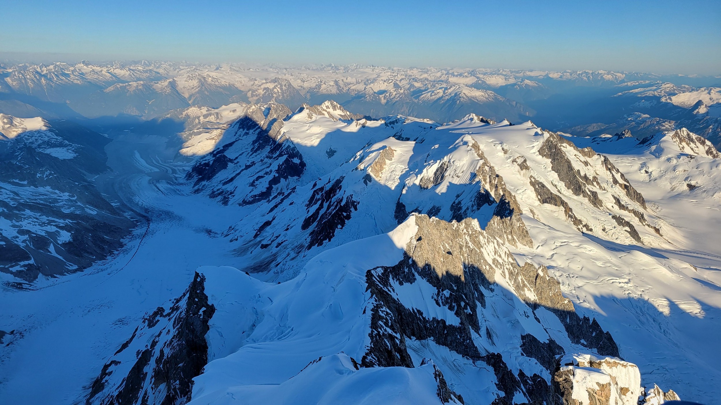
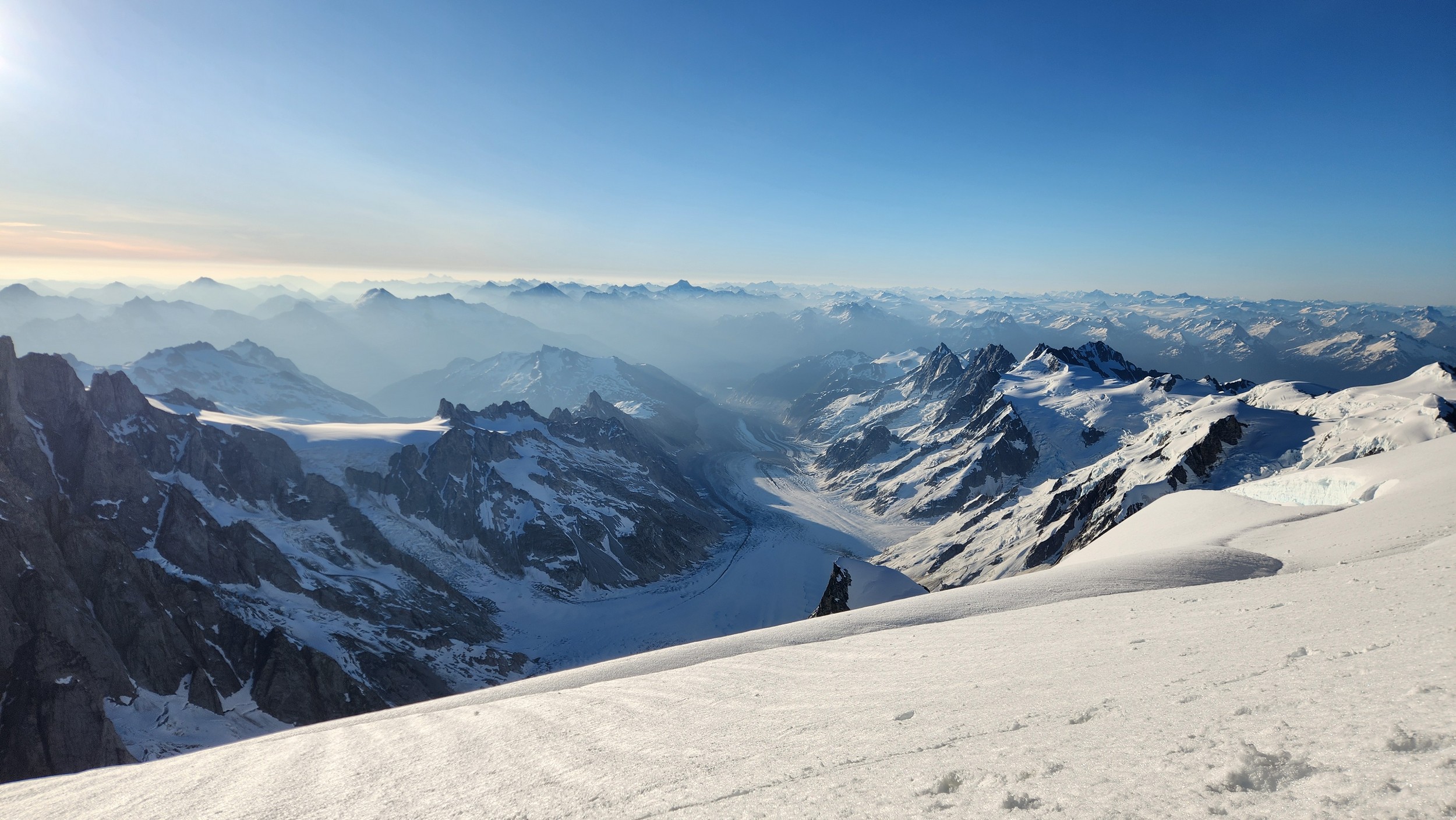
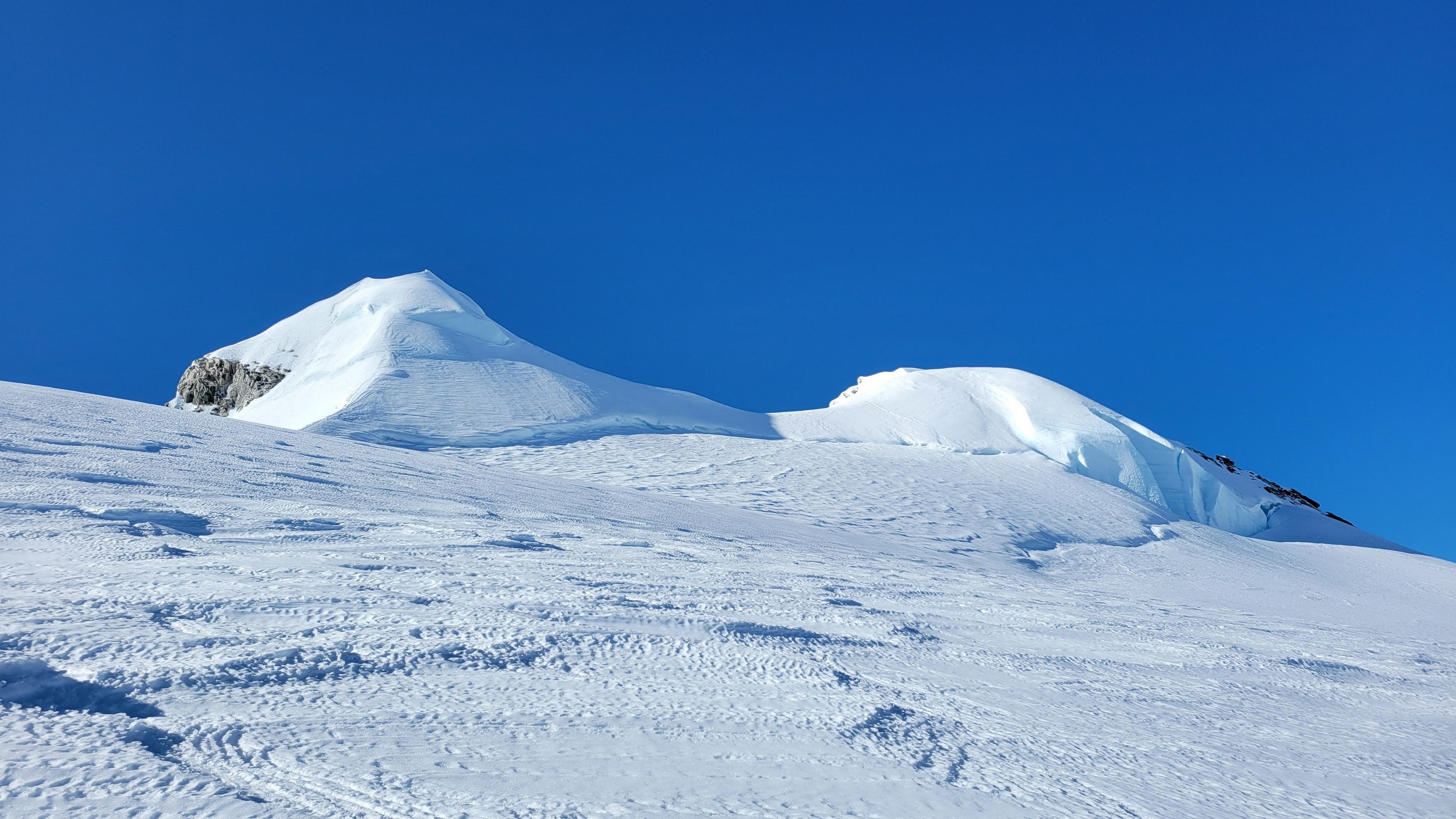
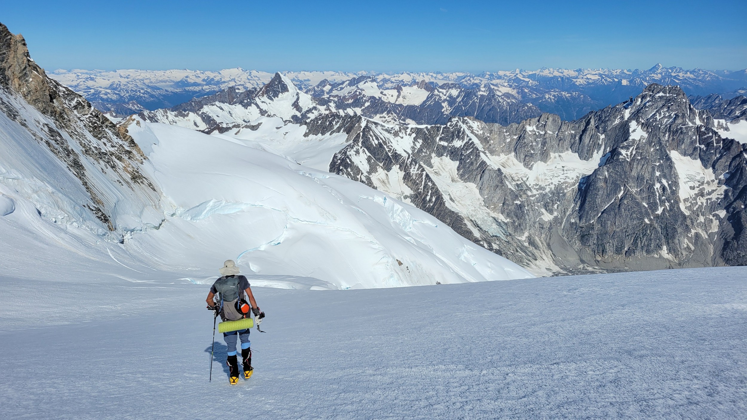
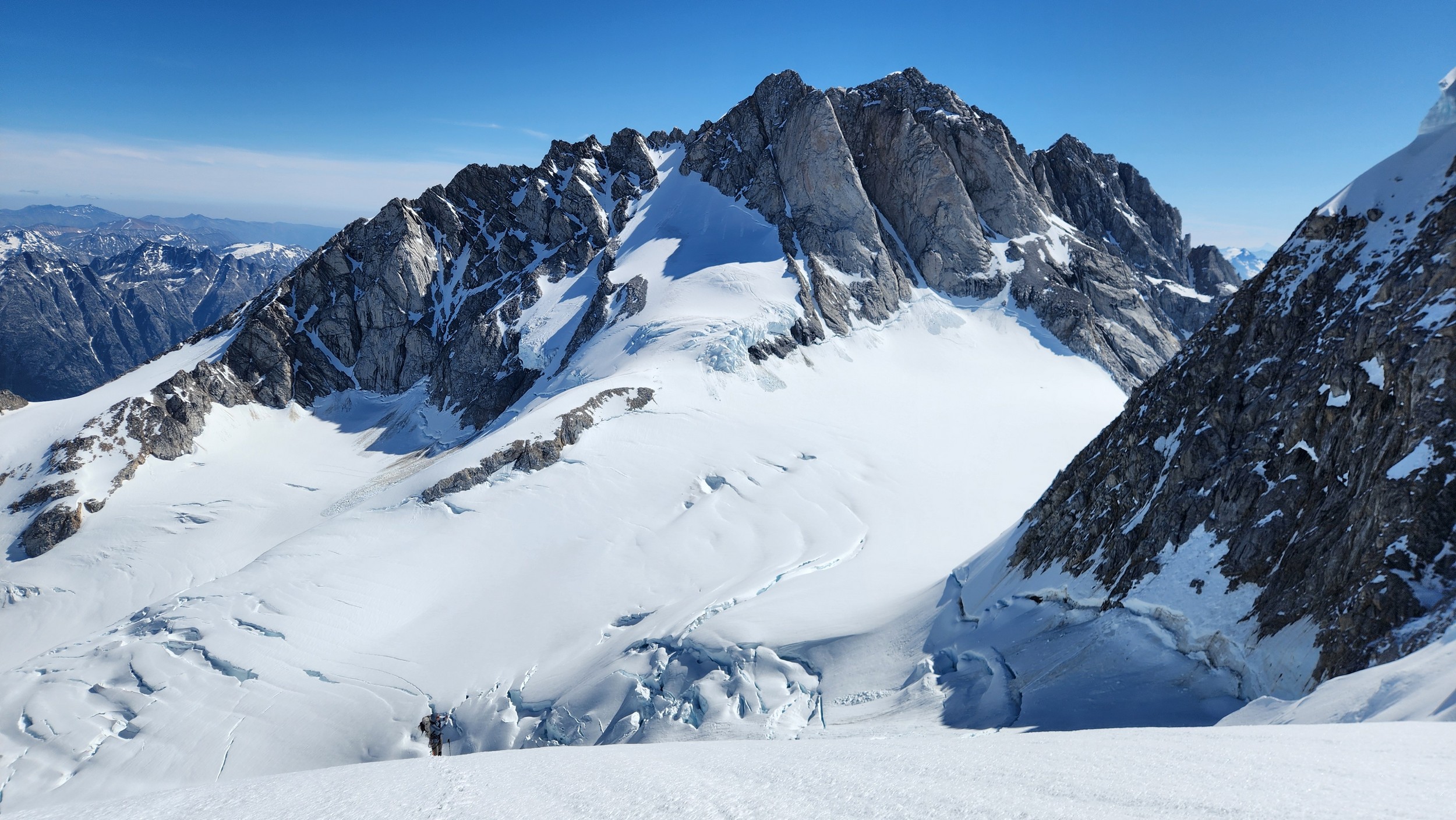
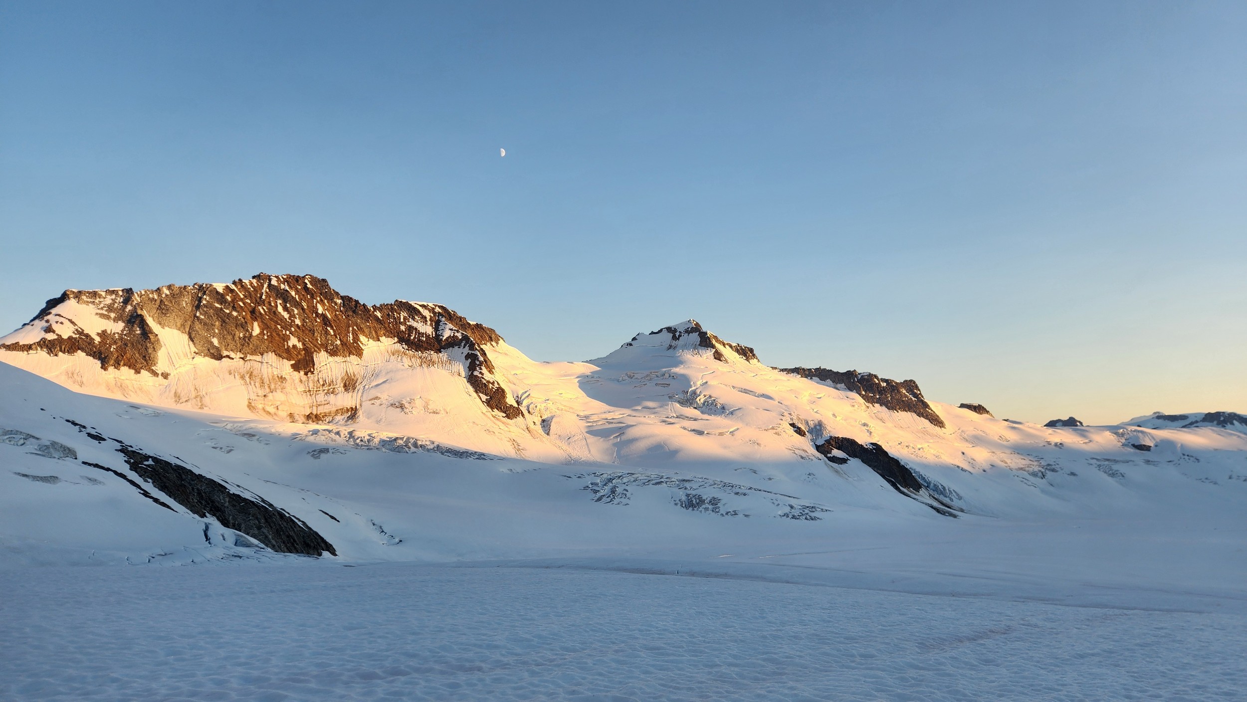
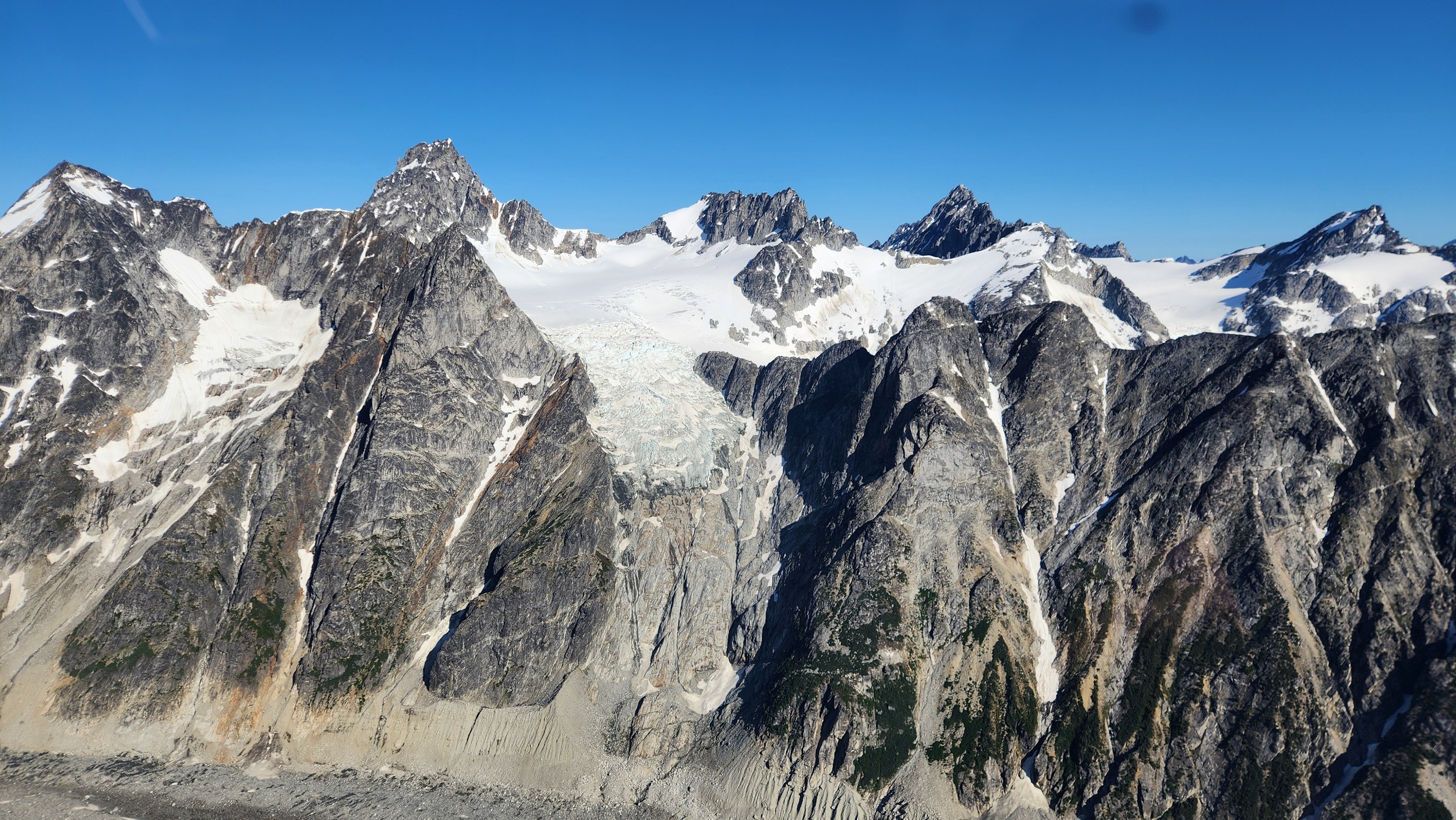
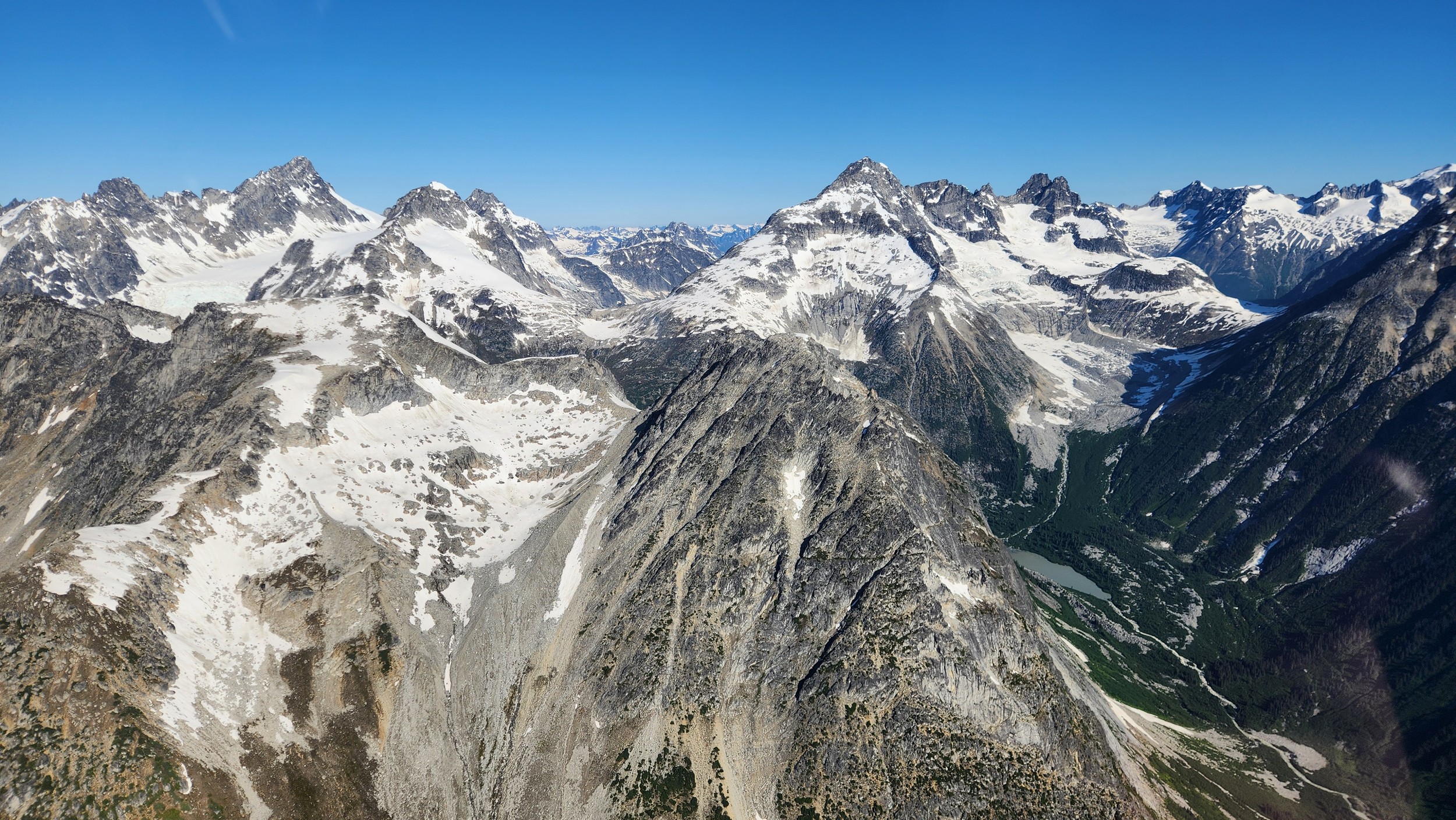
By 8:25am we lifted off and started flying southwest up the Mosley River and over Middle and Twist Lakes. It didn't take long for us to see the east side of Waddington as we circled around the north side, then to the west side. As we approached the Dais Glacier, I guided Mike to the spot we wanted to land at about 7400 feet on the final flat bench of the glacier before it began rising abruptly towards the west face of Waddington. We landed, quickly unloaded and in no time we were the only ones around. Mike had flown off and a silence quickly took over. Sarah and I smiled as we began setting up our meager base camp. The MSR Advance Pro 2 we had used on Fairweather would be left here along with our diffel bag of extra gear and food. We decided to use an even lighter weight BD trekking pole tent to bring up the mountain since the weather forecast was so good. This saved a couple pounds easily and since I was the one carrying the tent was much appreciated! Within about an hour of getting dropped, we saddled up our packs and started walking up climbers left side of the upper Dais glacier towards Regal Dome. A topo of the SW face route I made is shown below that can be referenced throughout the report. Note the original Weissner Route is shown. We did not climb the Beckey variation.
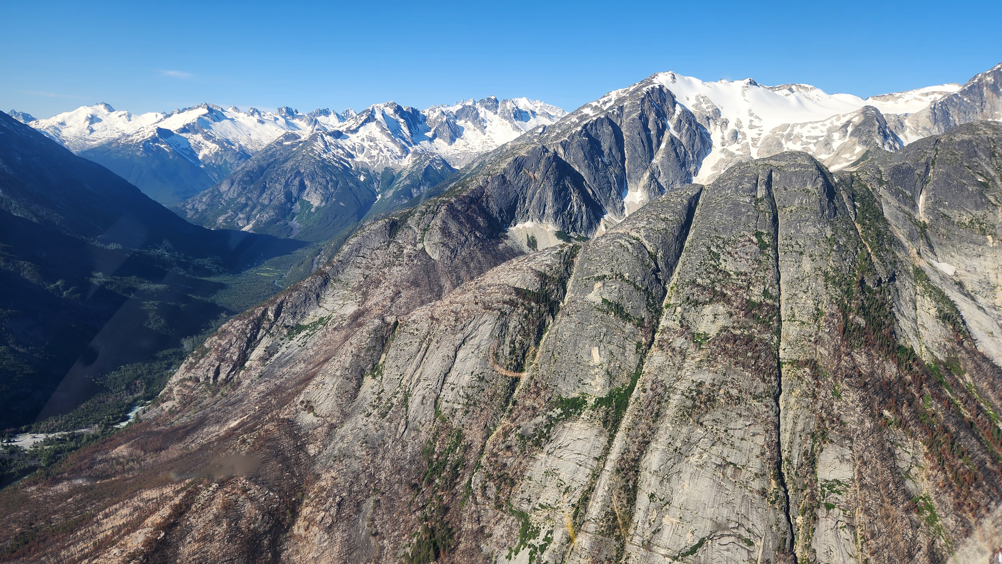
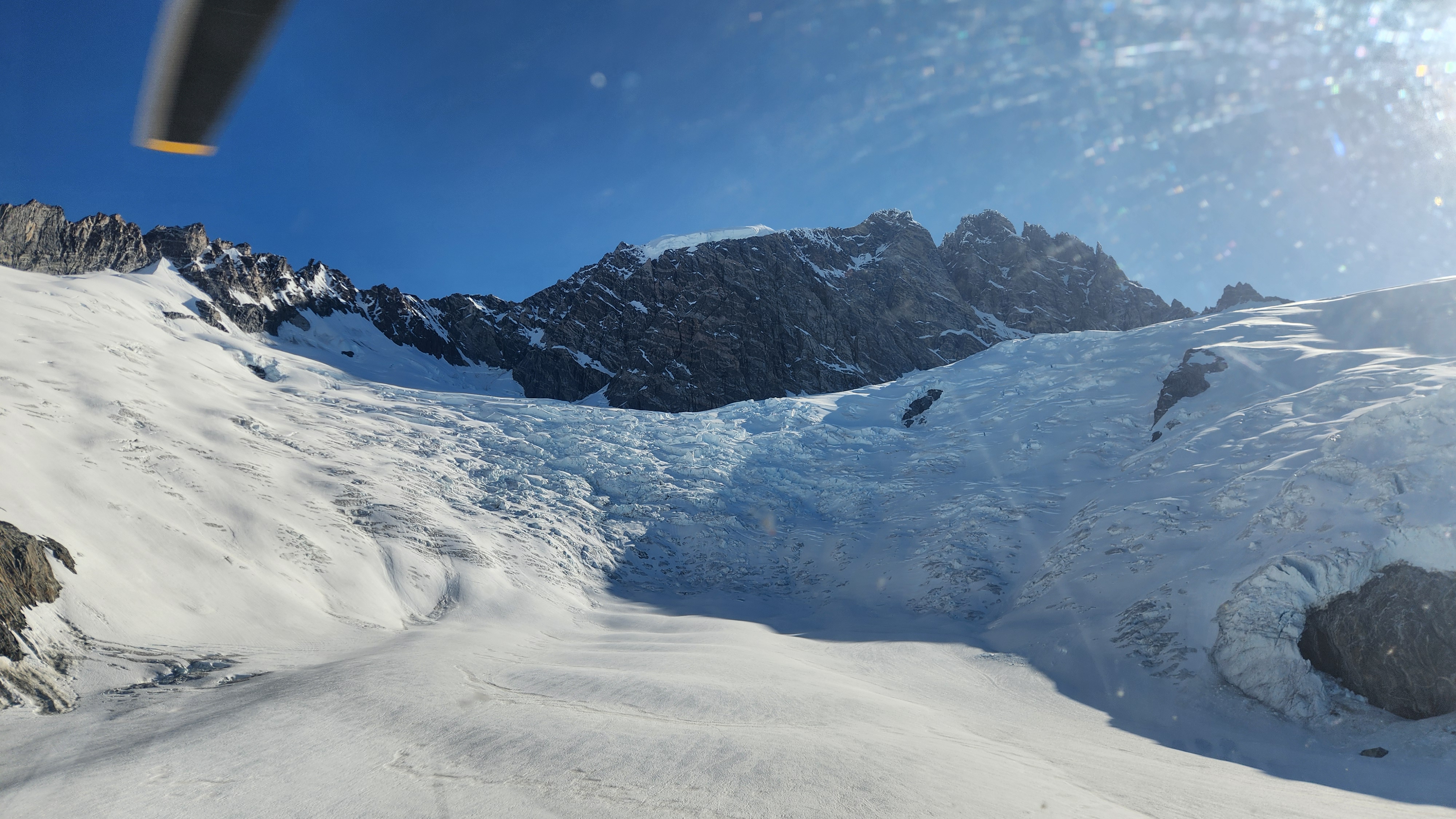
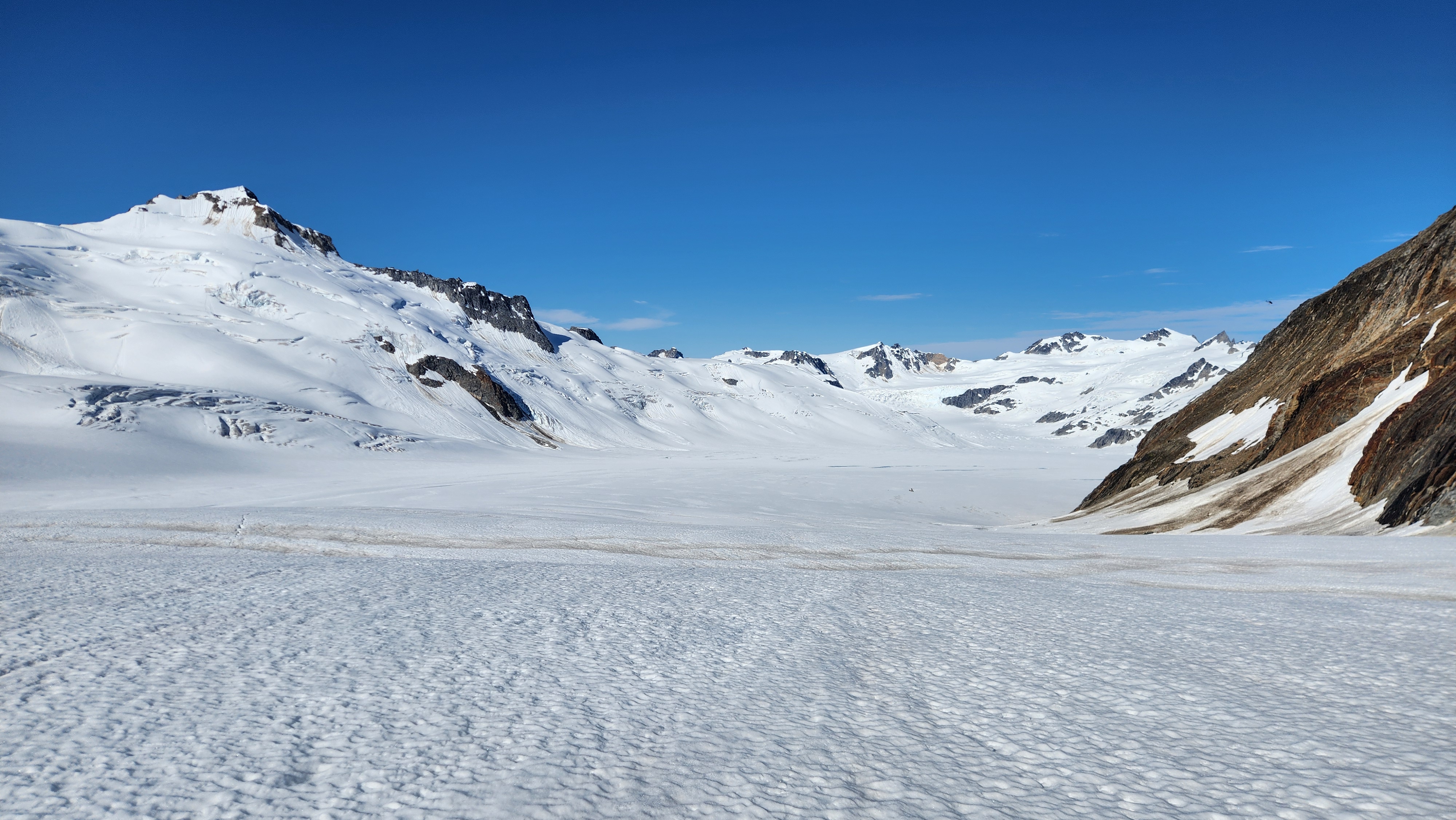
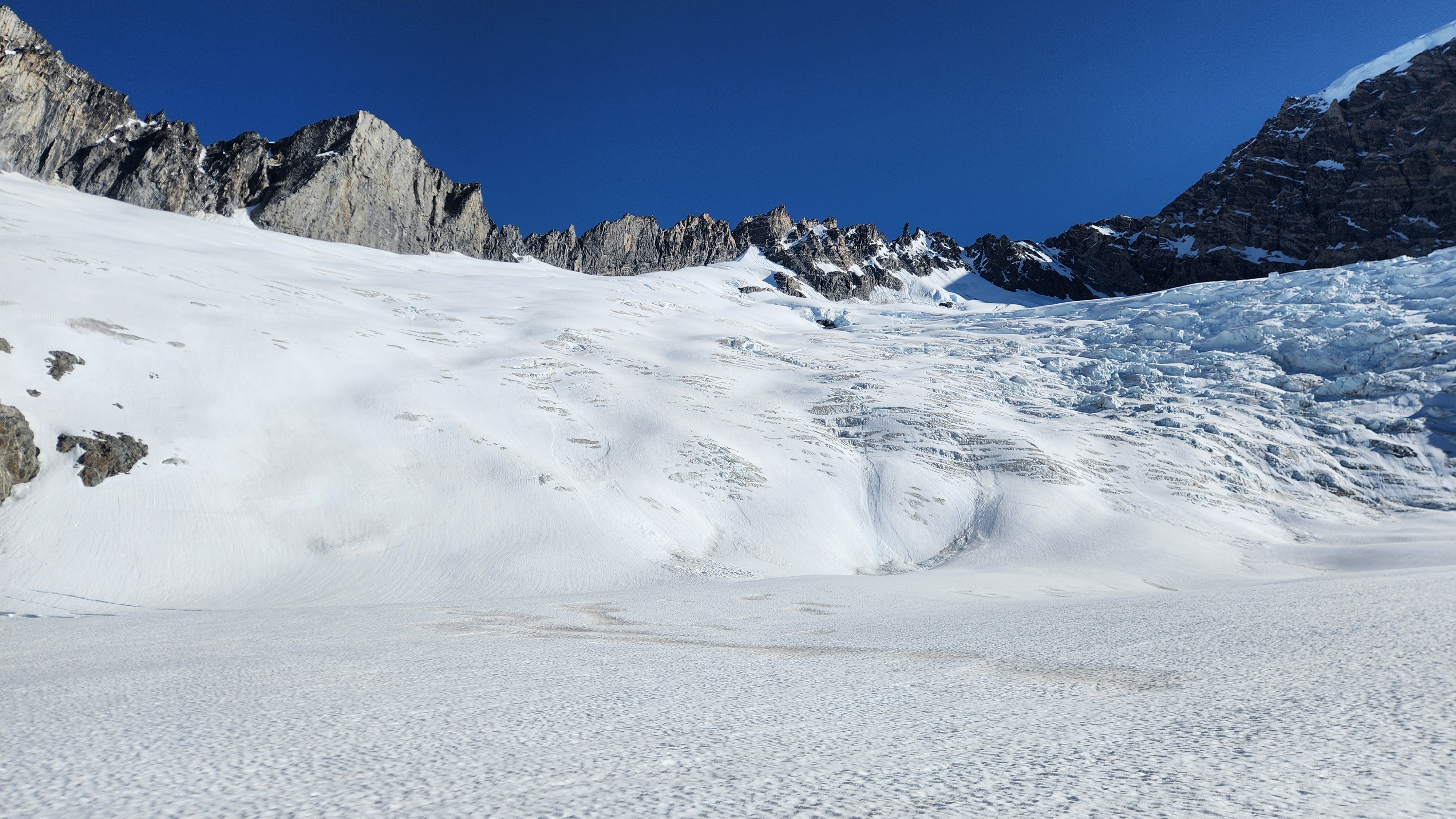
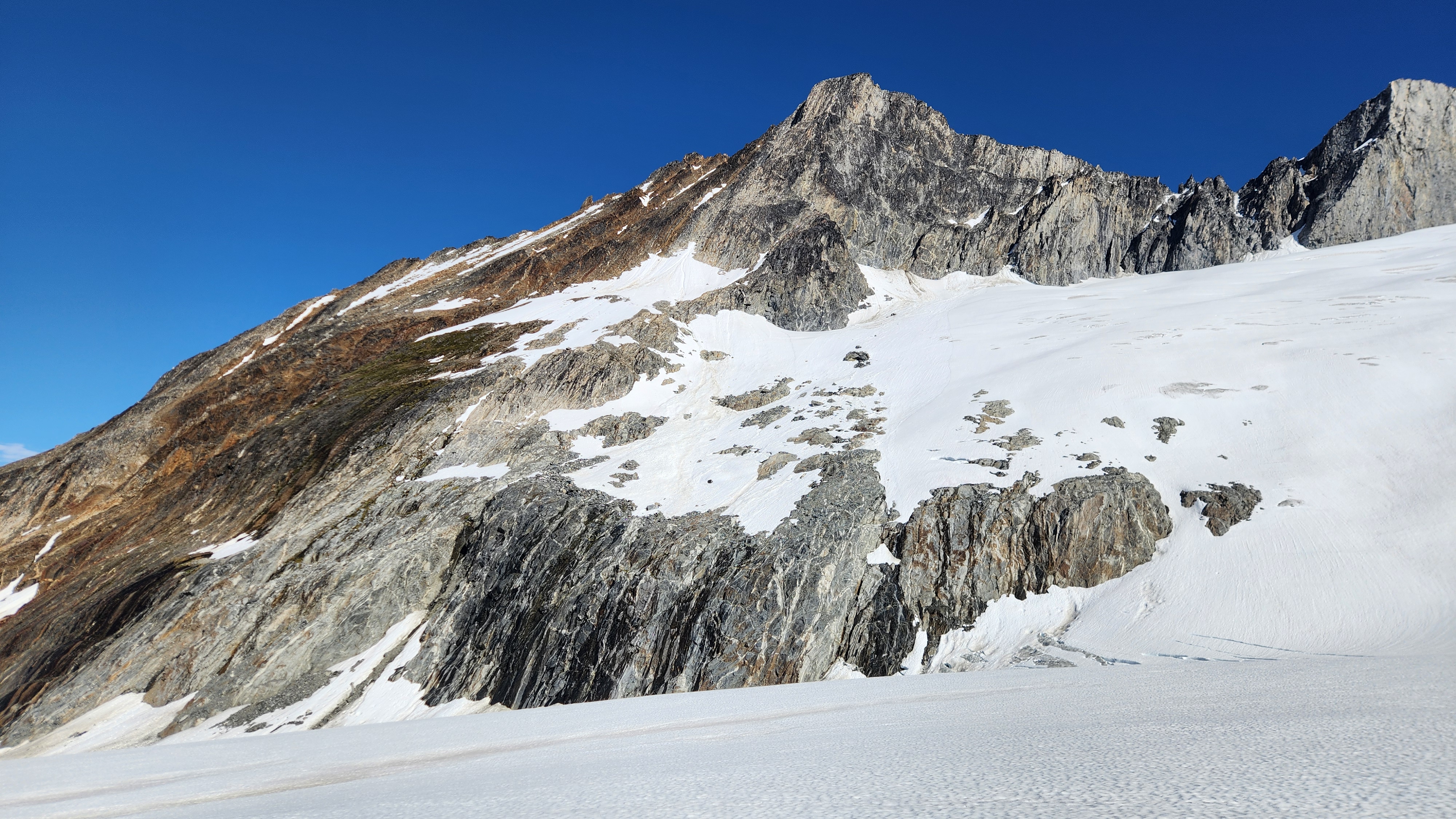
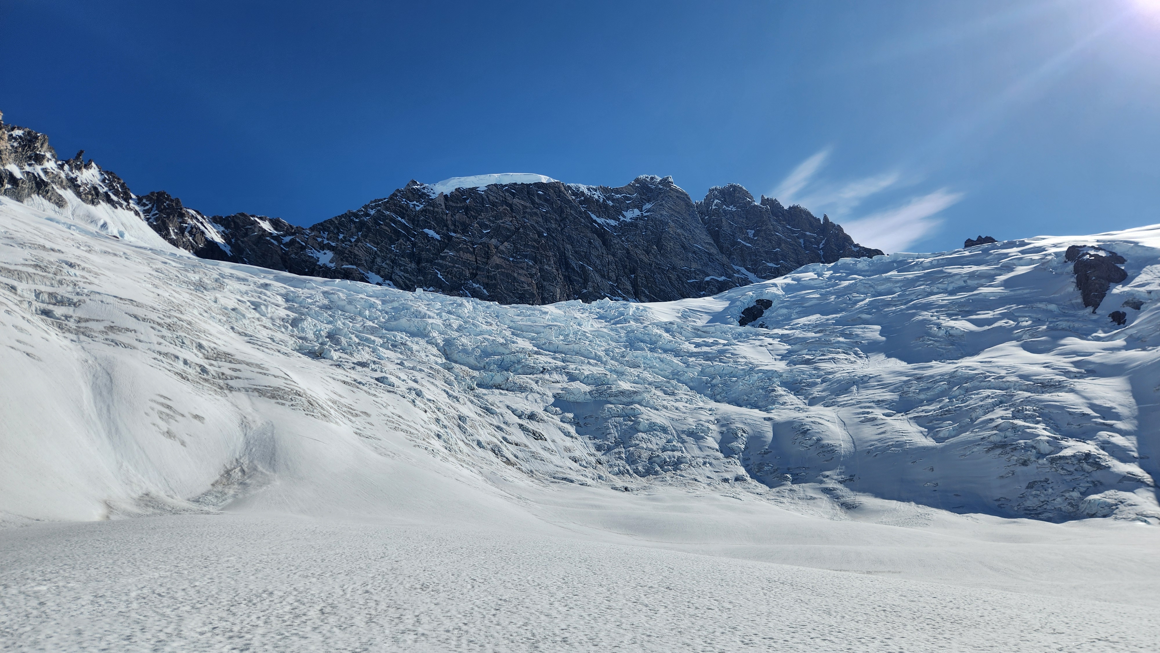
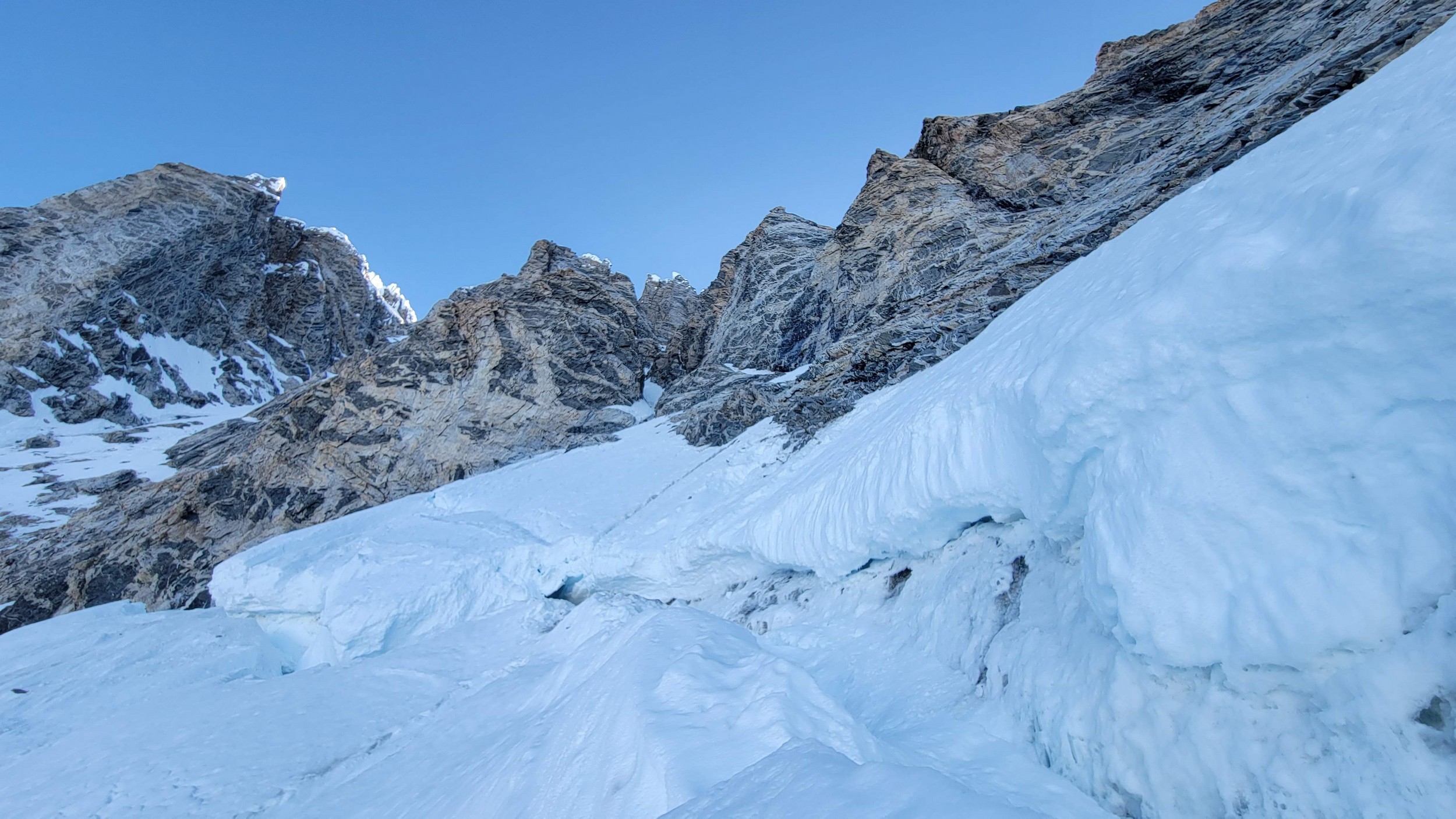
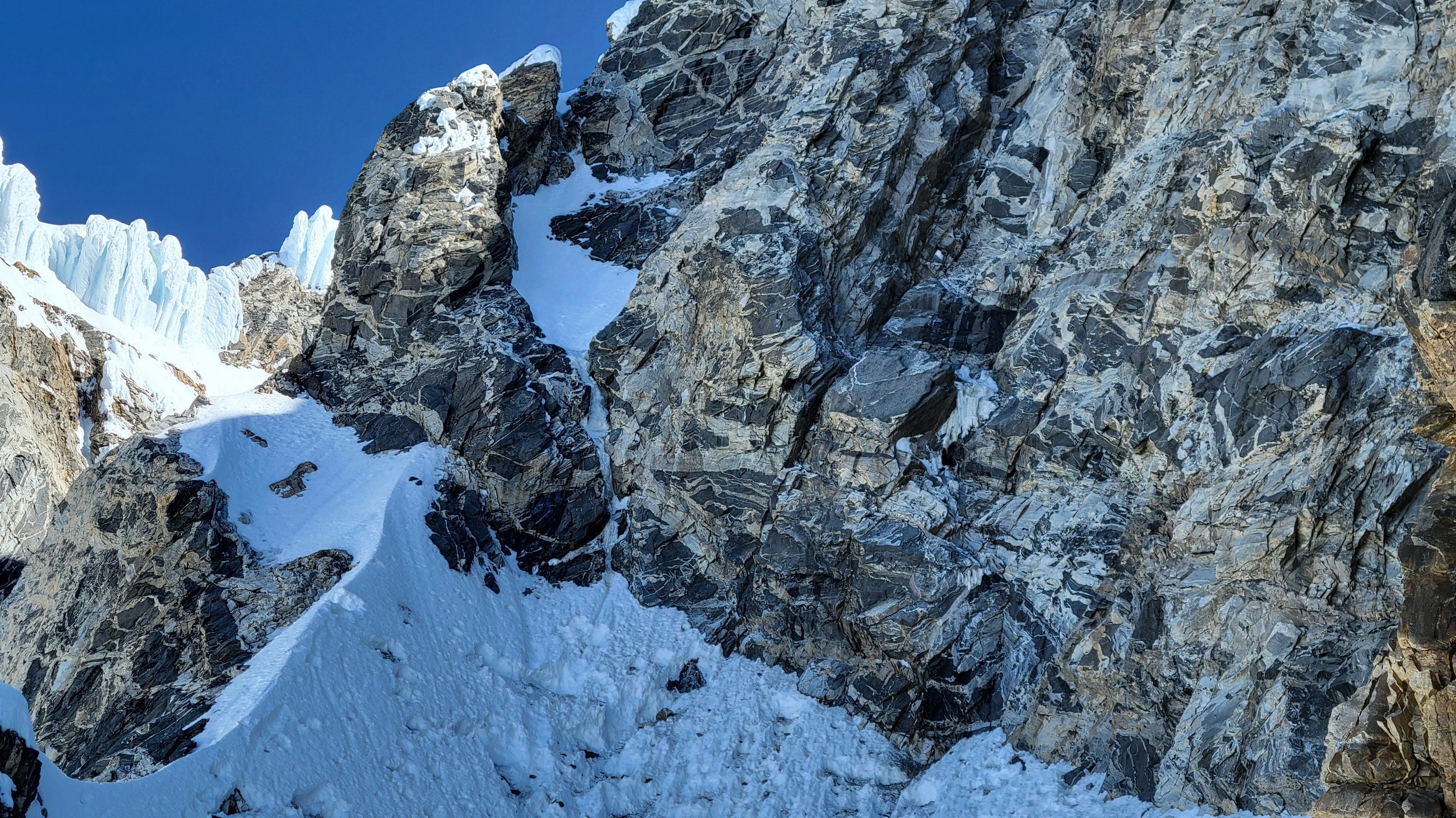
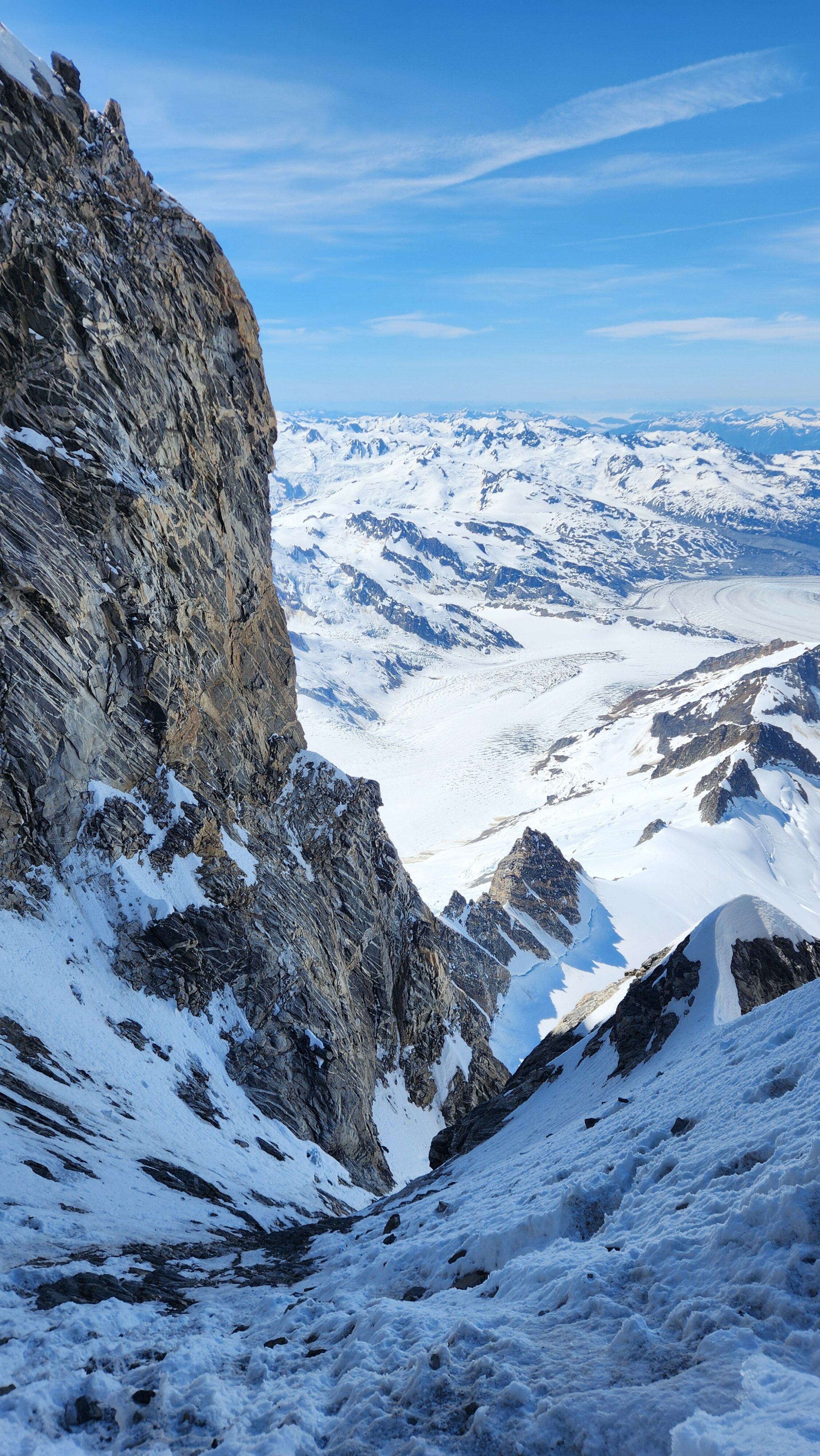
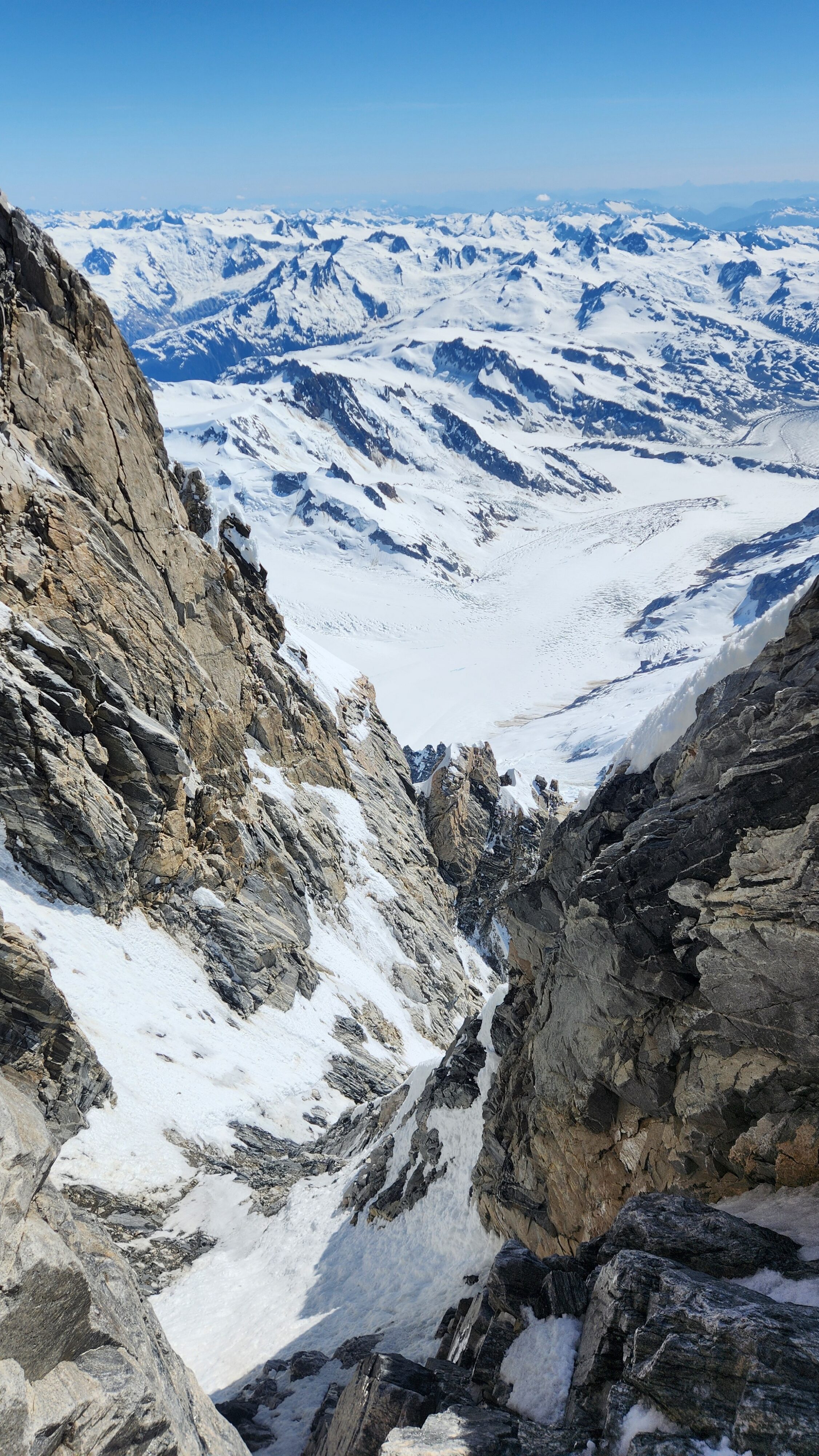
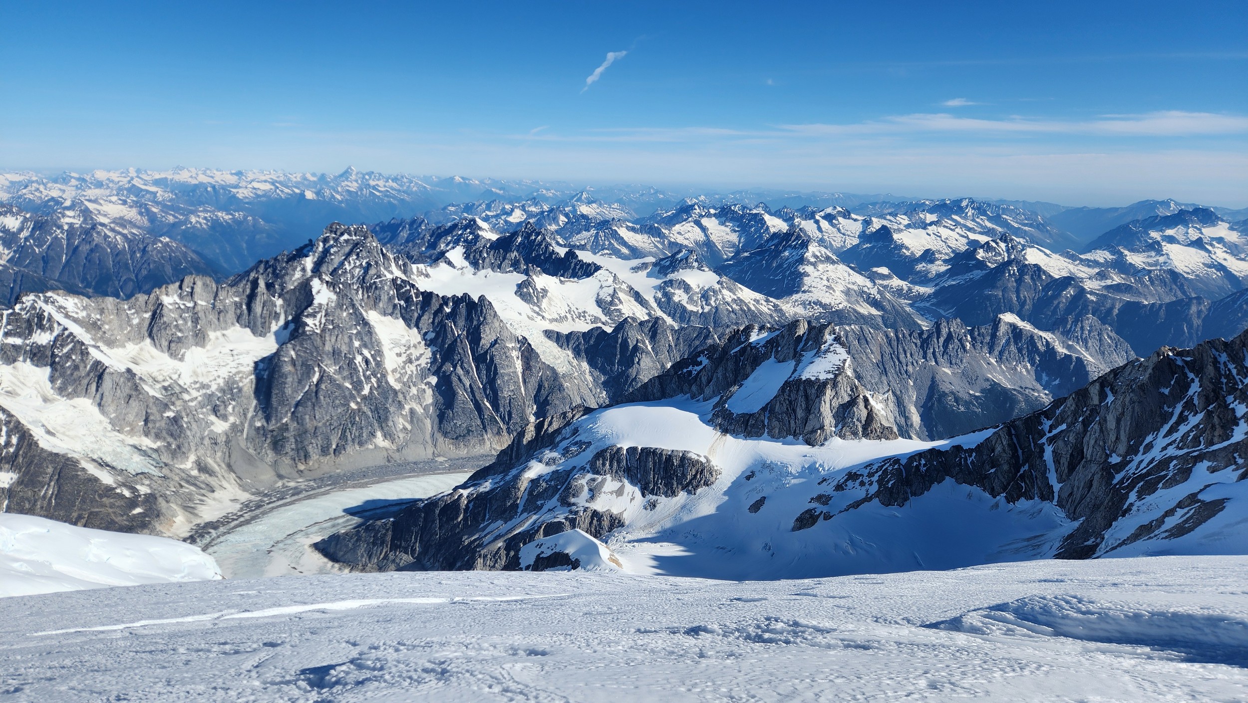
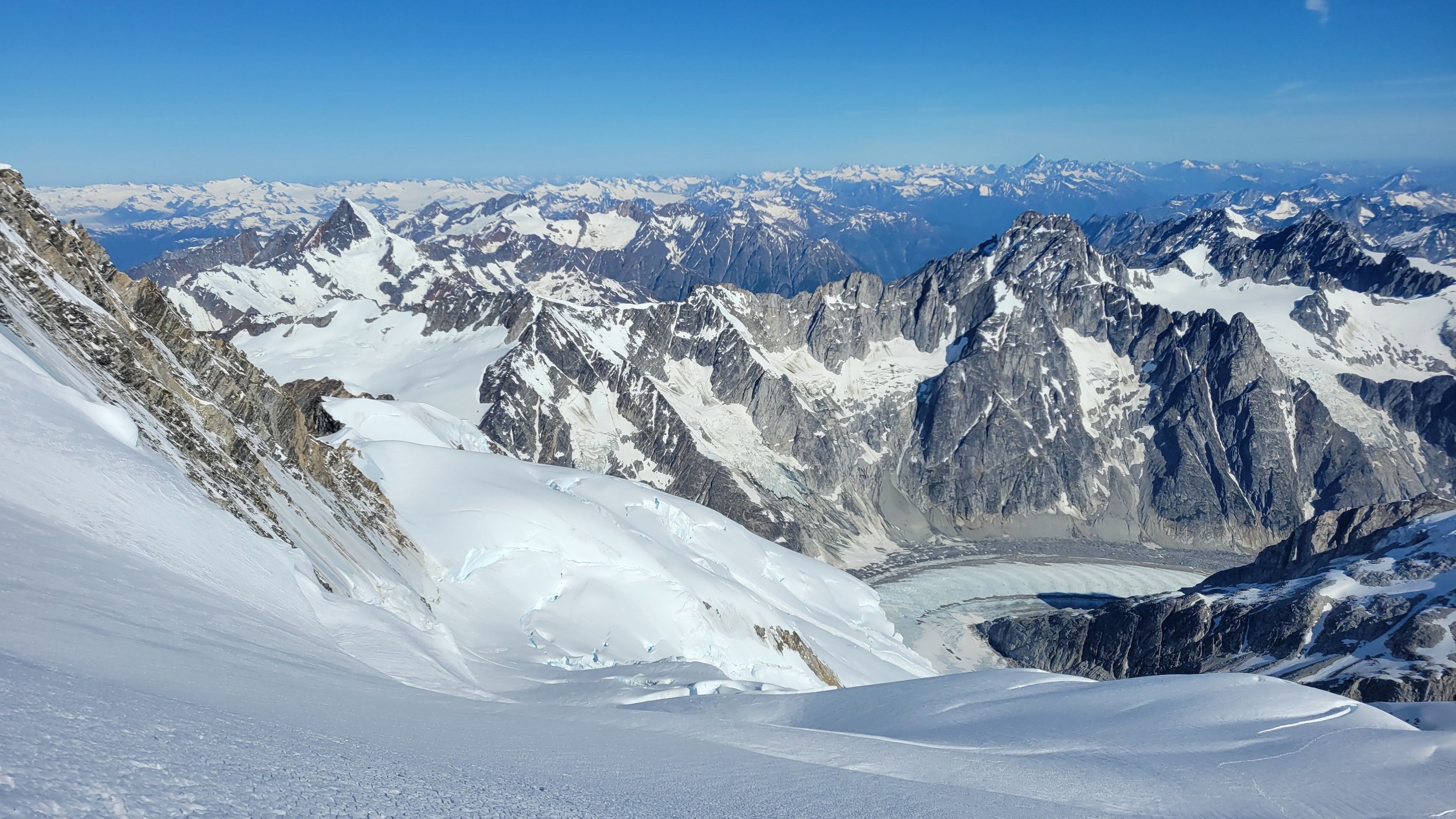
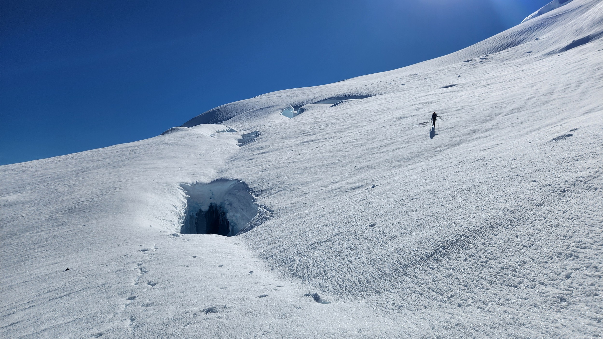
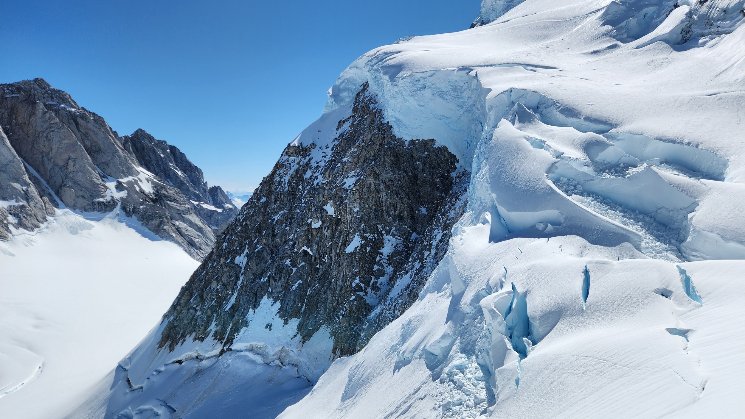
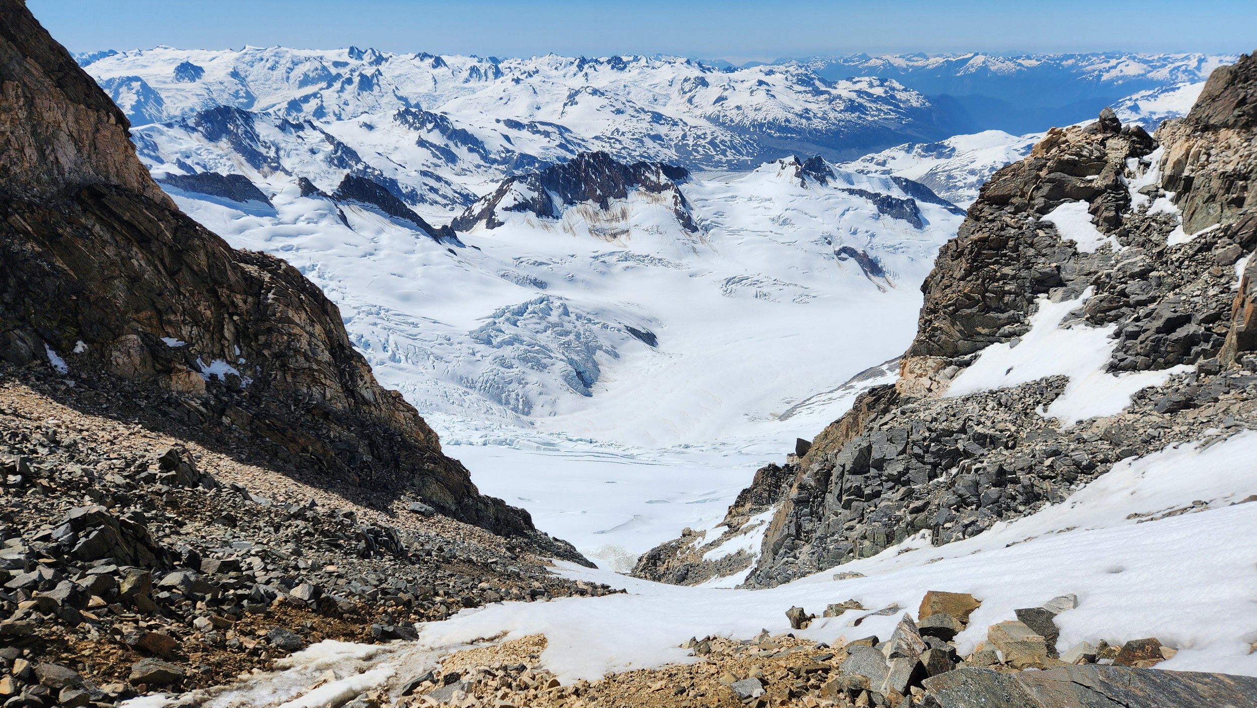
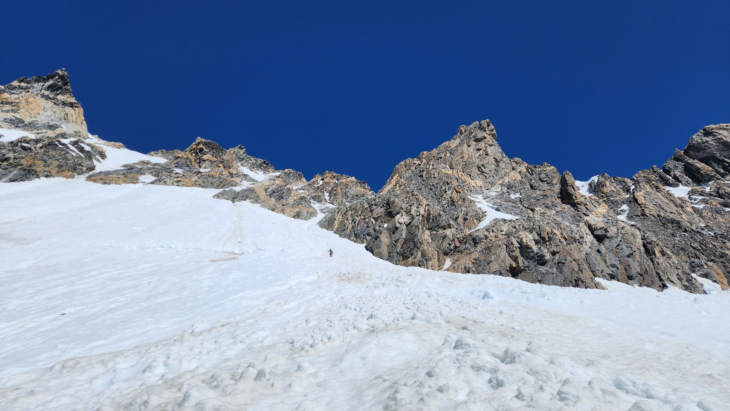
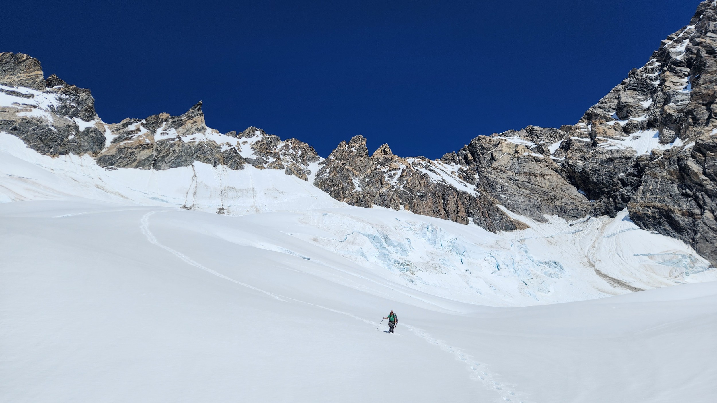
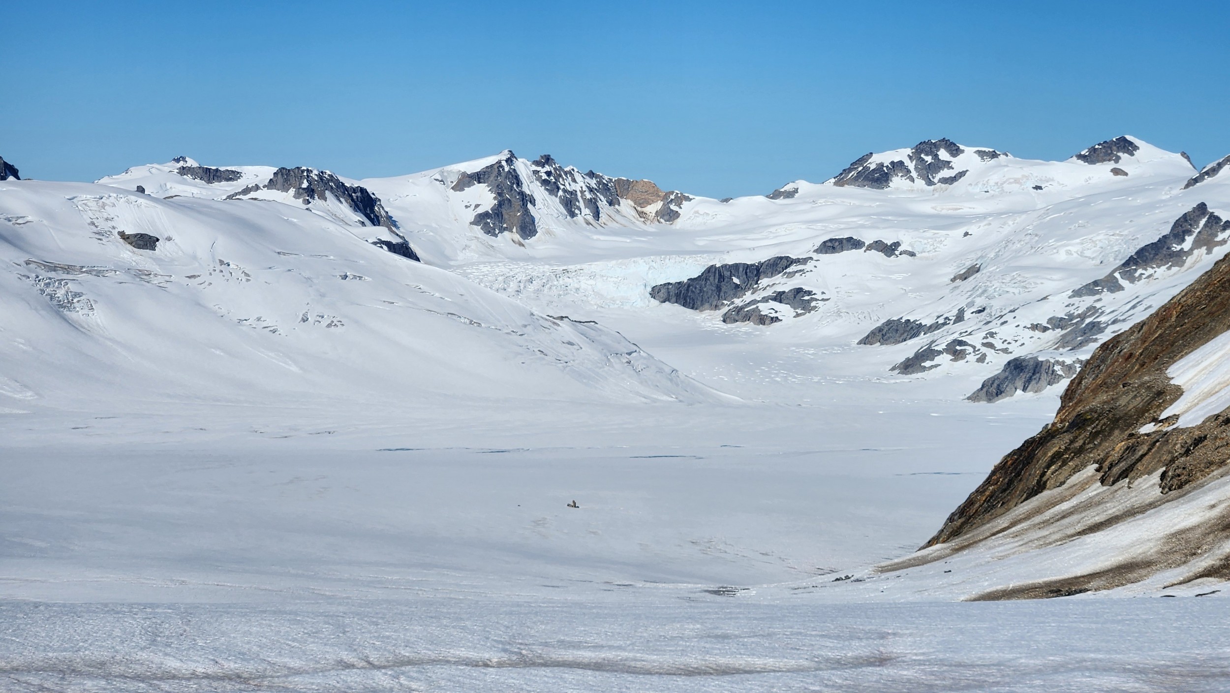
As we hiked up the lower Dais Glacier, we started crossing small crevasses right away. The flat bench on the glacier below the headwall separating the long expanse of low elevation valley glacier with the upper bench at the base of the steep faces of Waddington quickly turned into steeper snow covered slopes. The left side of the glacier offered as much more feasible approach to the upper bench from what we could see from the helicopter as we flew in. In hindsight, the far right side would have also worked as well, and may actually have been shorter. We started up and passed below the south face of Regal Dome, and continued northeast until we got to the base of the couloir dropping from the north from the small col immediately east of Councillor Peak. We took a good look up this couloir as we would utilize this on our descent, and it actually looked very straightforward which provided some relief knowing we would have an easy descent once we can get to that point.
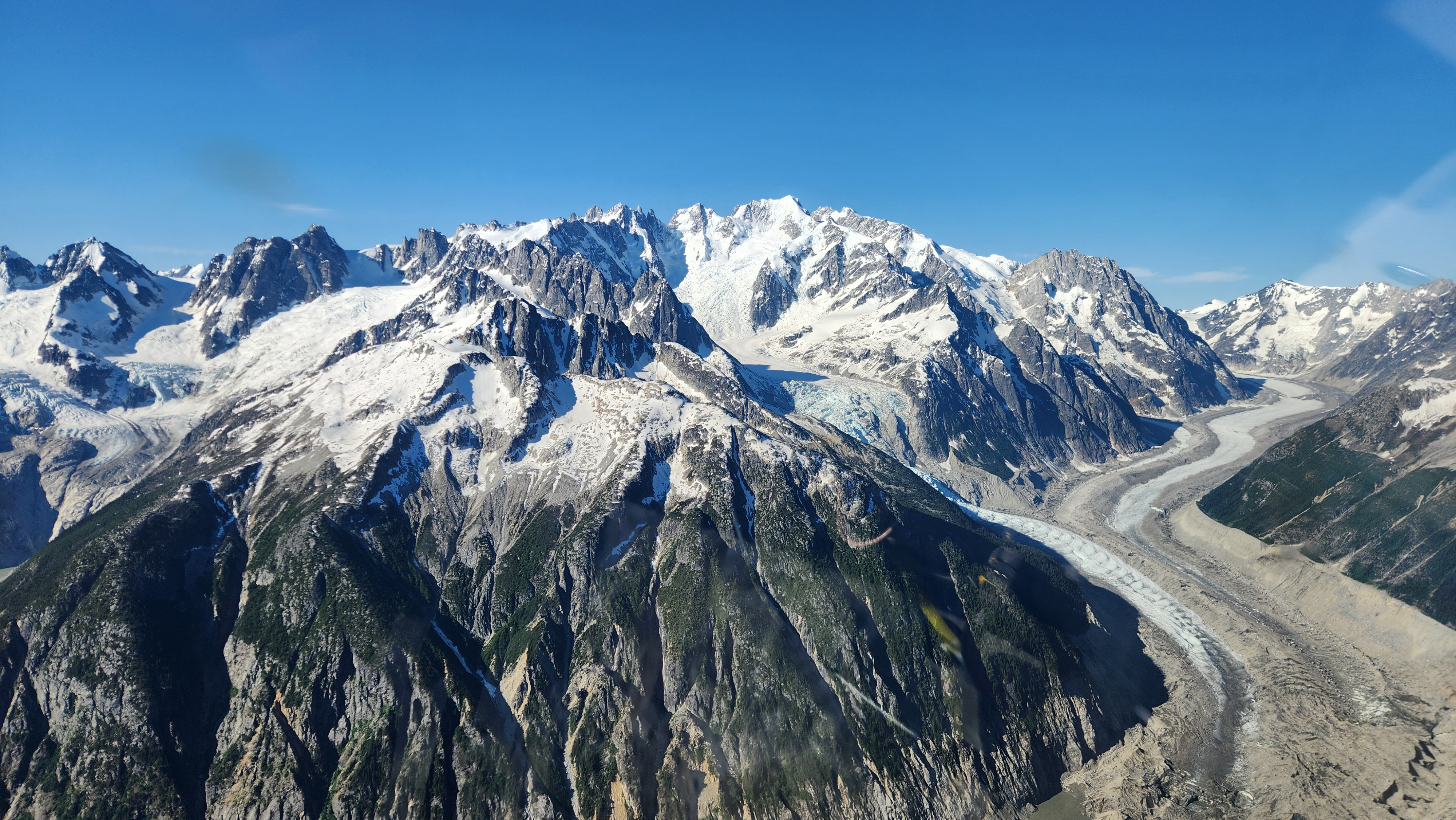
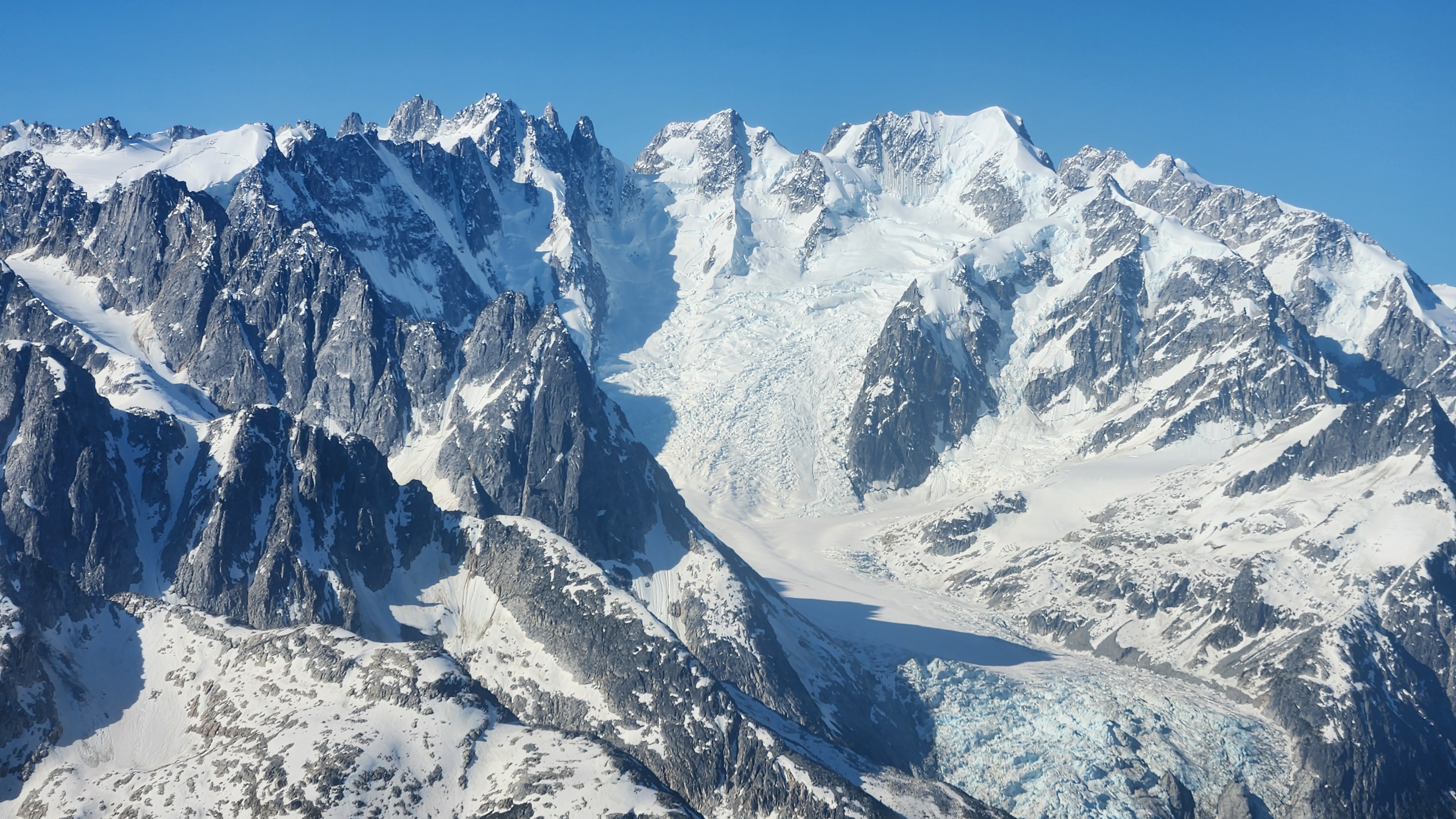
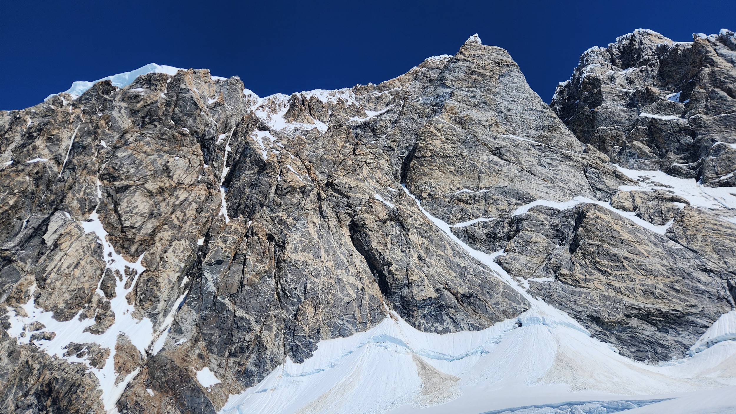
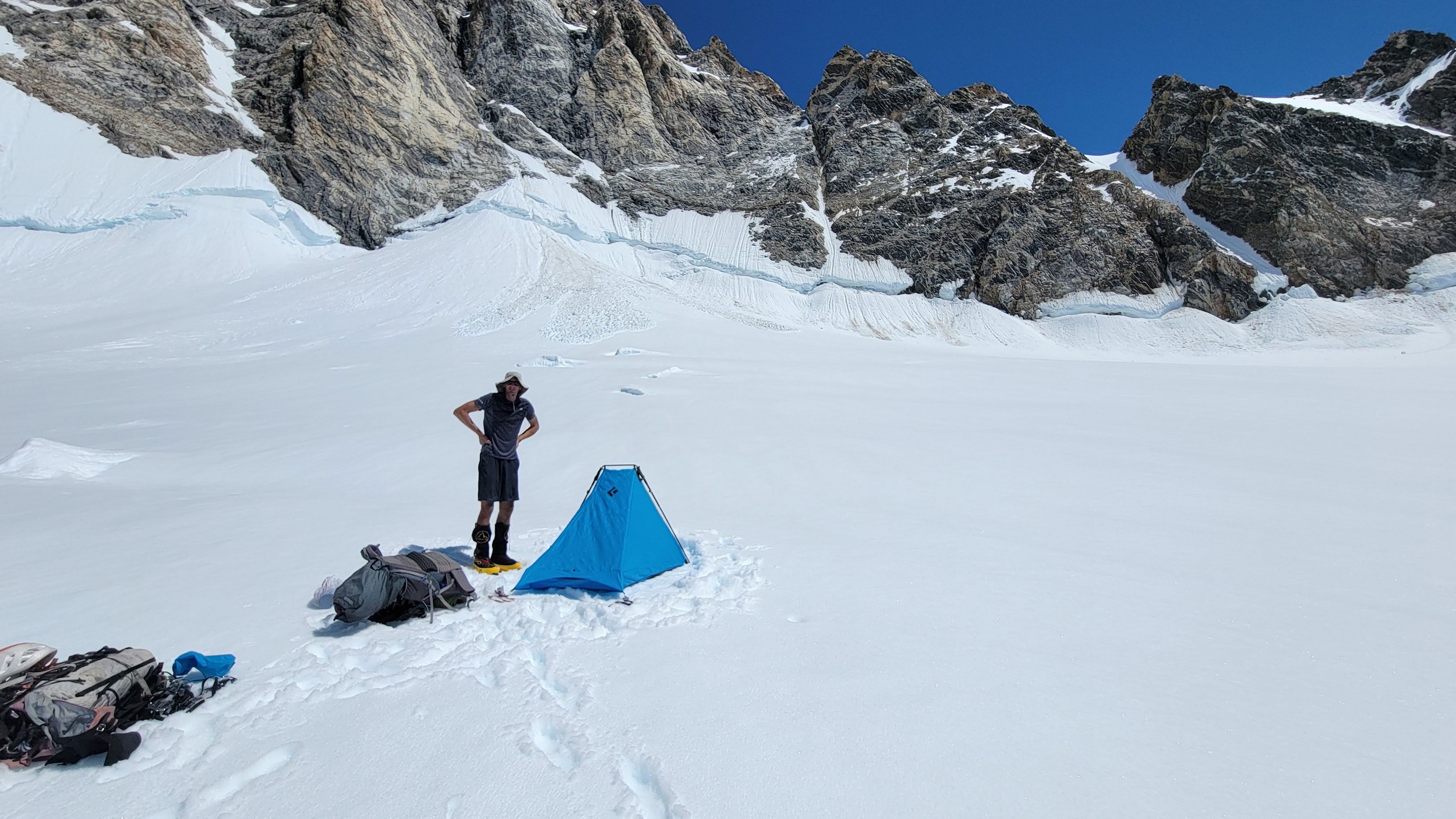
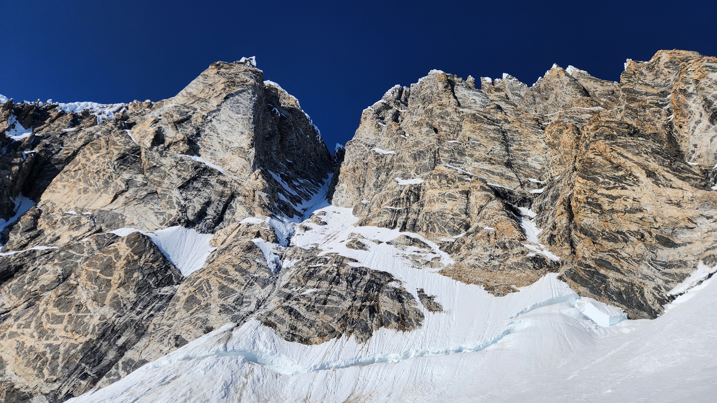
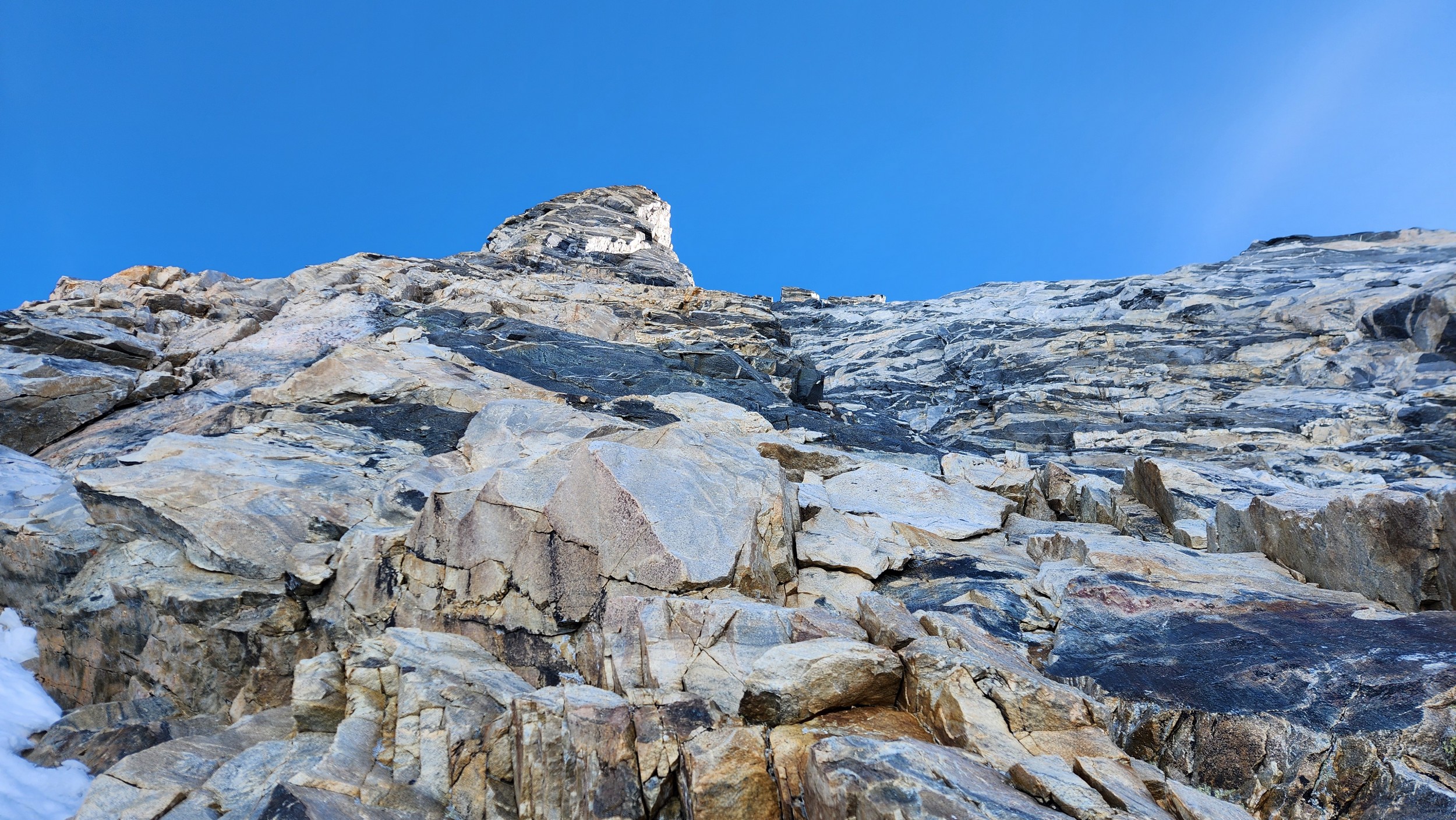
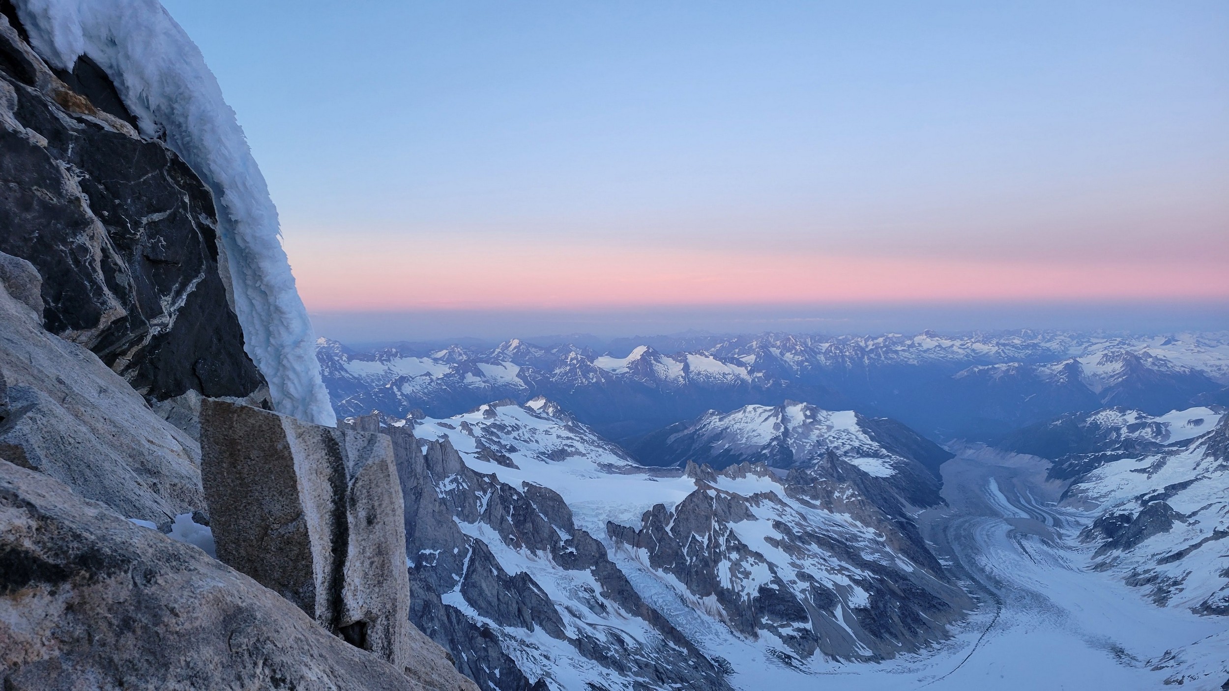
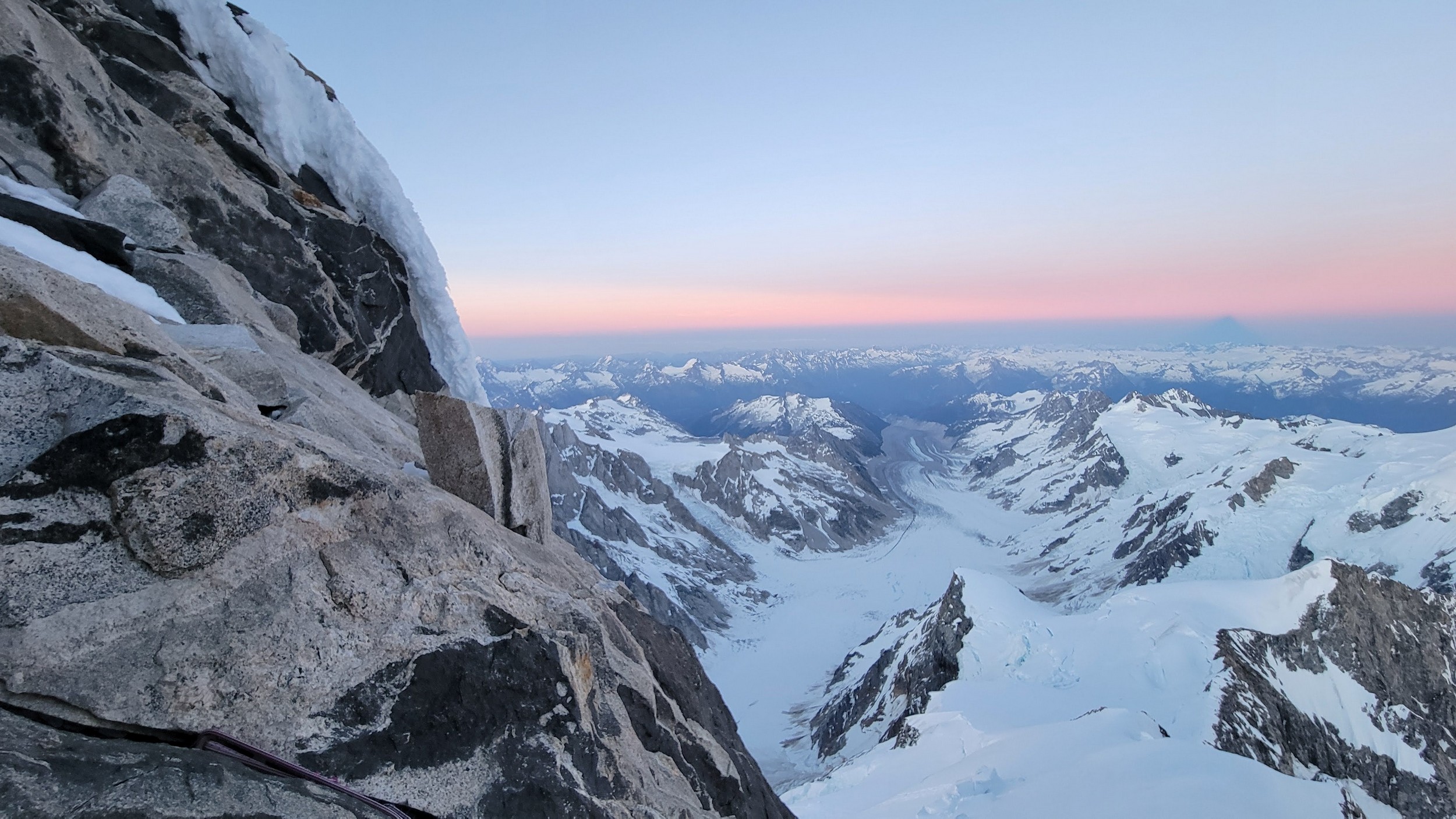
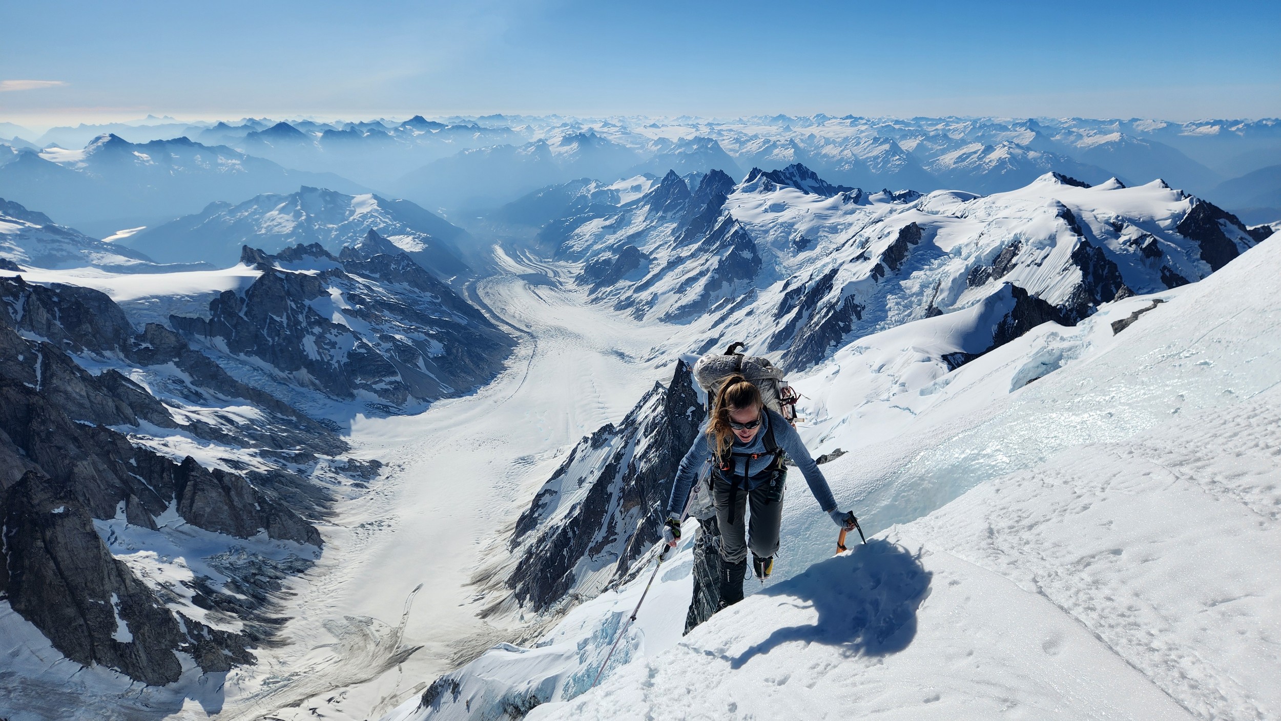
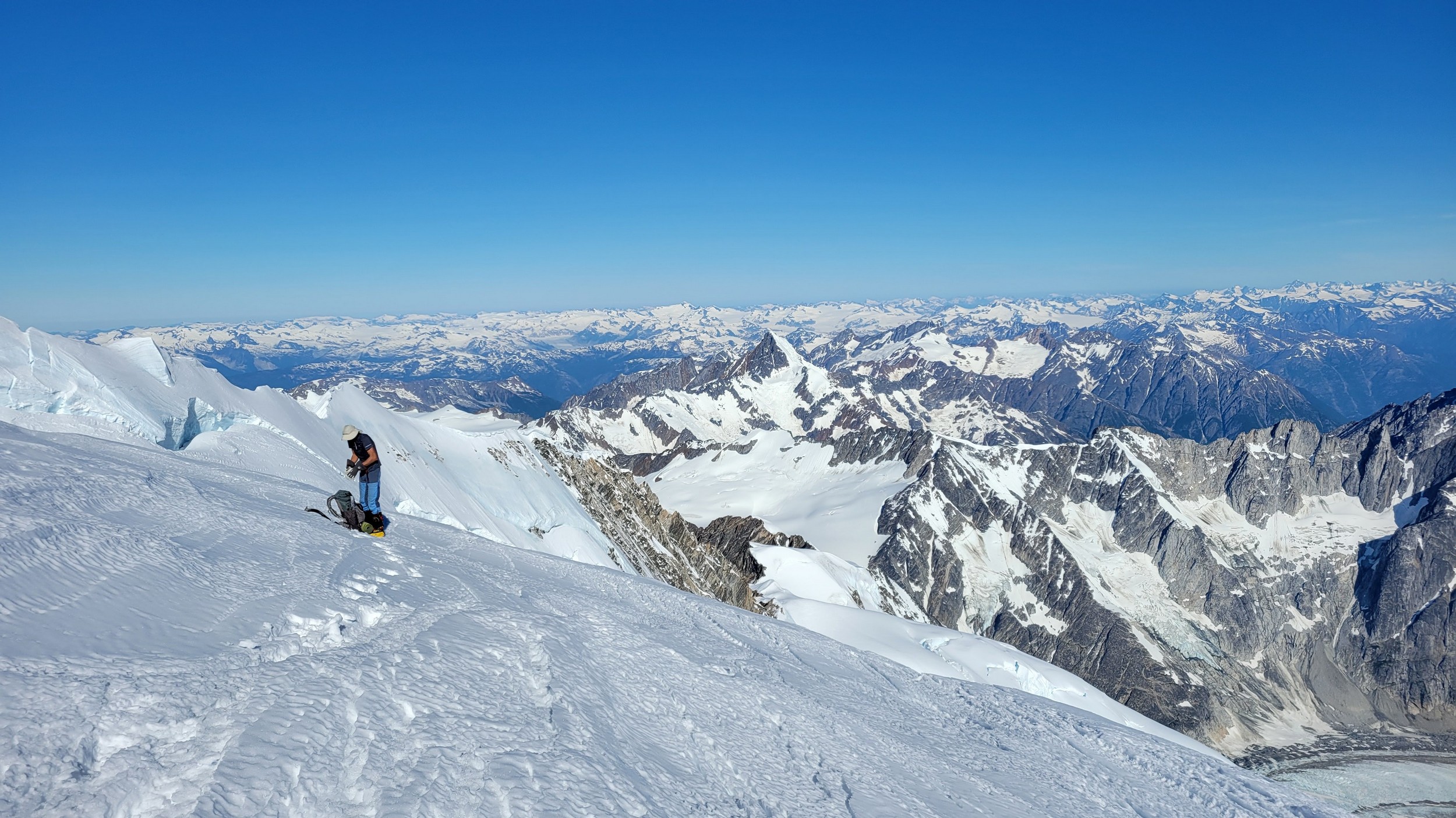
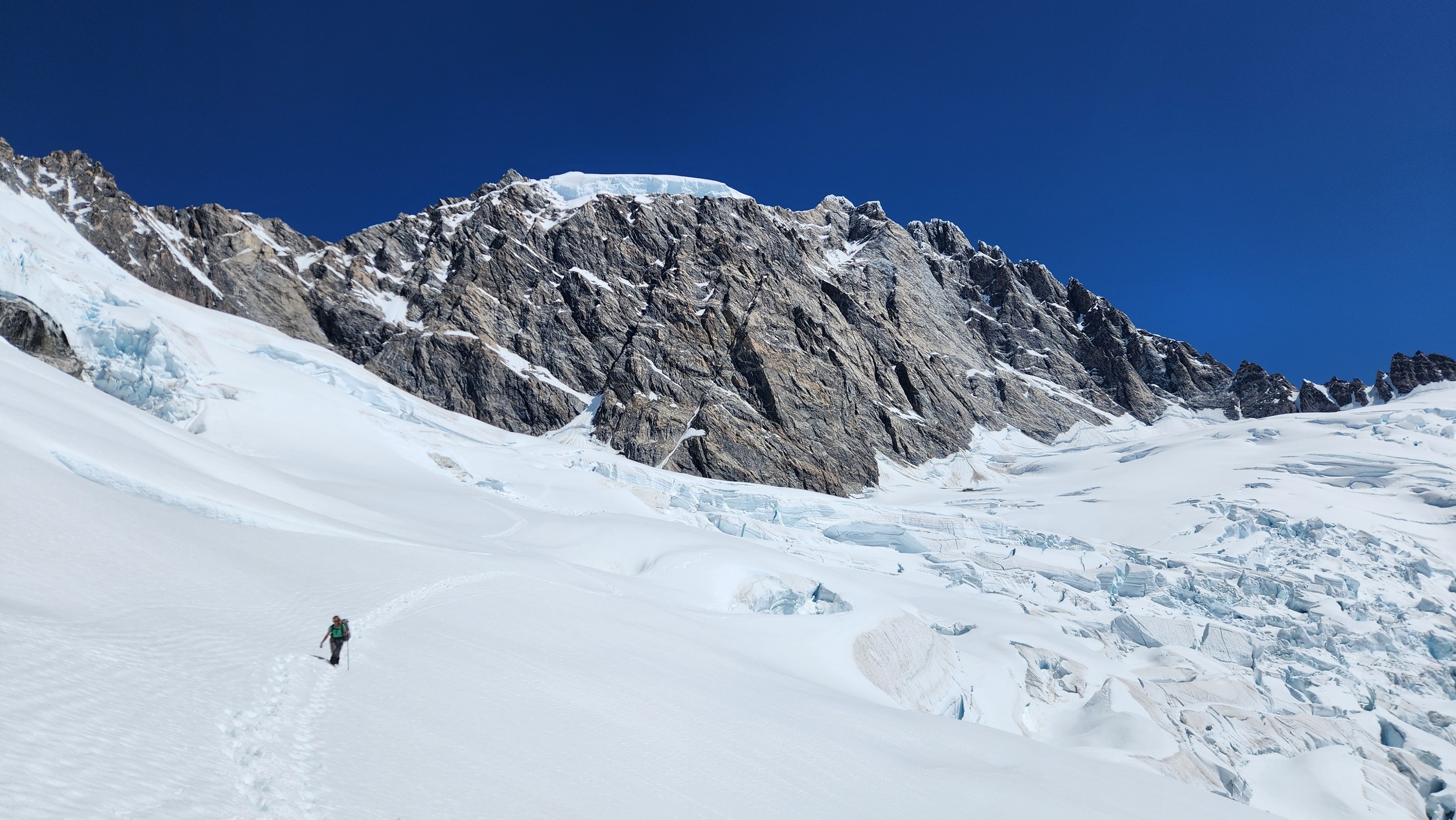
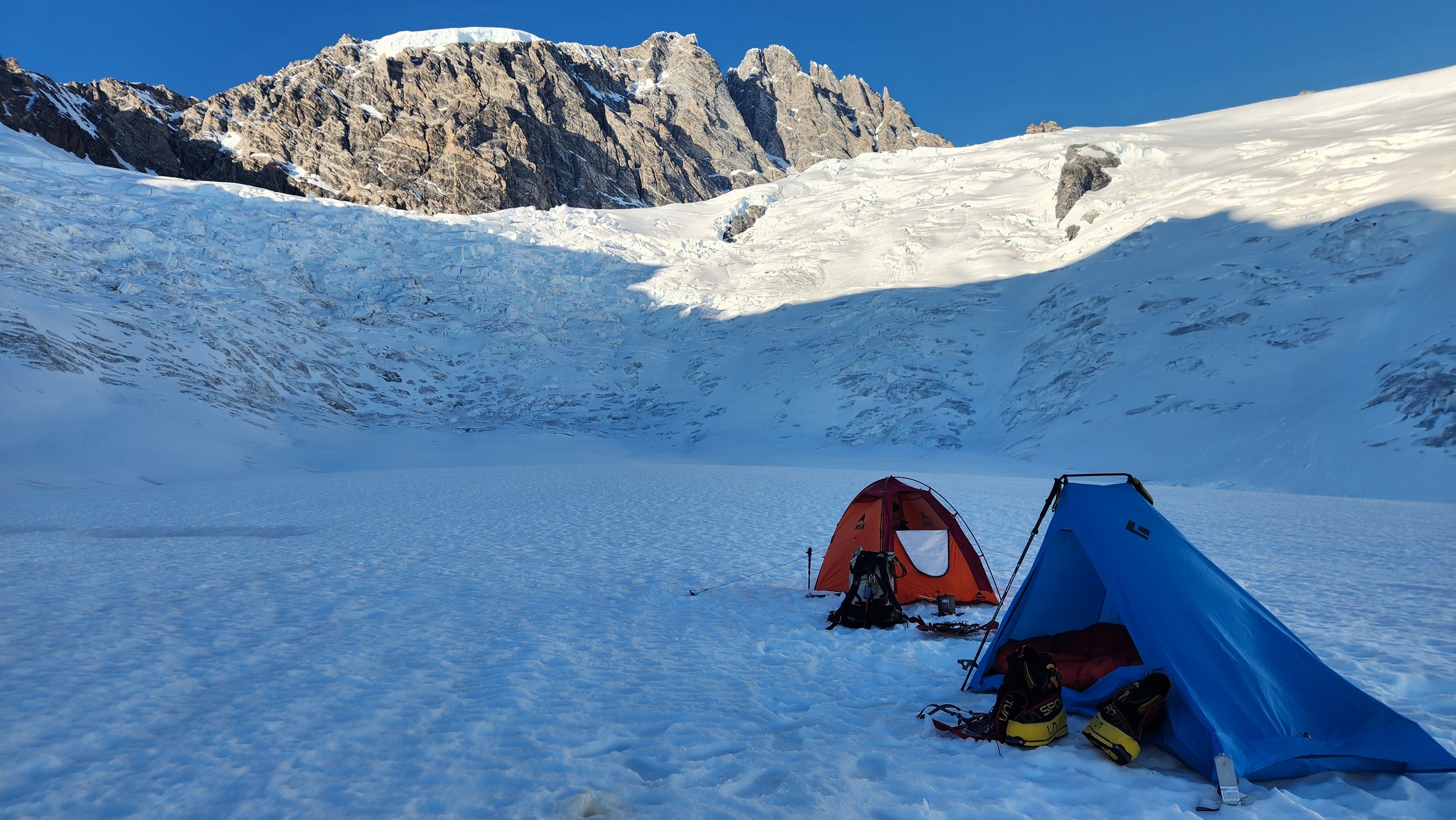
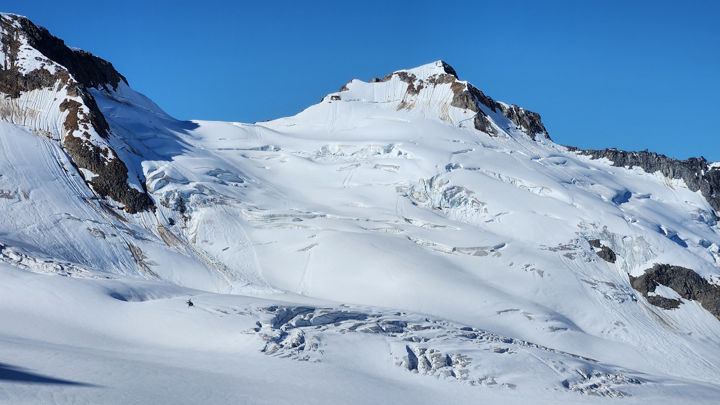
From this point, we started curving rightward and continued up a lower angle slope traversing along the base of the very steep west face of Mount Waddington. Midway up this traverse there was a large crevasse that did require a short vertical step to navigate after cutting way left towards the base of the cliff to find a spot with a snow bridge. Once we got past this one crevasse it was easy walking, however the snow was starting to get soft as we were approaching midday. By about 1:30pm we reached an elevation of 3200 meters right at the base of the start of the south face route. We setup the ultralight test right on the flattest spot on the upper bench as close as possible to the route. A nice afternoon of resting was had and I took a short walk further out to the south to the edge of the upper bench to the low spot in the SW ridge where I could get a good unobstructed view to the south, and a great view of the route behind me to the north. I snapped the photo with the route topo above from this spot and I gained some more confidence after studying it a bit, as all the snow/ice sections on the bottom 2/3 of the route all seemed fairly doable, with just a couple spots that looked challenging where there appeared to be thin bare ice in the entry couloir.
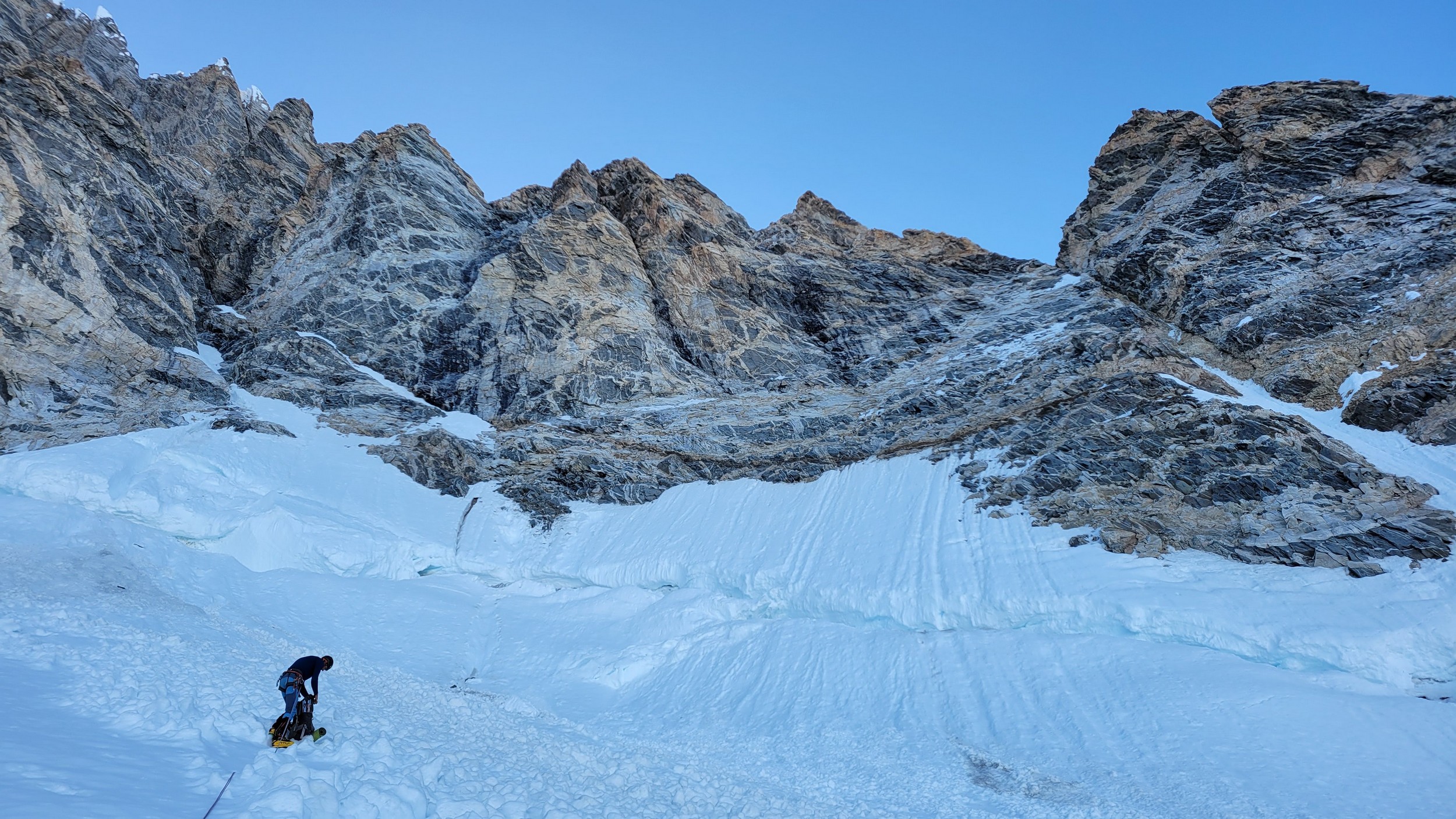
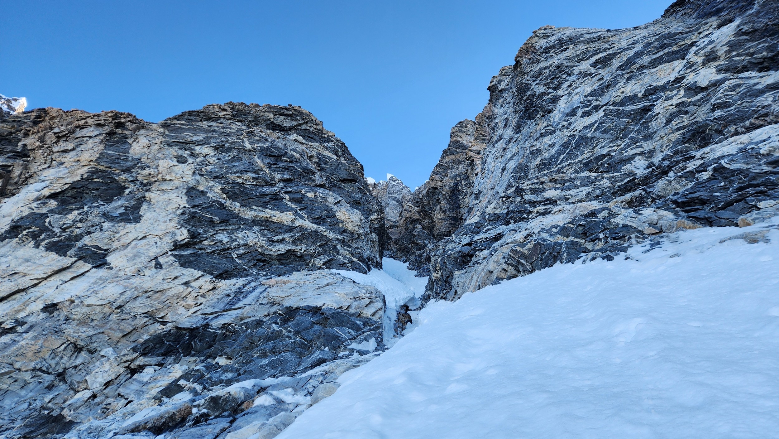
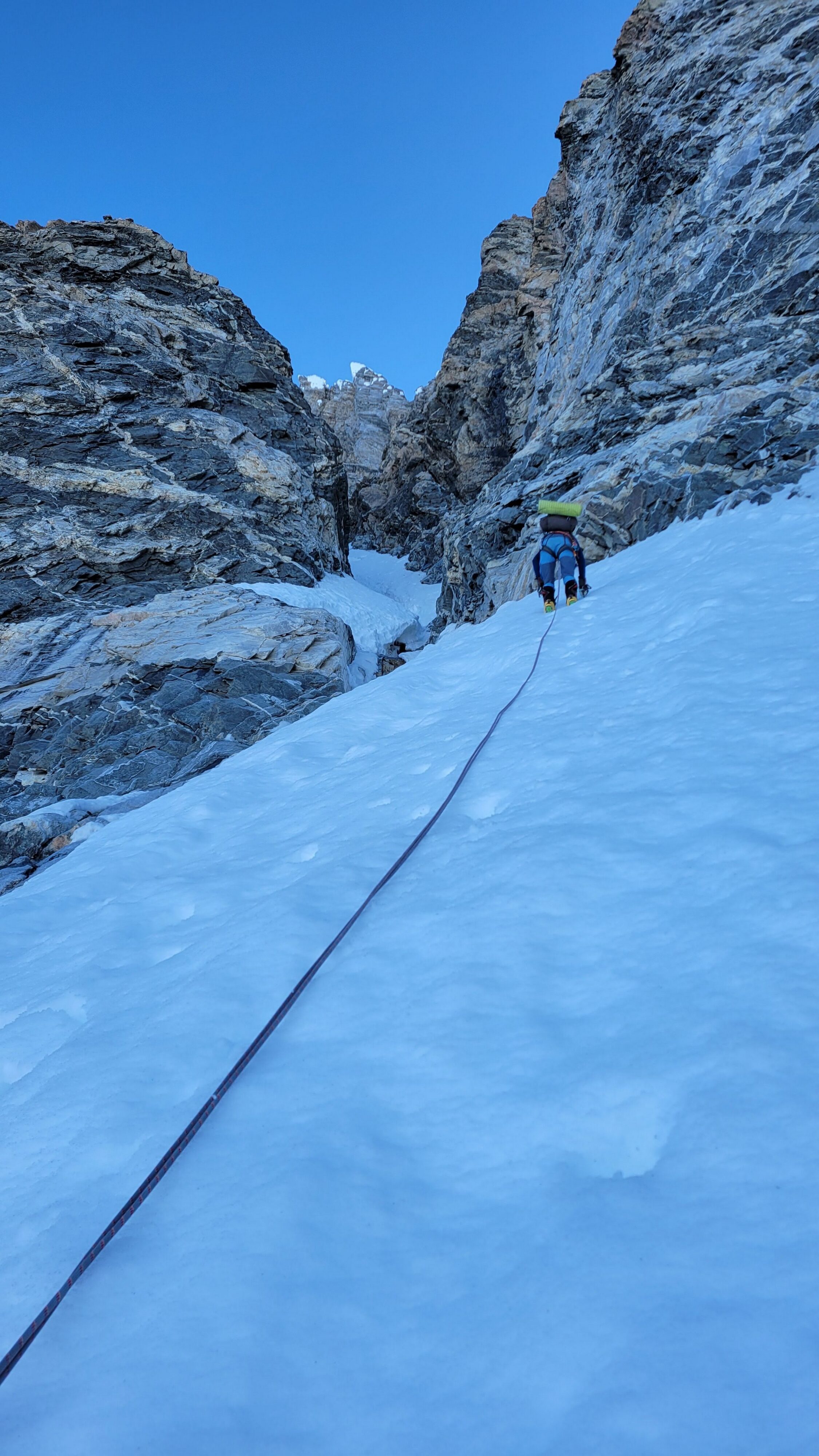
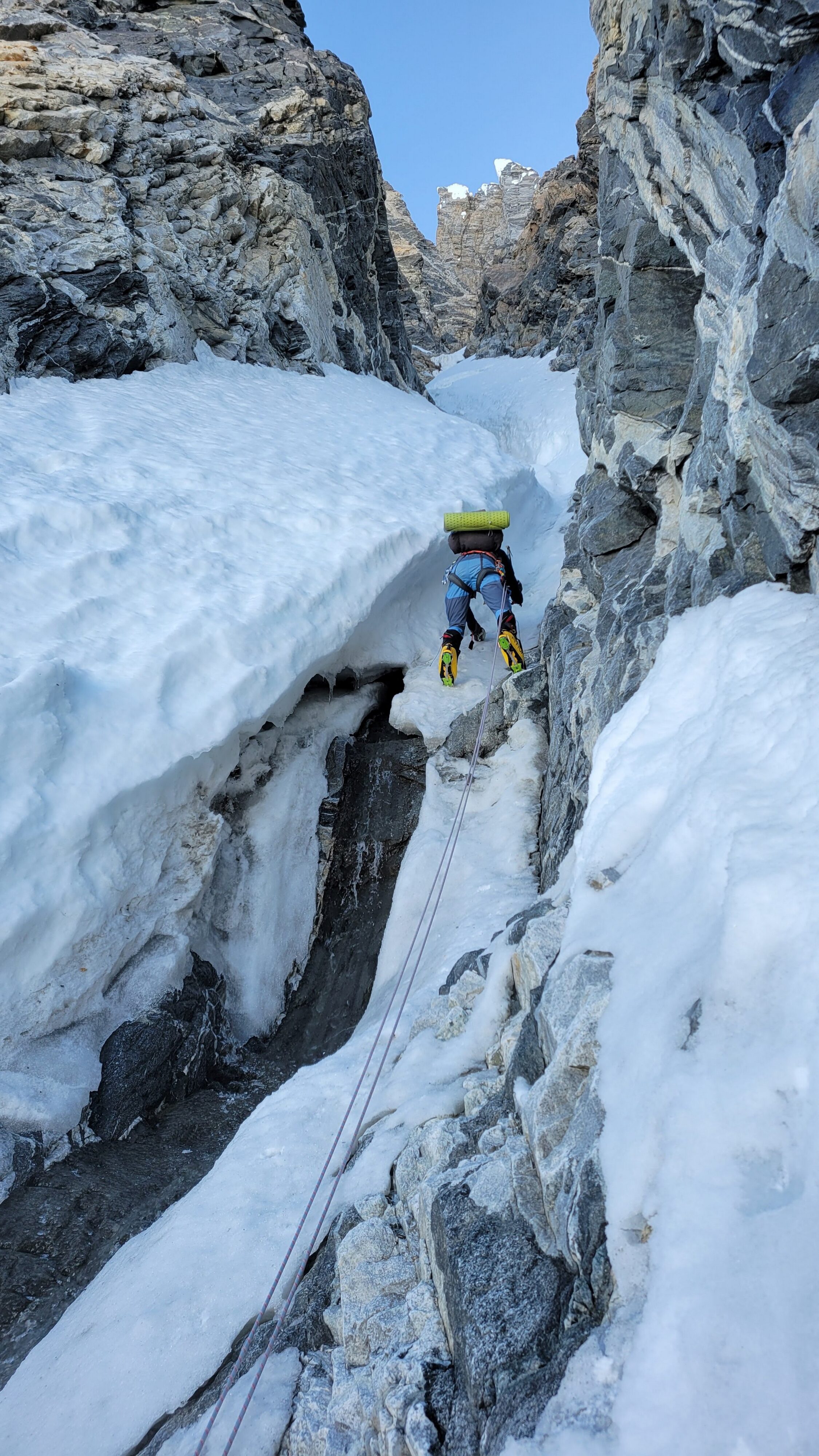
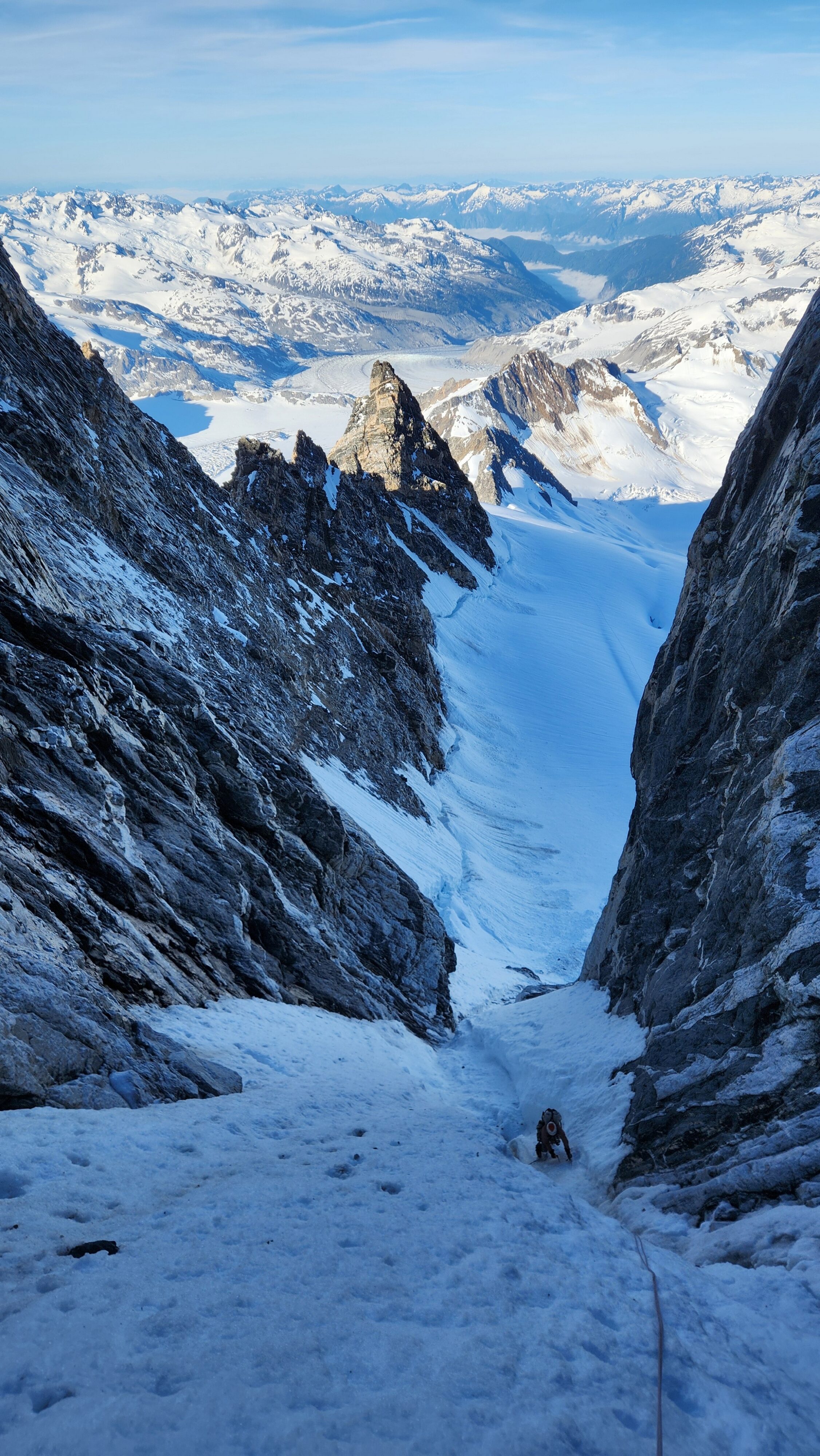
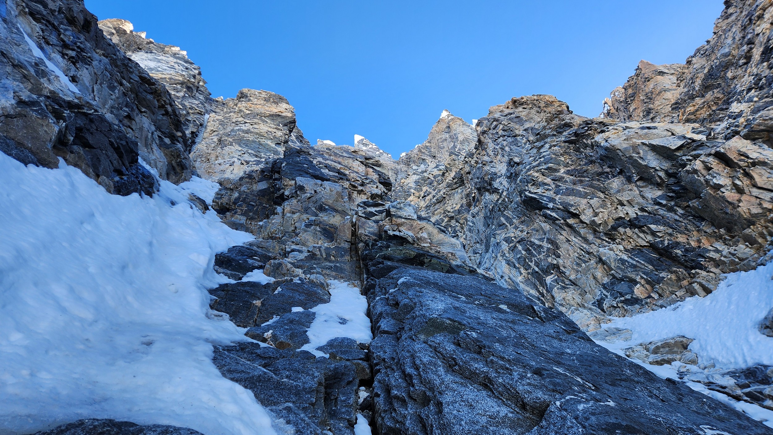
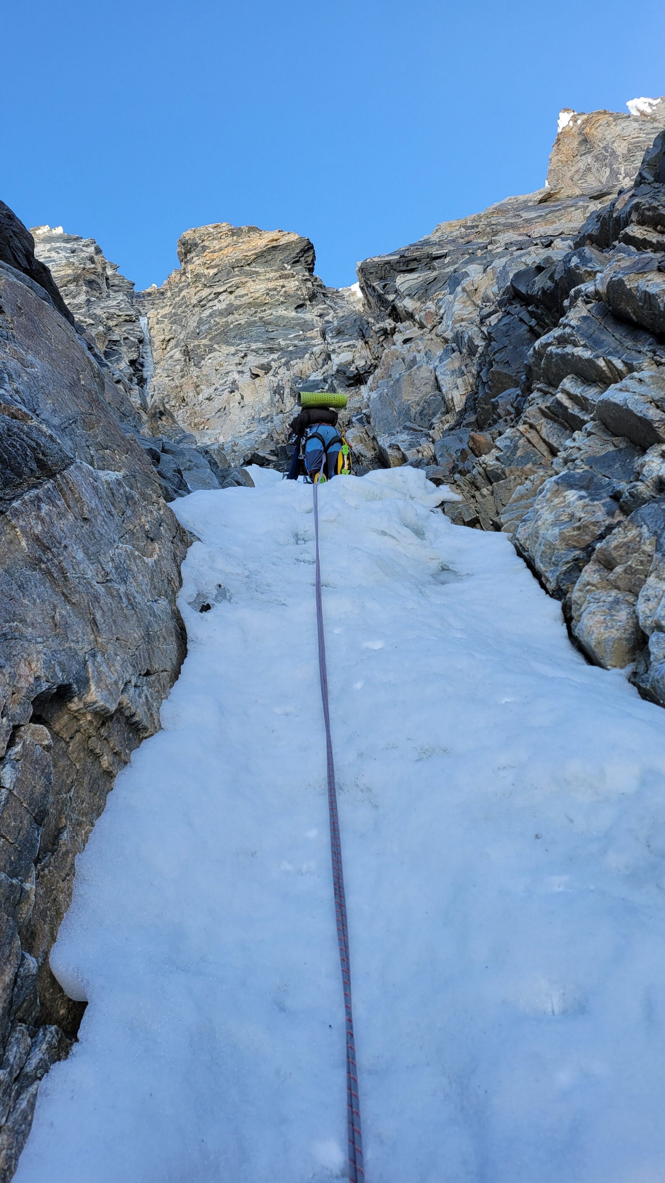
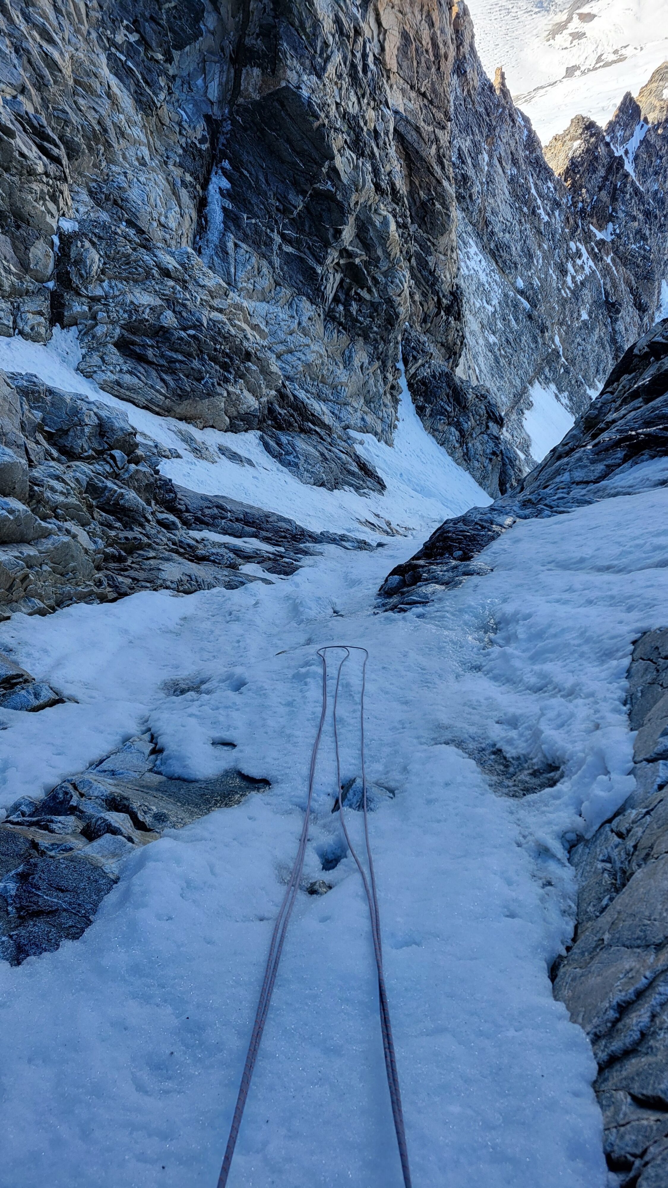
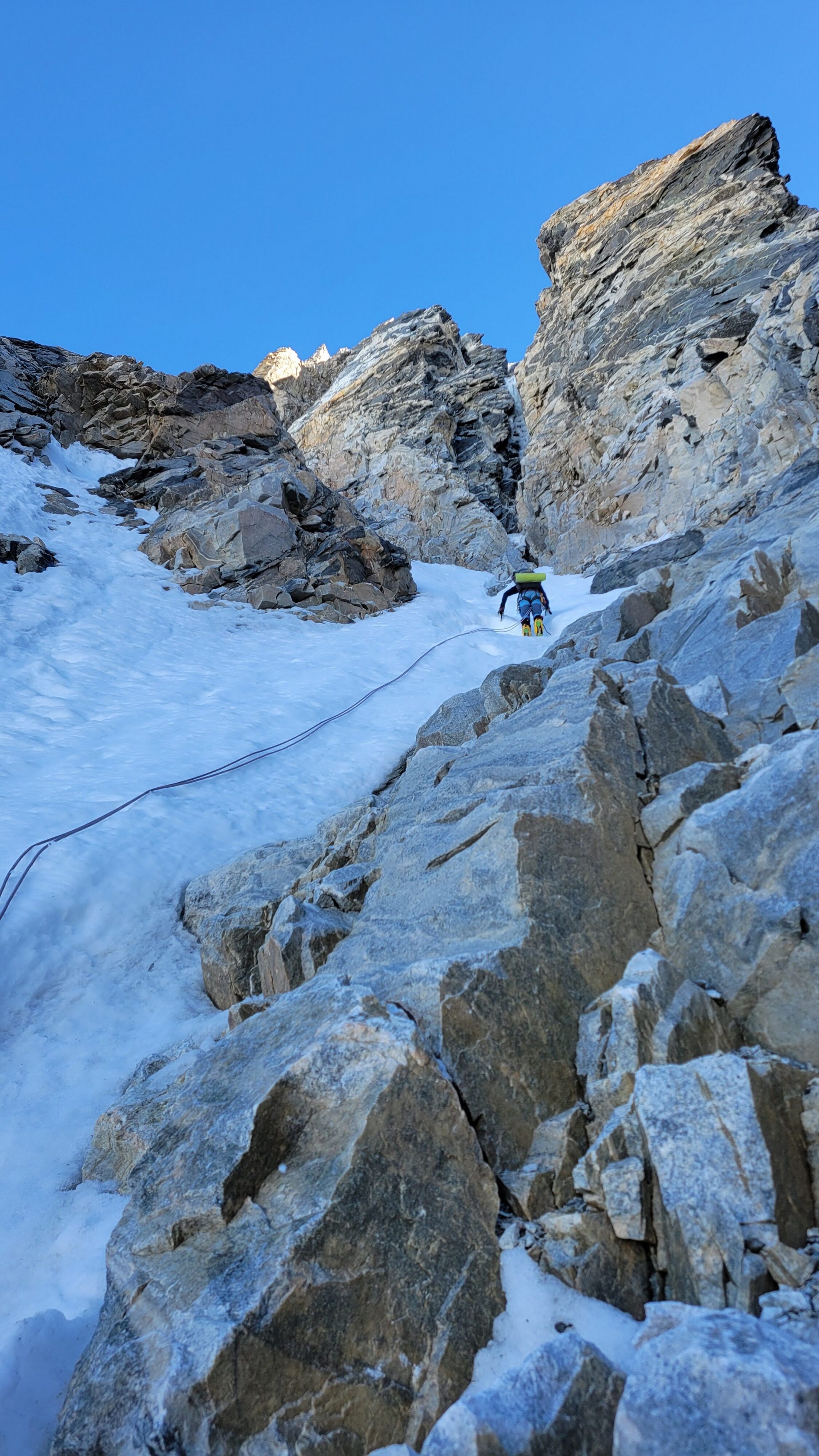
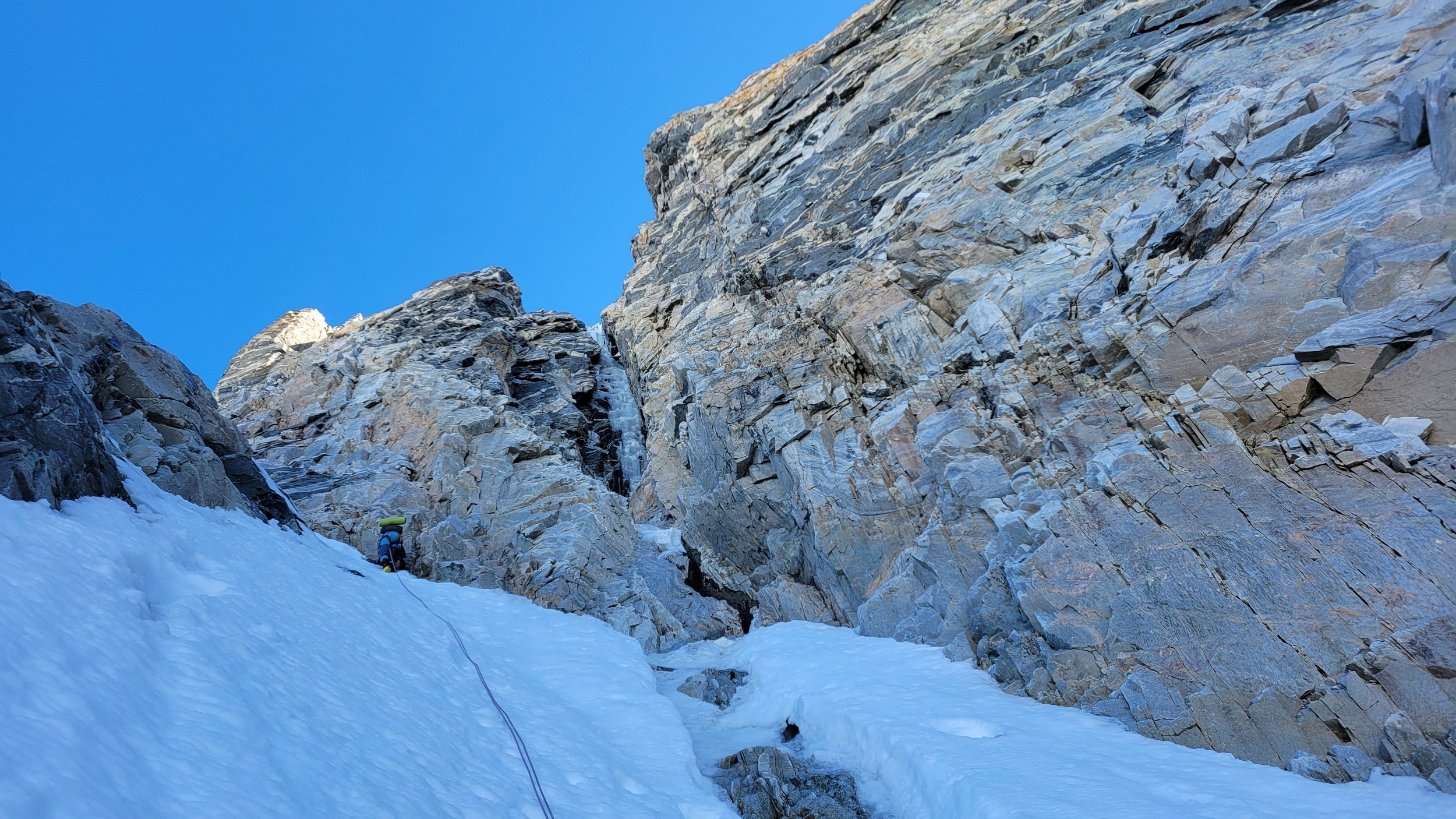
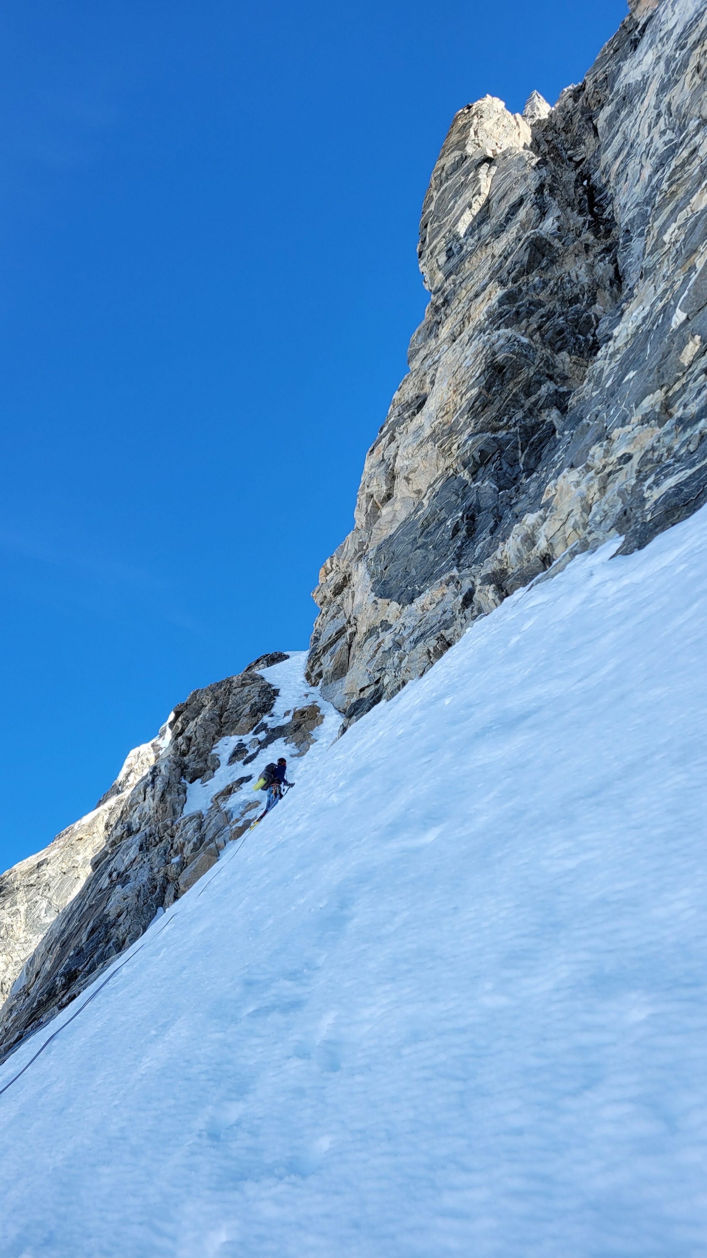
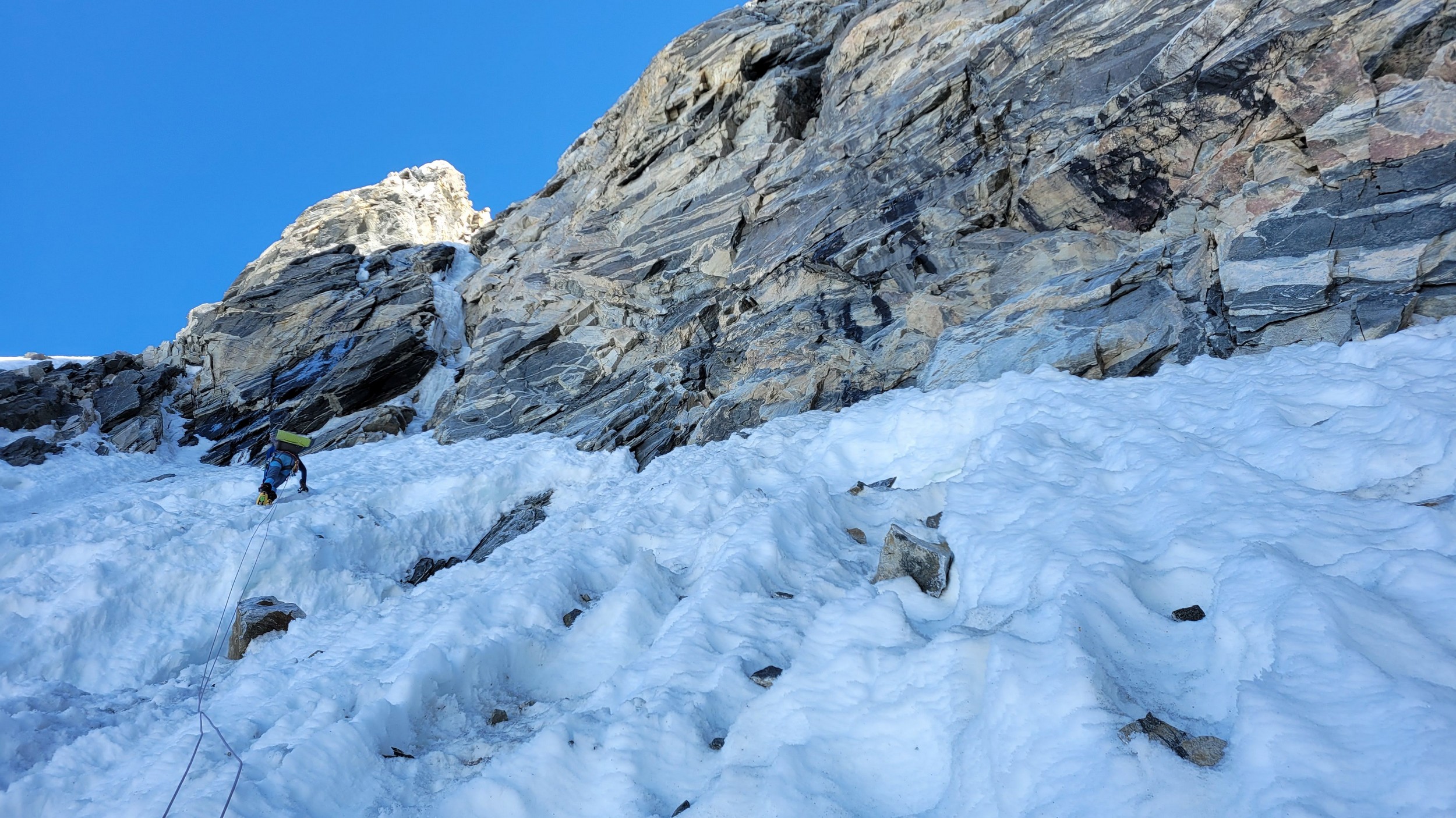
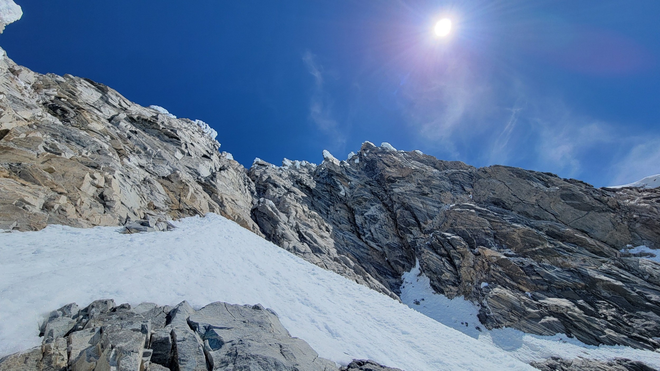
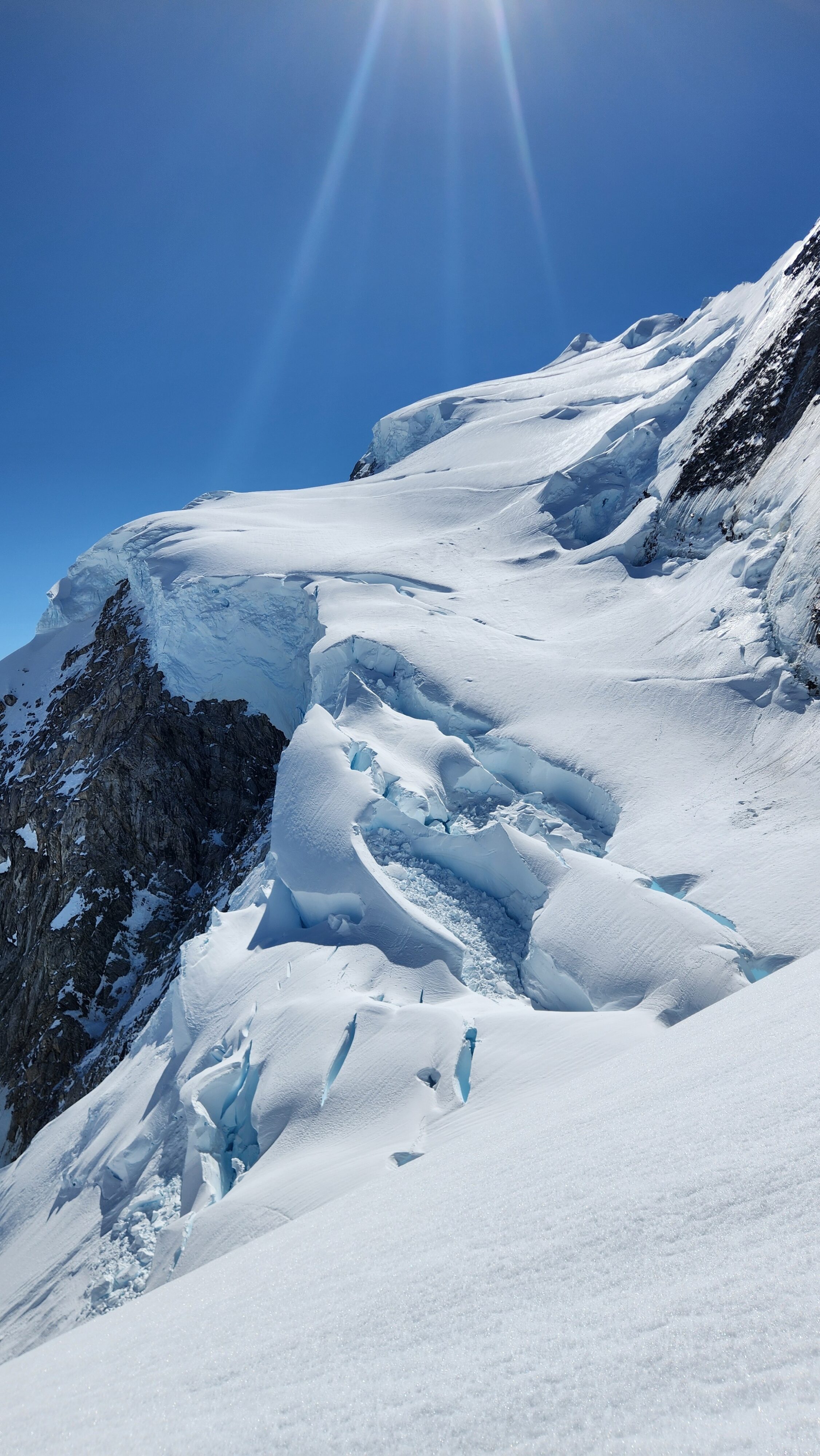
At about 5am we were packed up and started up the entry slopes up to the bergschrund, which thankfully was not a hard crossing. A zig zag to the left, right and then back left on a couple small snow bridges was all it took, then we could begin ascending the long steep couloir. The snow/neve in the couloir was in almost perfect condition offering excellent front pointing. After a few hundred feet of 50 degree climbing we hit the first obstacle, a 25 foot near vertical step where the ice was way too thin to try and climb, so Sarah led a wet and unprotectable rock line just to the right of the thin ice. It took over 30 minutes to get past this short but difficult 5.7 step where only one good cam placement was found.
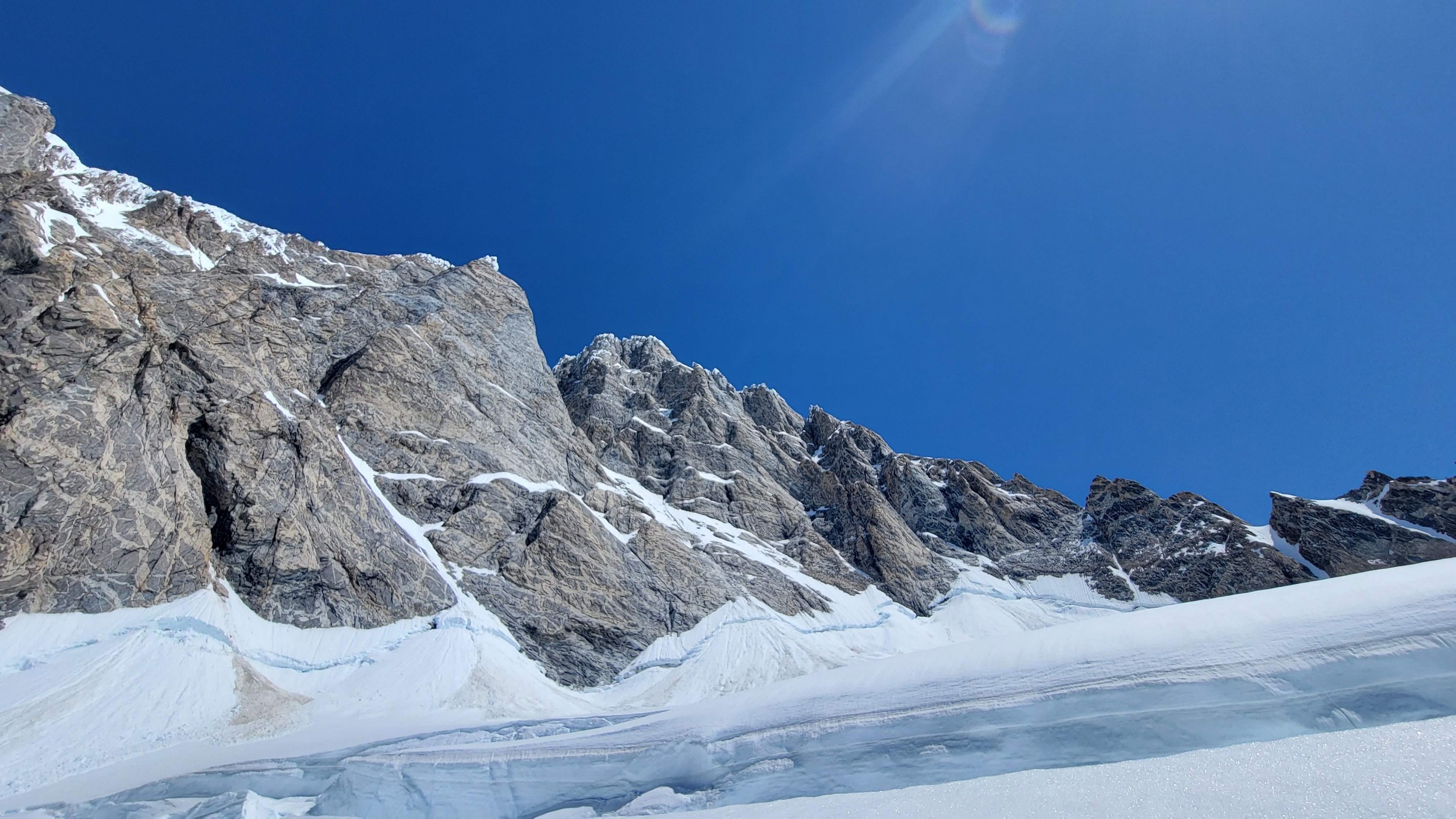
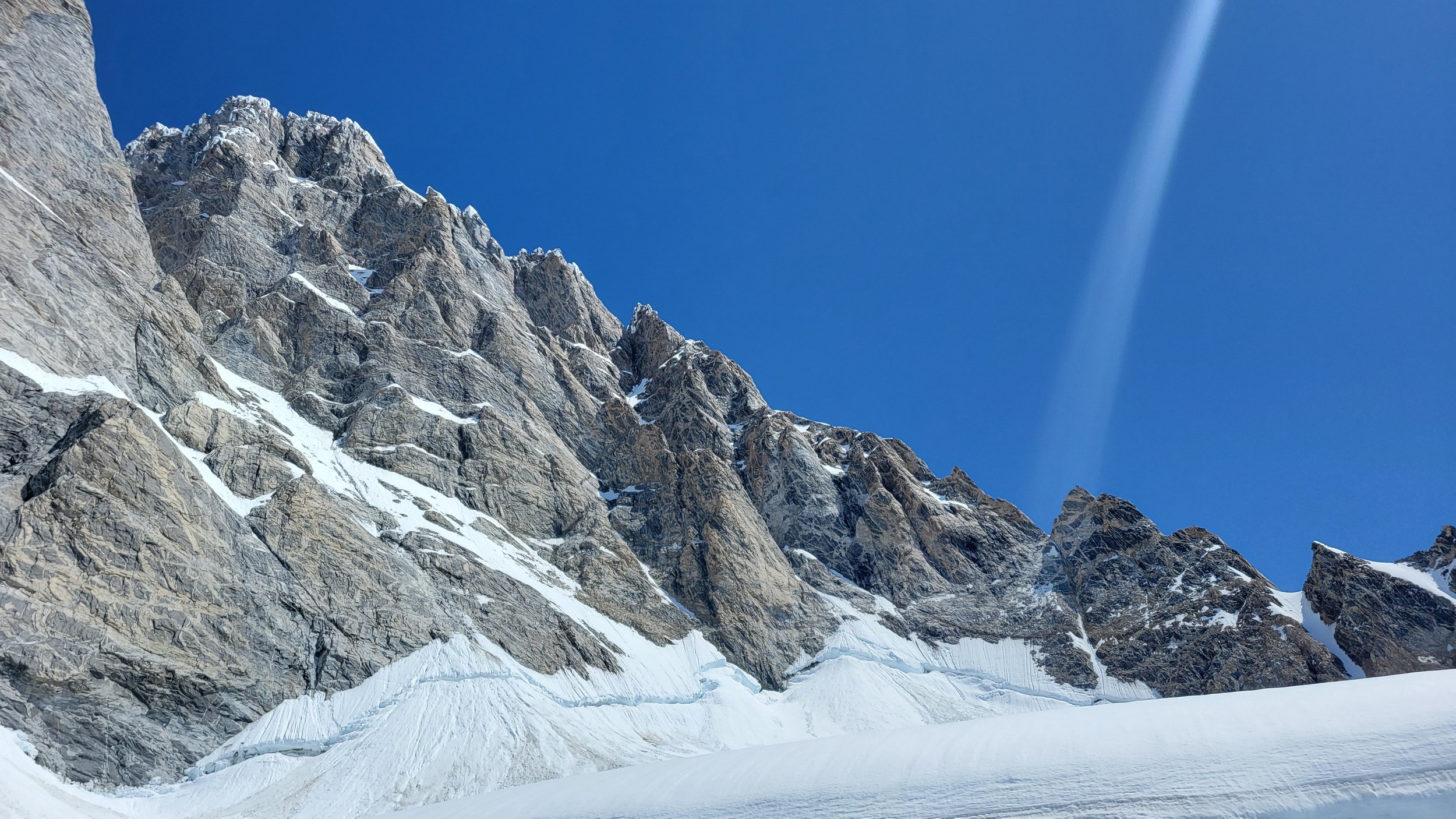
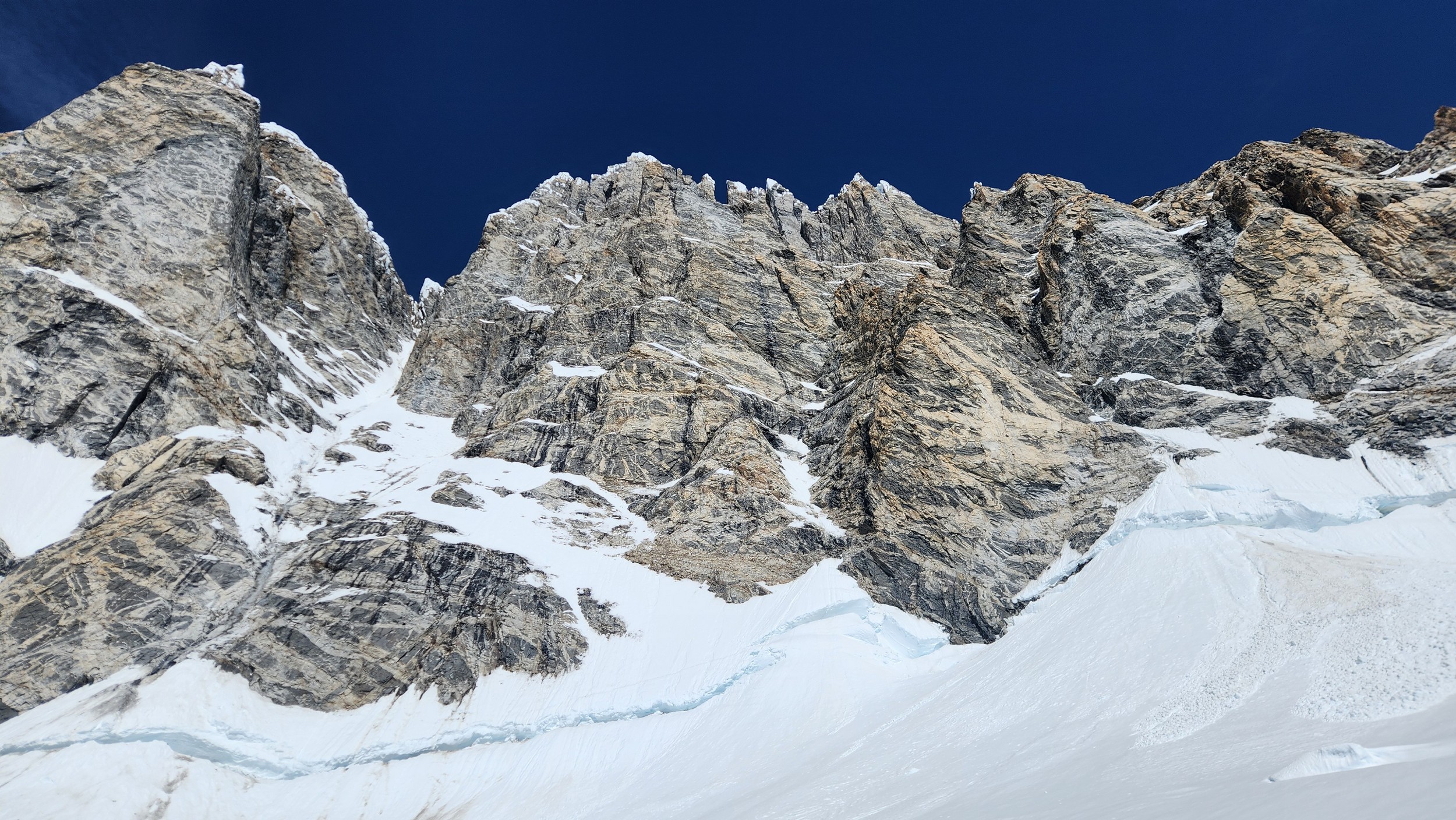
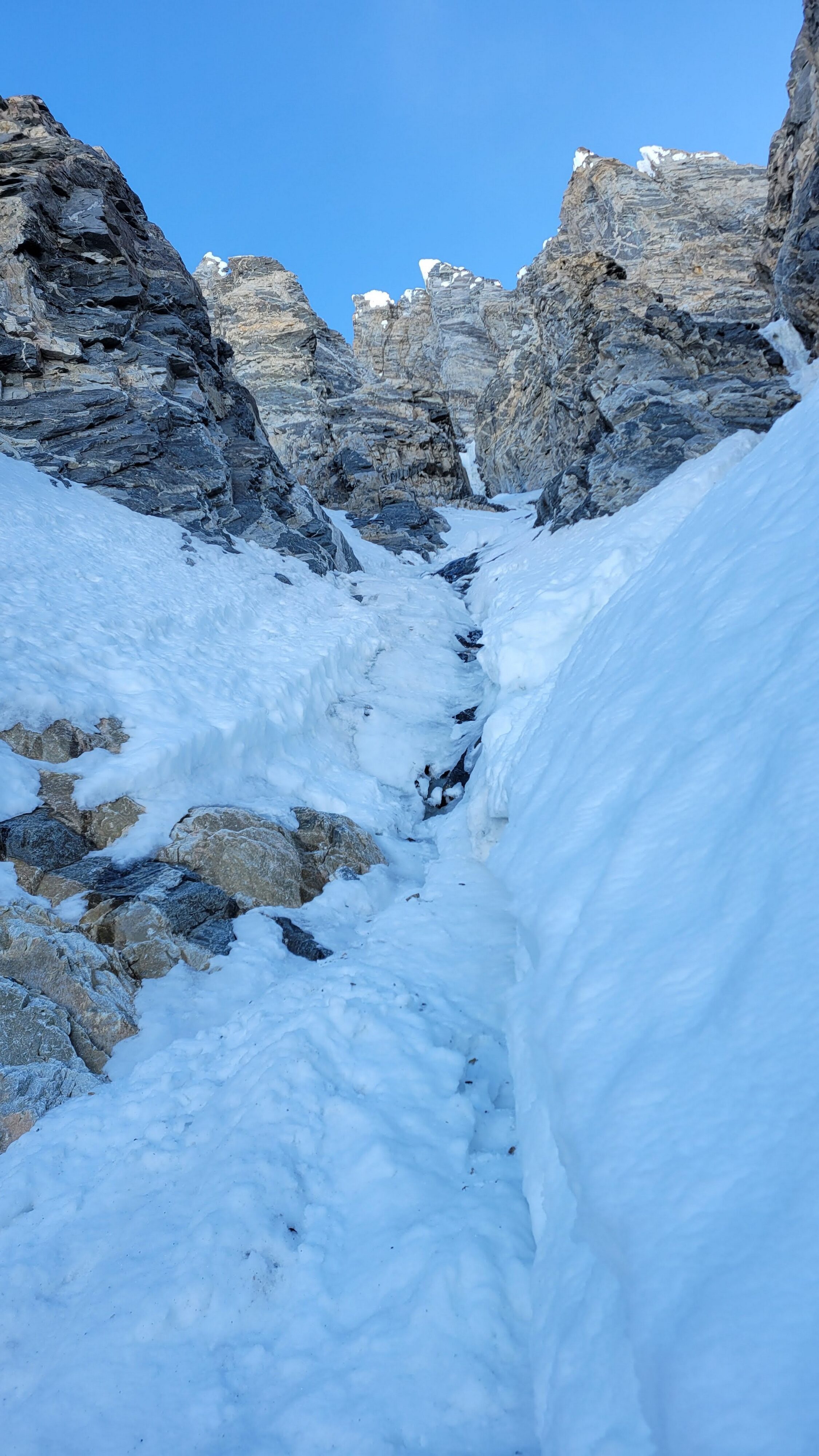
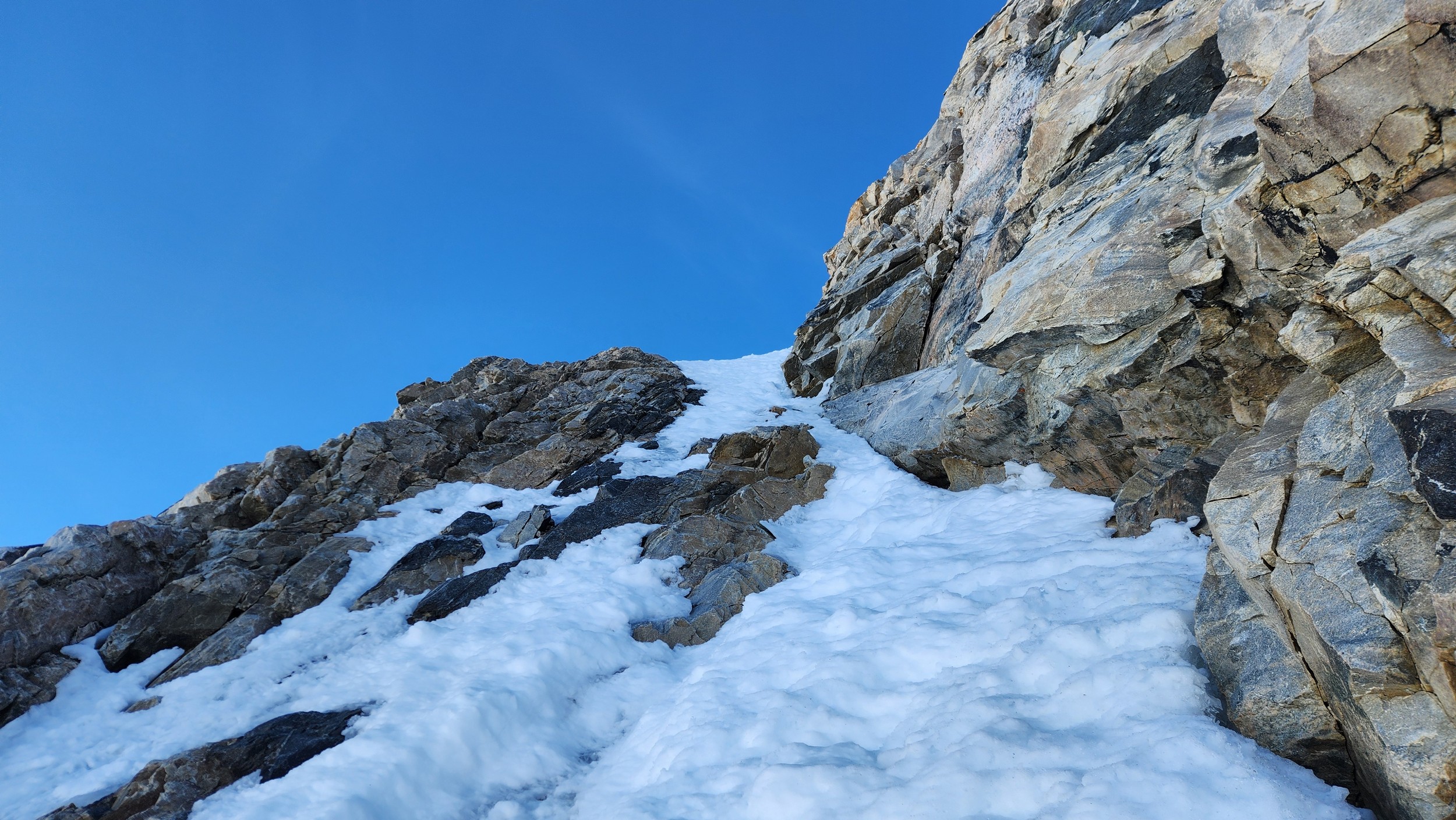
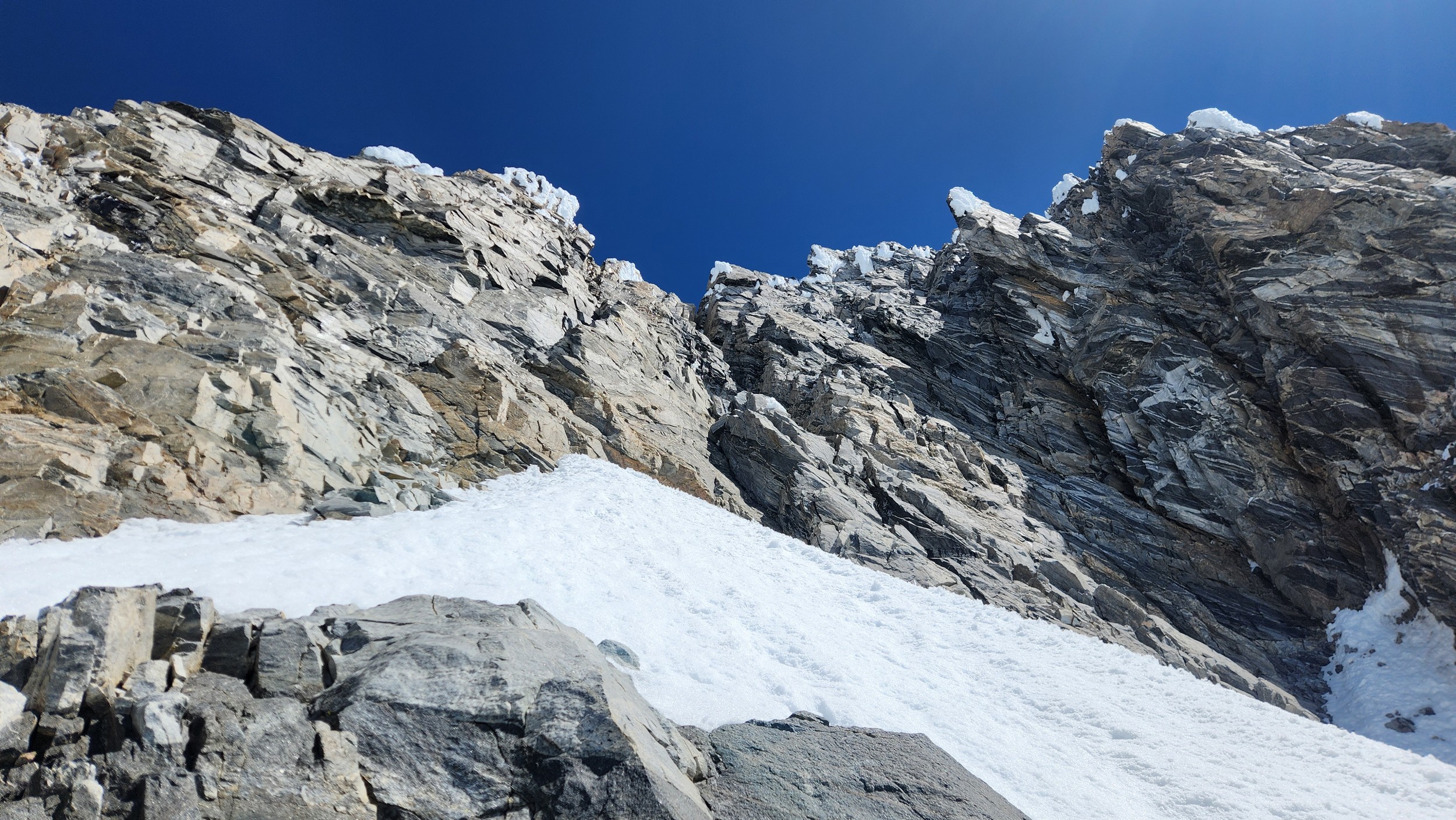
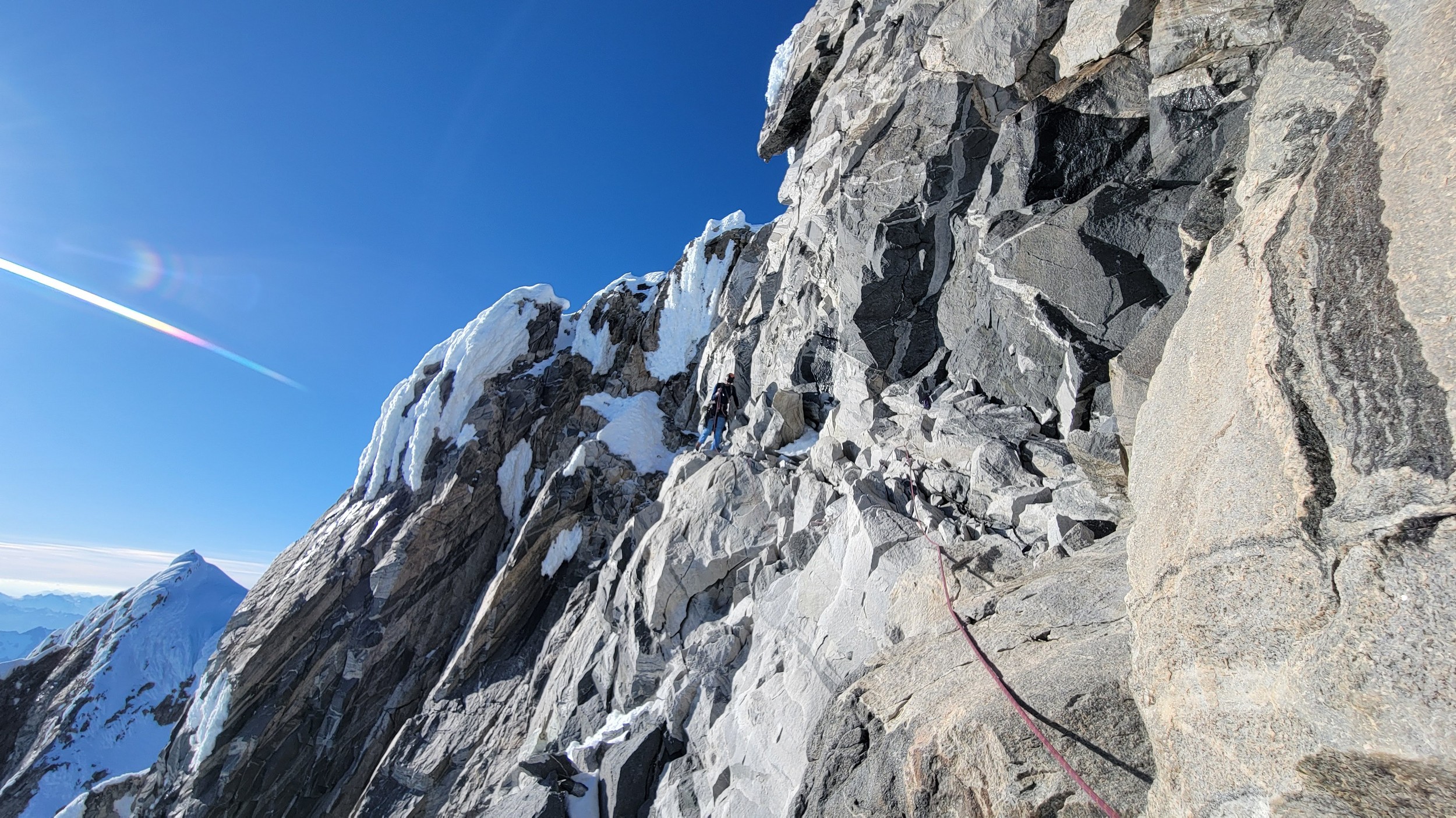
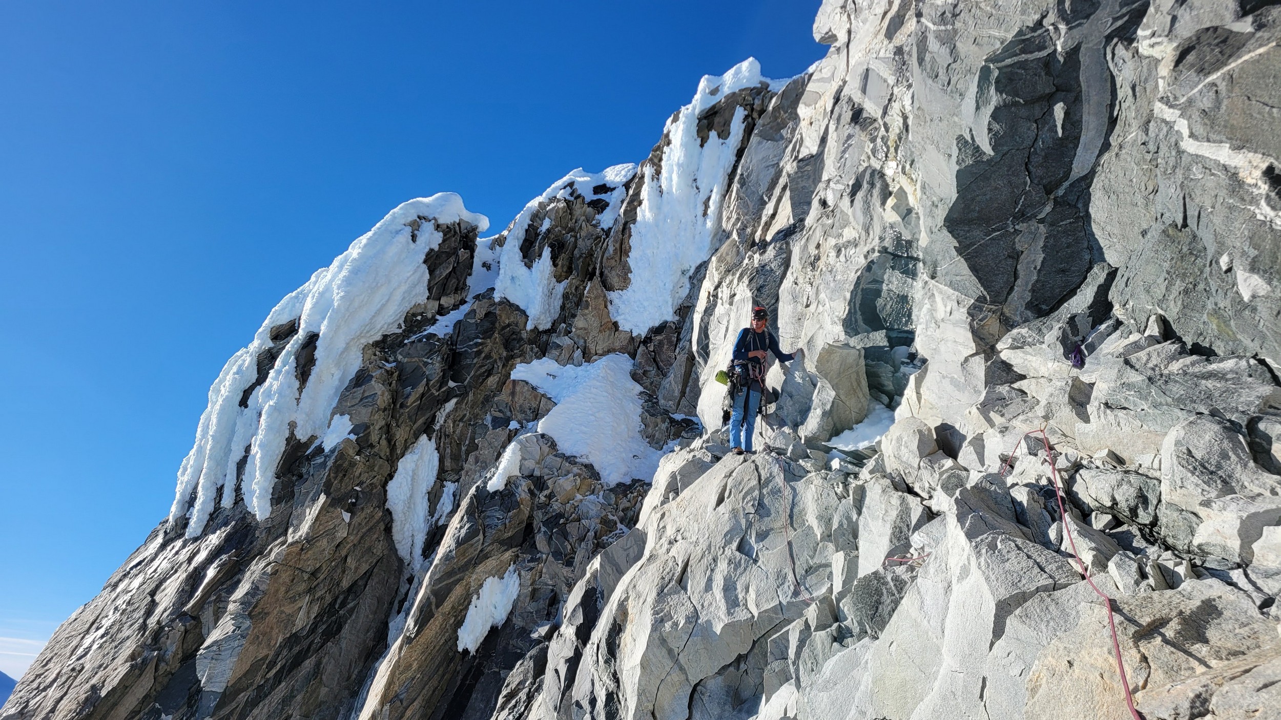
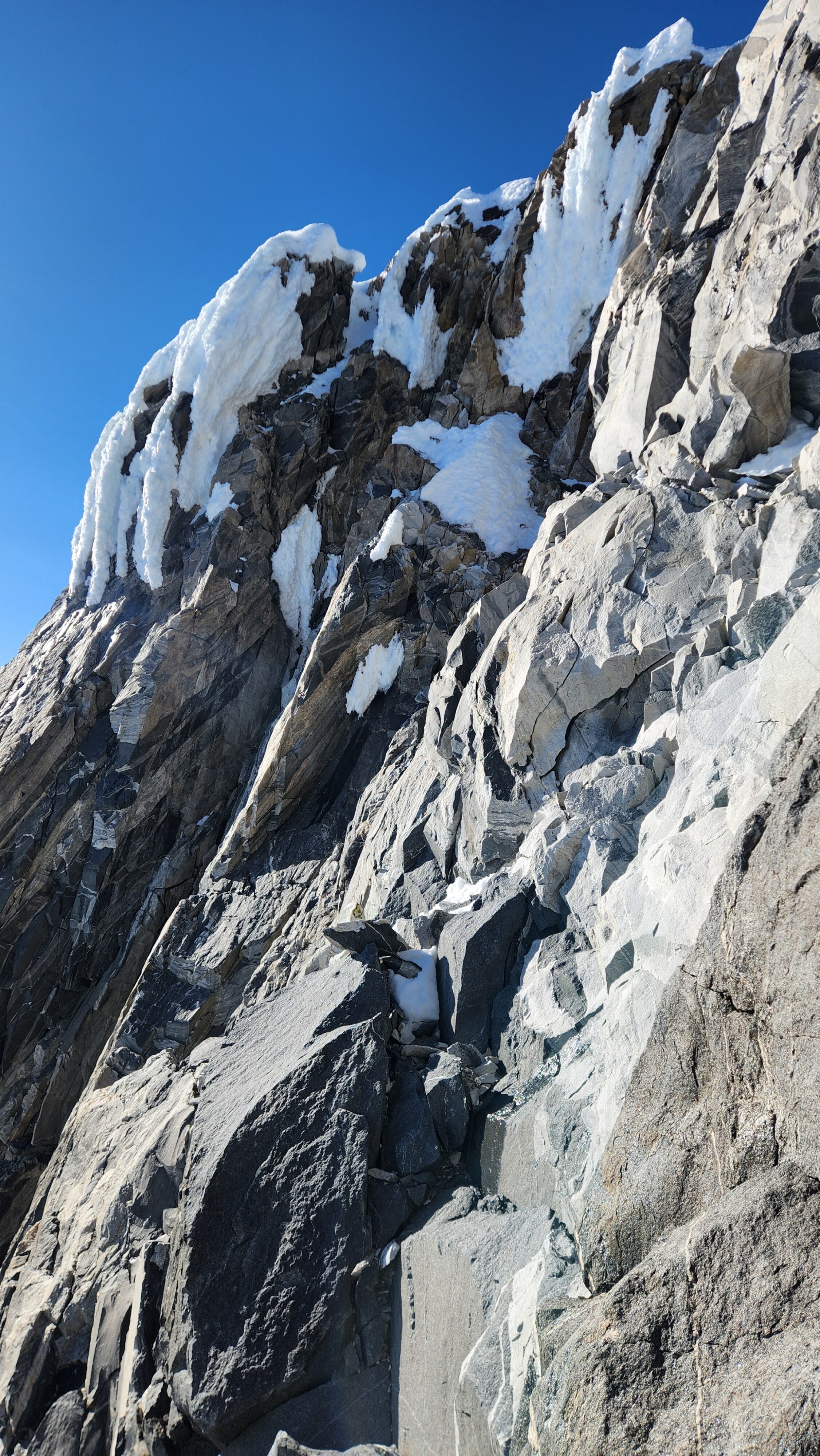
Above this we continued climbing up the now uniform shaded couloir which stayed a consistent 50 degrees. We made a special point to finish climbing the couloir before the sun hit it to ensure we were not getting pummeled with snow and ice due to sunlight thawing. The weather was perfect and warm for the foreseeable future and the temperatures were warm which was incredibly lucky. Conditions like this were something I'd waited half a decade for! We pretty quickly hit a fork in the couloir and we turned left and followed the ramp traversing up and cutting under a prominent rock pillar with a light colored cross on it shown in the beta photo above. The snow ramp abruptly ended and we found ourselves on some dry rock scrambling. The route took a sharp rightward traverse on a low angle but icy rock ledge to the triangle shaped snowfield. This infamous snowfield that had given previous parties pause or difficulty ended up being one of the easiest parts of the day for us. The snow had receded substantially in recent years and offered a very simple traverse across, with large steps/holes from where rocks had fallen offering plenty of places to casually stand. The photos below show the entry couloir through the triangle snowfield.
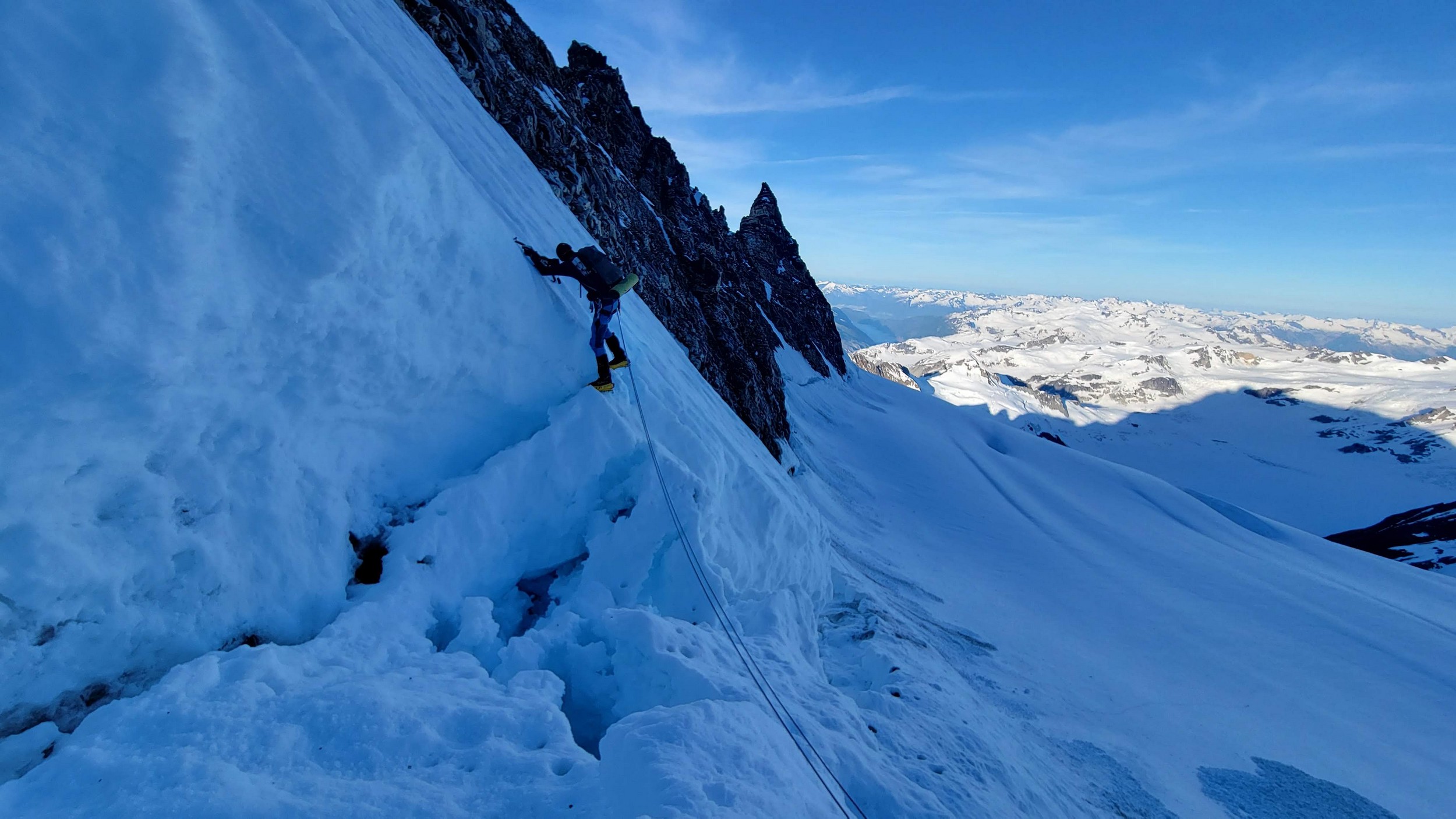
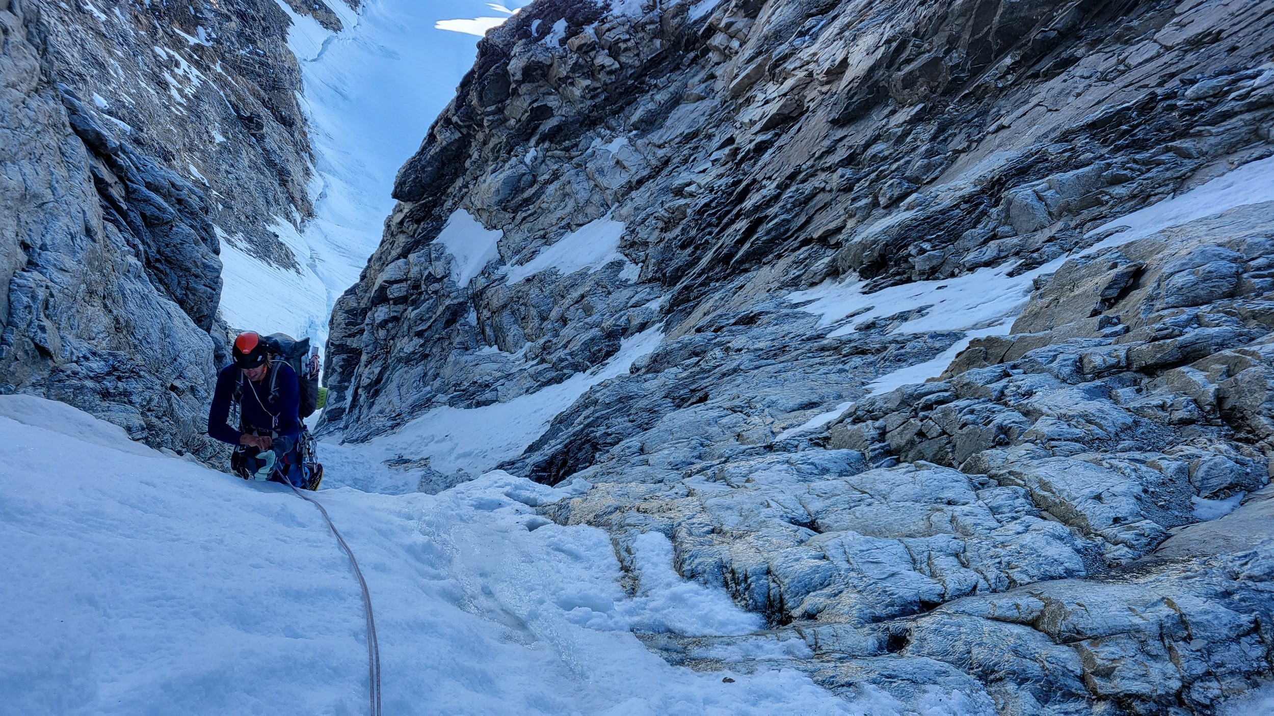
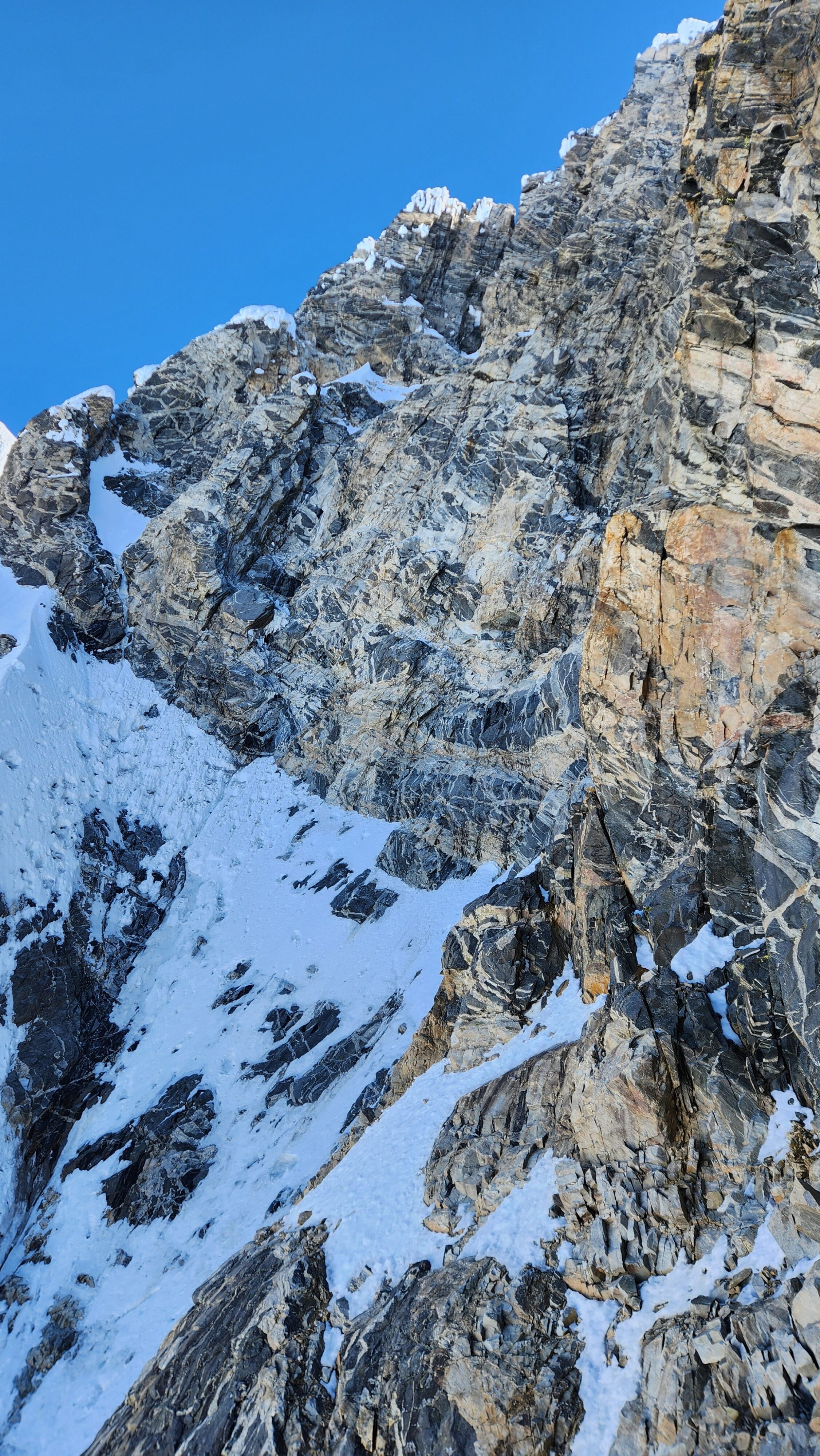
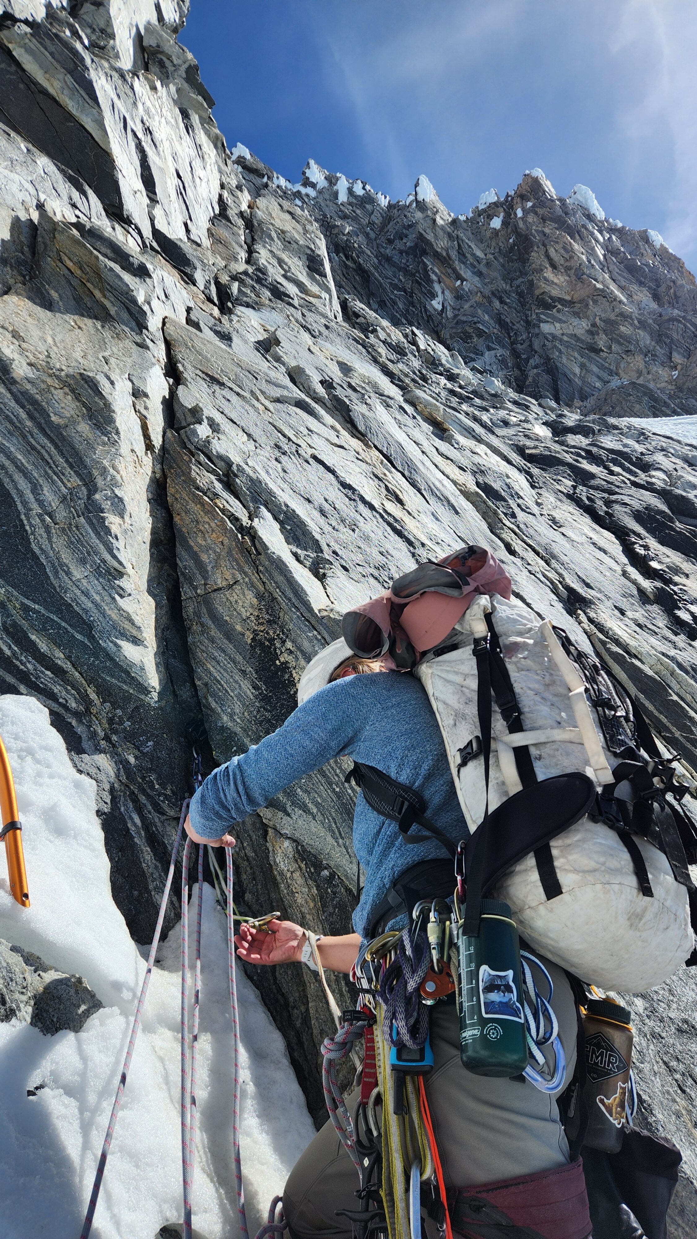
One of the cruxes of the day came next, as we reached the upper left tip of the triangle snowfield. Two options presented themselves to climb the 100 foot step that was now directly above. Either a low 5th class rock pitch off to the left that definitely was somewhat wet or a heads up pitch of WI3 ice would get us up. I opted to lead the WI3 ice, however I had brought only one ice screw on this trip so I was forced to use a couple small cams between the small gap between the solid ice and the rock! Not sure if that would have held a fall or not, so I was definitely in a no fall zone, especially since I was carrying a 40 pound pack. Upon topping out this 80 foot pitch I placed a picket anchor and belayed Sarah up as we entered the full sunshine. A couple hundred more feet of 40-45 degree rapidly softening snow in a wider gully brought us to the start of rock climbing. We took a 15 minute break here to transition our gear and eat a short snack. It was just after noon at this point and we were about 2/3rds of the way up the route, however we were barely halfway based on time we would soon find out.
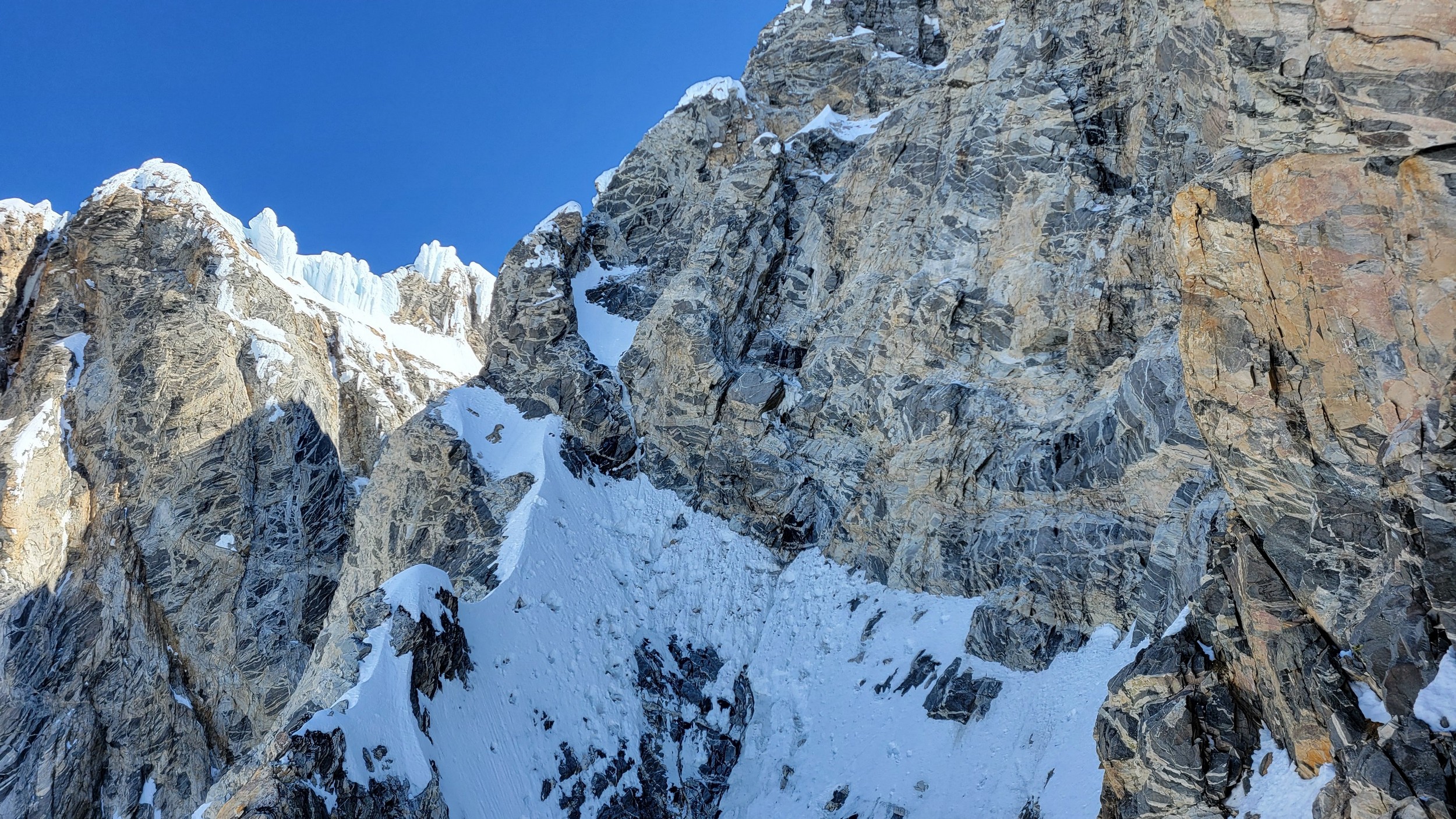
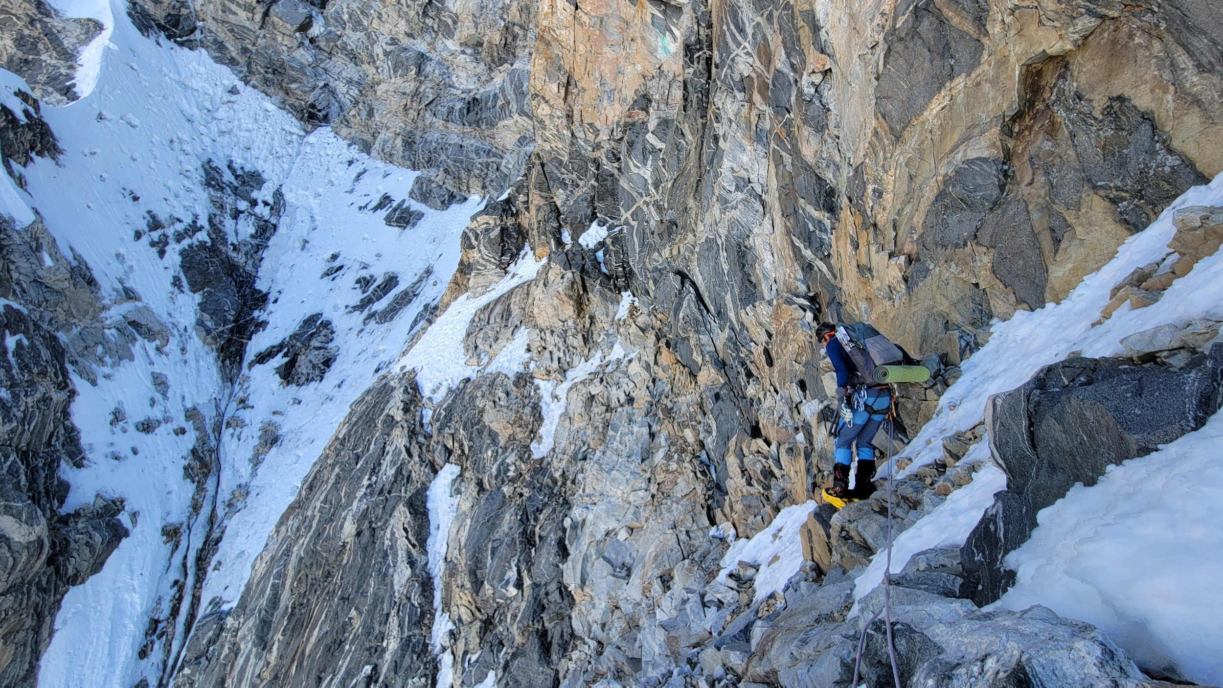
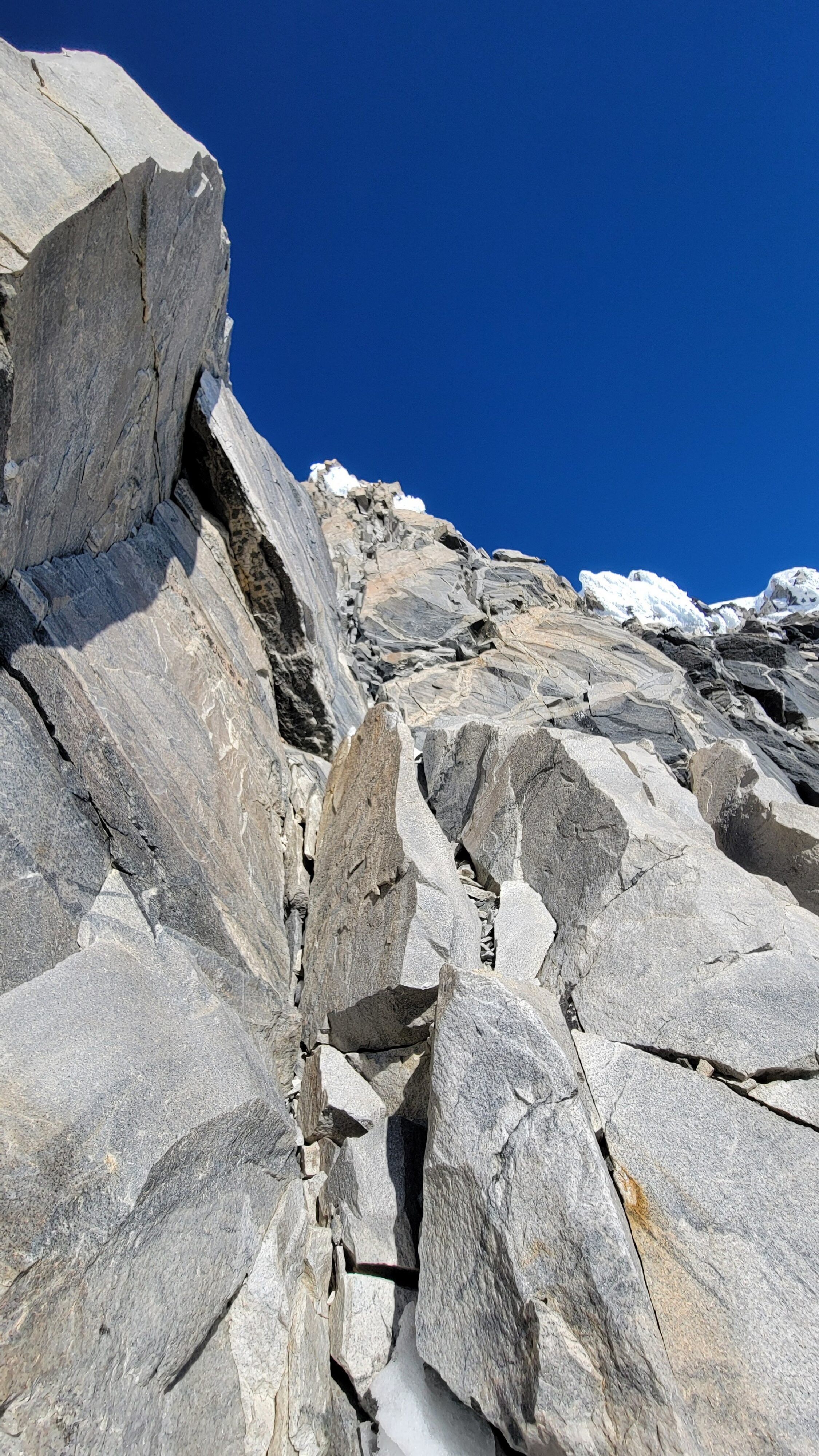
Sarah took lead and made a slabby 5.7 runout lead on nice and dry rock in the sun, followed by another lead until we hit another small snow patch that had softened a lot. My decision to leave my big boots on paid off. At this point we hit a crossroads, and Beckey traversed right into the wide amphitheater on his second ascent rather than climb the rock buttress jumping up and left. Since we were seeing large snow and ice chunks falling in this amphitheater quite often we decided to follow the original Weissner route and continue climbing moderate rock up the buttress to the left of the amphitheater. We were safer for the next few hundred feet, but we would trade off for it later.
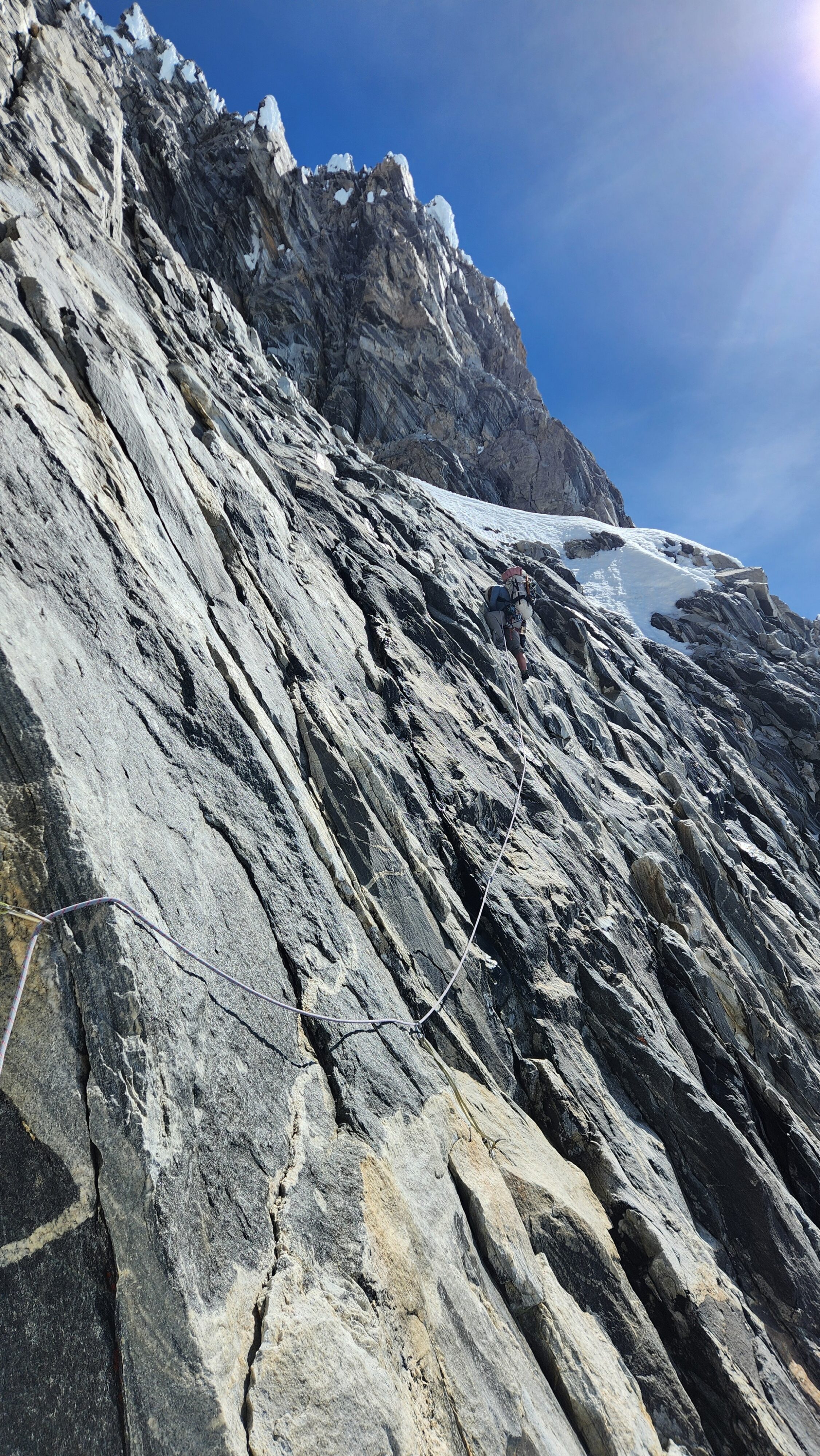
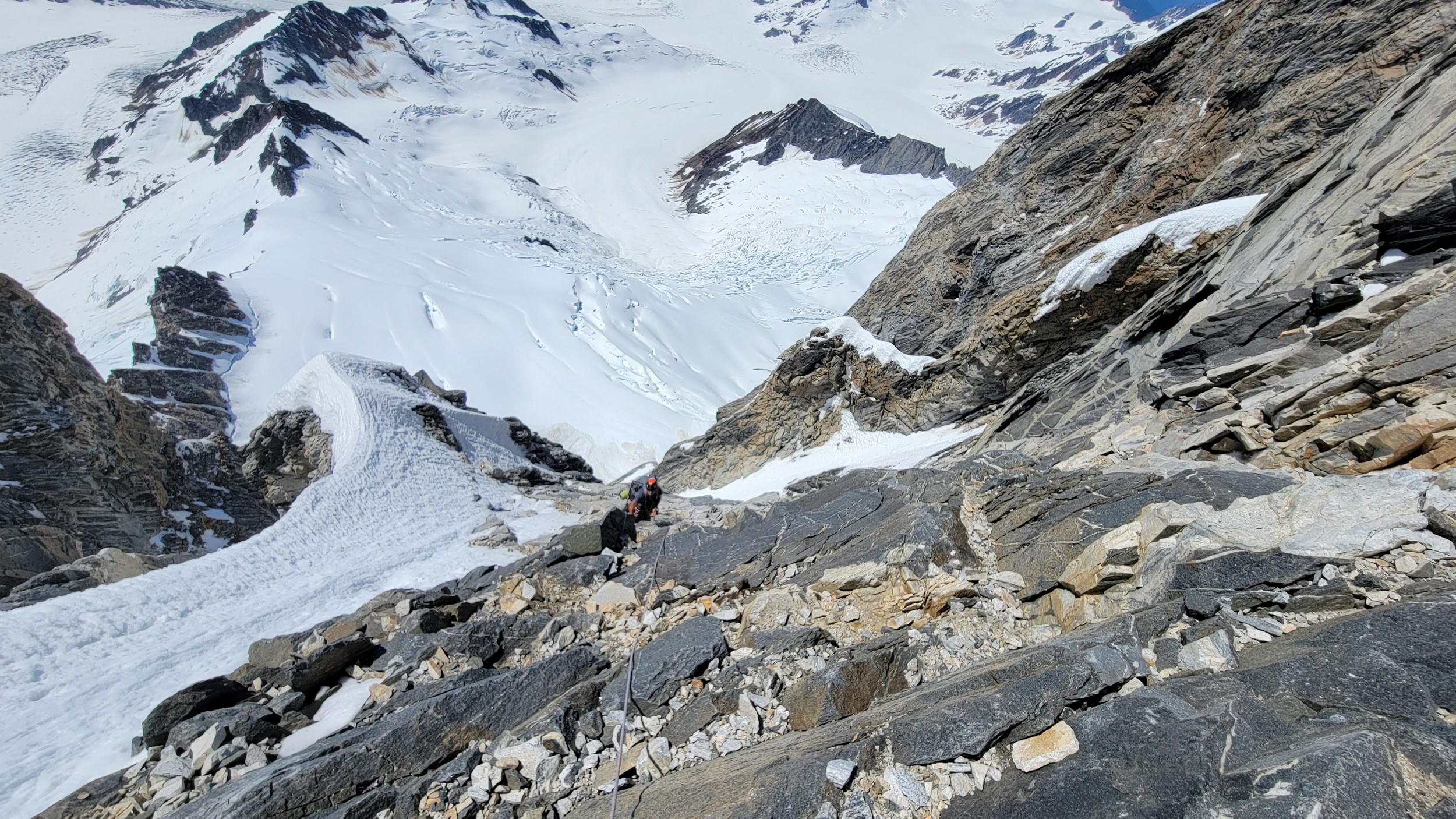
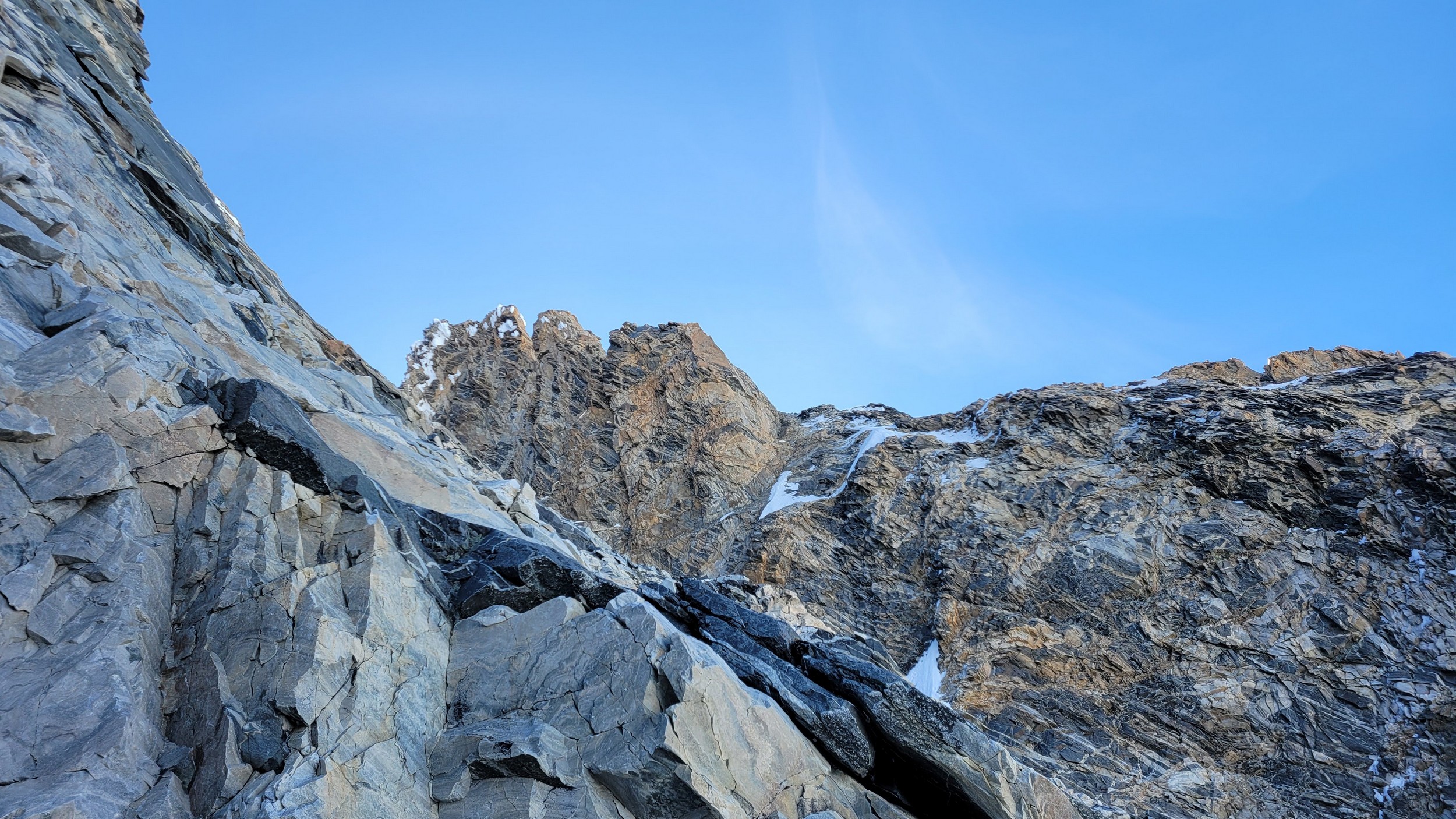
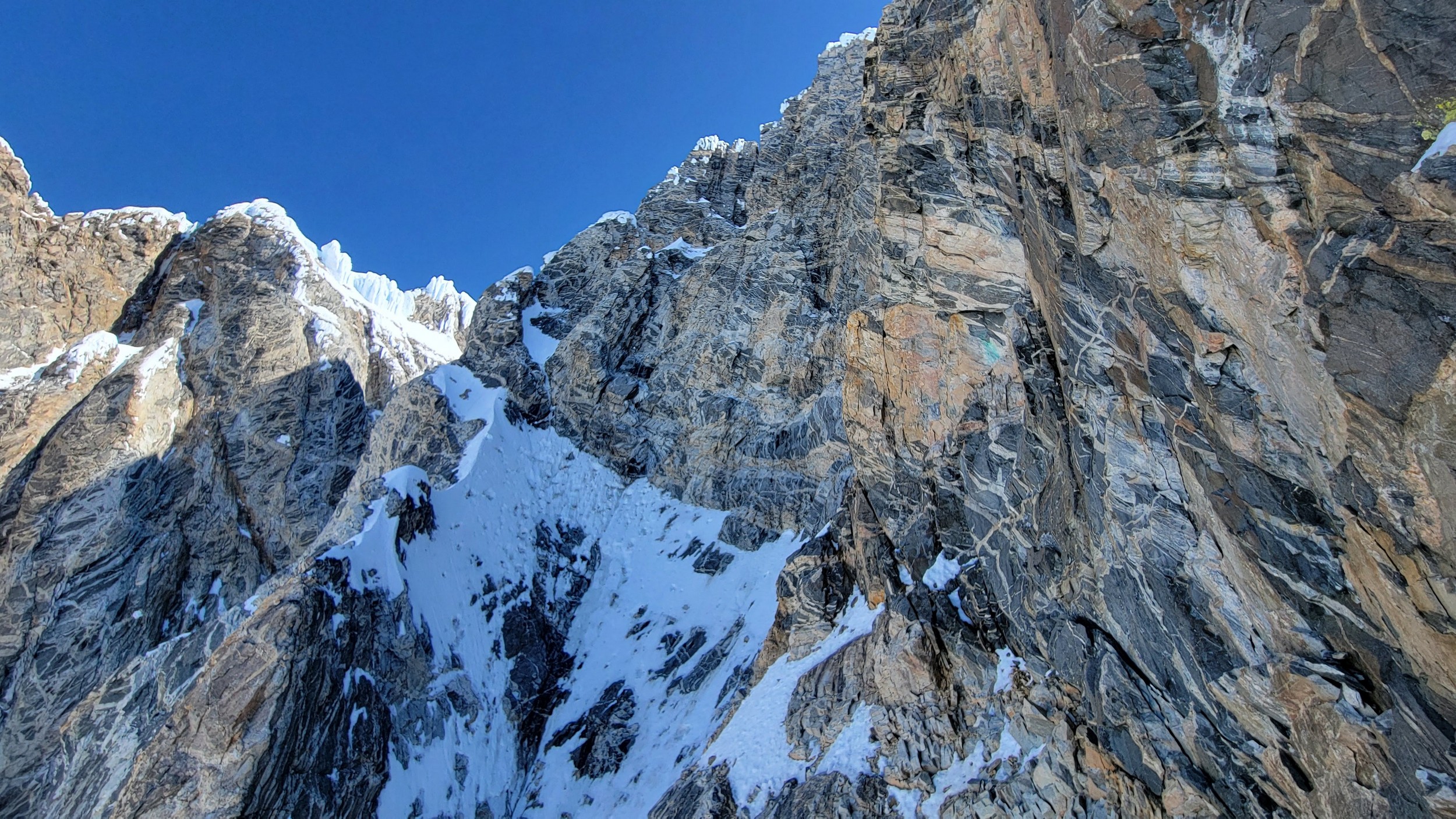
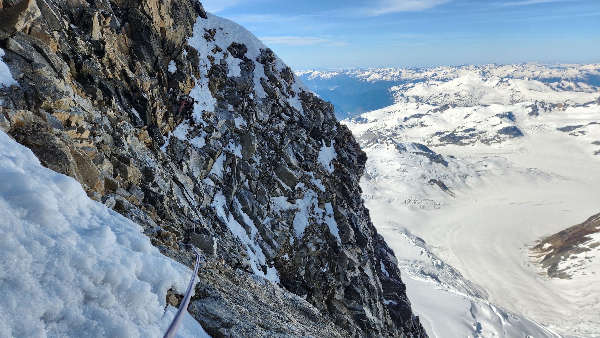
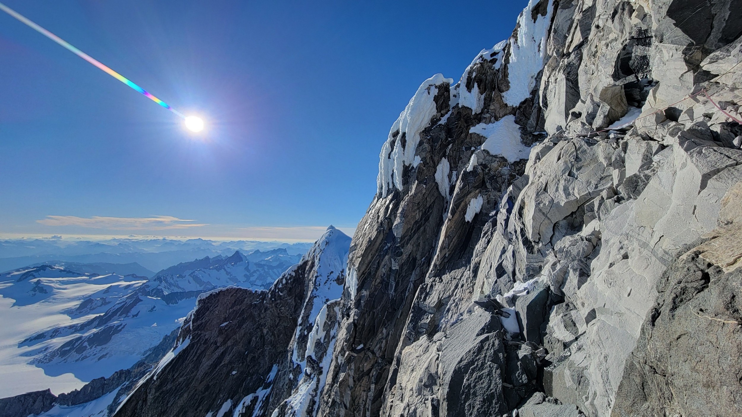
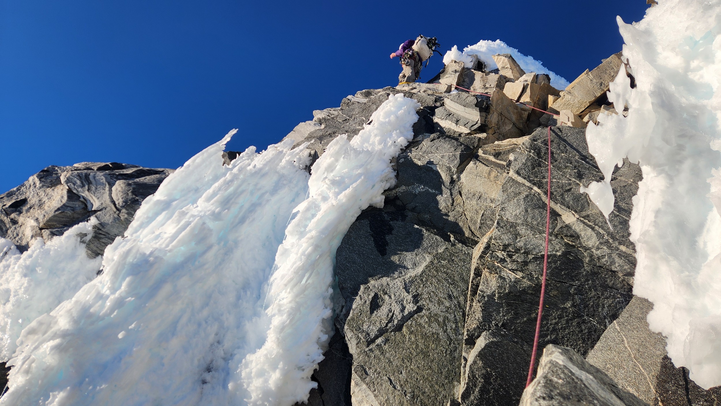
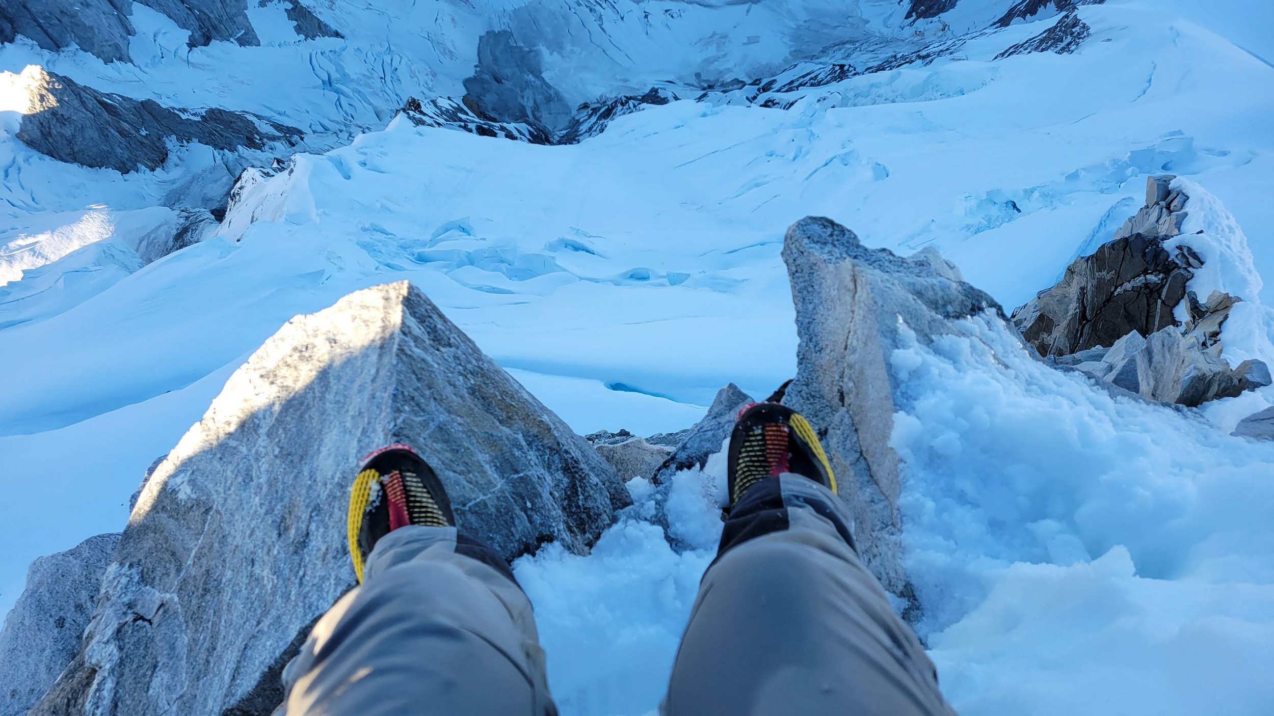
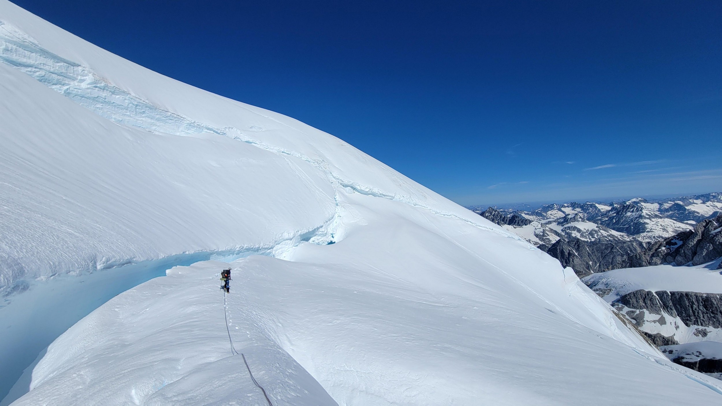
As we climbed the rock buttress, it became evident we were not going to be able to get back into the amphitheater that was dropping steeply off to our right. Sarah made a few more leads and we topped out on another snow finger that ended at a knife edge, and then dropped off the opposite side on a tricky mid 5th class 15 foot downclimb. At this point we were at the base of the two gullies on the upper mountain mentioned in the Waddington guide. Sarah led two full rope lengths straight up the left hand gully, which ended up being the worst part of the route with heads up loose climbing. I still had my big boots on, as I was following and ended up sending a couple large rocks down below me. We were really getting a bit confused as to where the crossover point was to traverse right into the right gully that was mentioned in the beta reports, since we had read a short pitch was all that was needed. Looking straight above us was a huge overhang at the top of the left gully and we had already done a full 60m and did not find a suitable crossover point. Sarah and I then figured we may find the best crossover point right at the base of the overhang above us, so she led another 50 feet up to the overhang and then made a delicate slab traverse on 5.7 rock over to the top of the right hand gully. This proved to be the correct location, just the fact we had to climb a bit over two full rope lengths in the left gully to reach it, which was more than the guides say. As I climbed the final 50 feet to the overhang, I was able to finally get a spot where I could take my pack off and change into my rock shoes. What a process that was in a tight spot, but with my rock shoes now on, I was able to made the delicate traverse. Halfway through the traverse however I was smashed with a chunk of snow/rime that had fallen off the ridge crest in the sun which was now only about 150 feet above me. Thankfully it was not ice and it didn't knock me down but I definitely got wet!
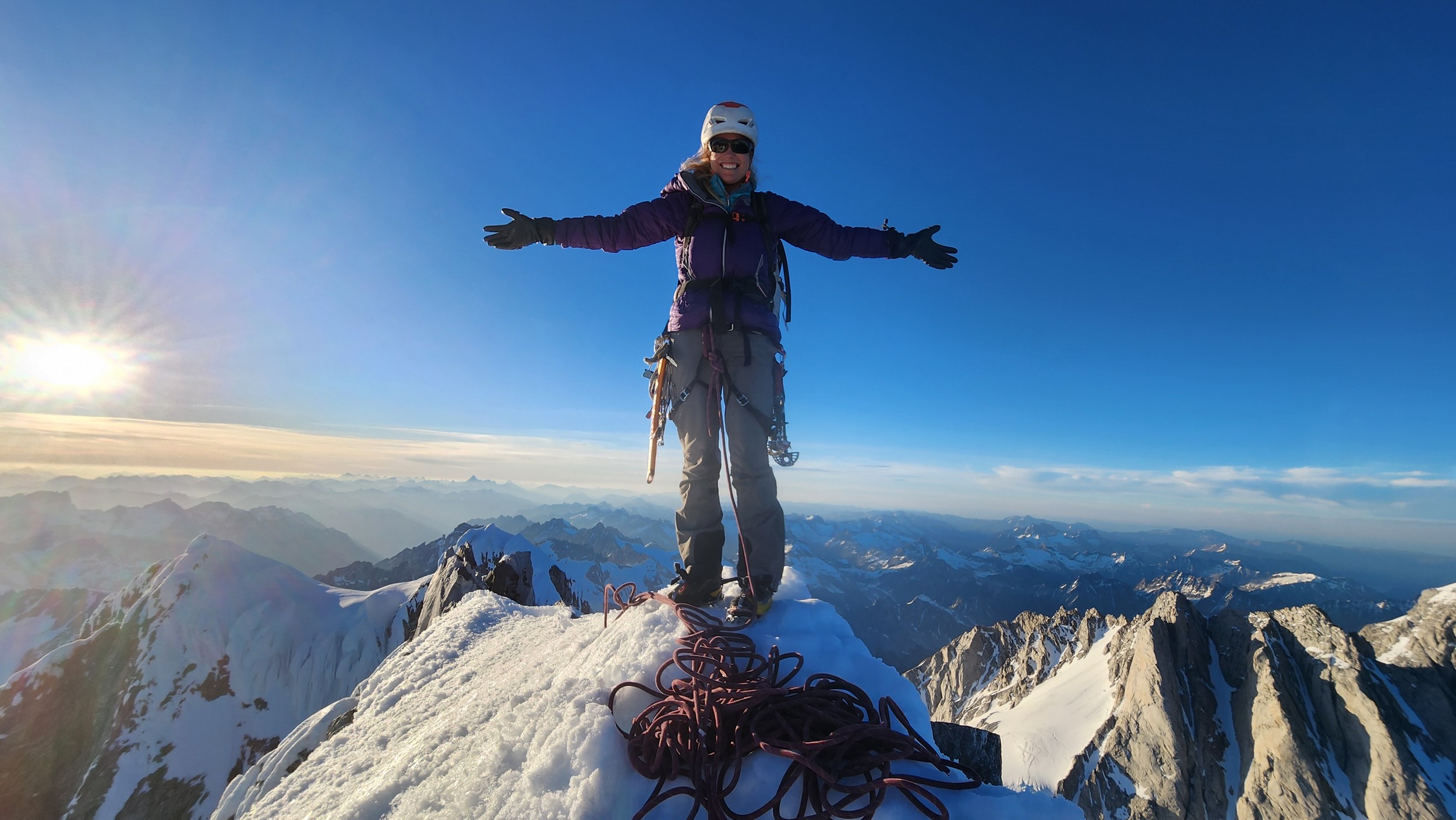
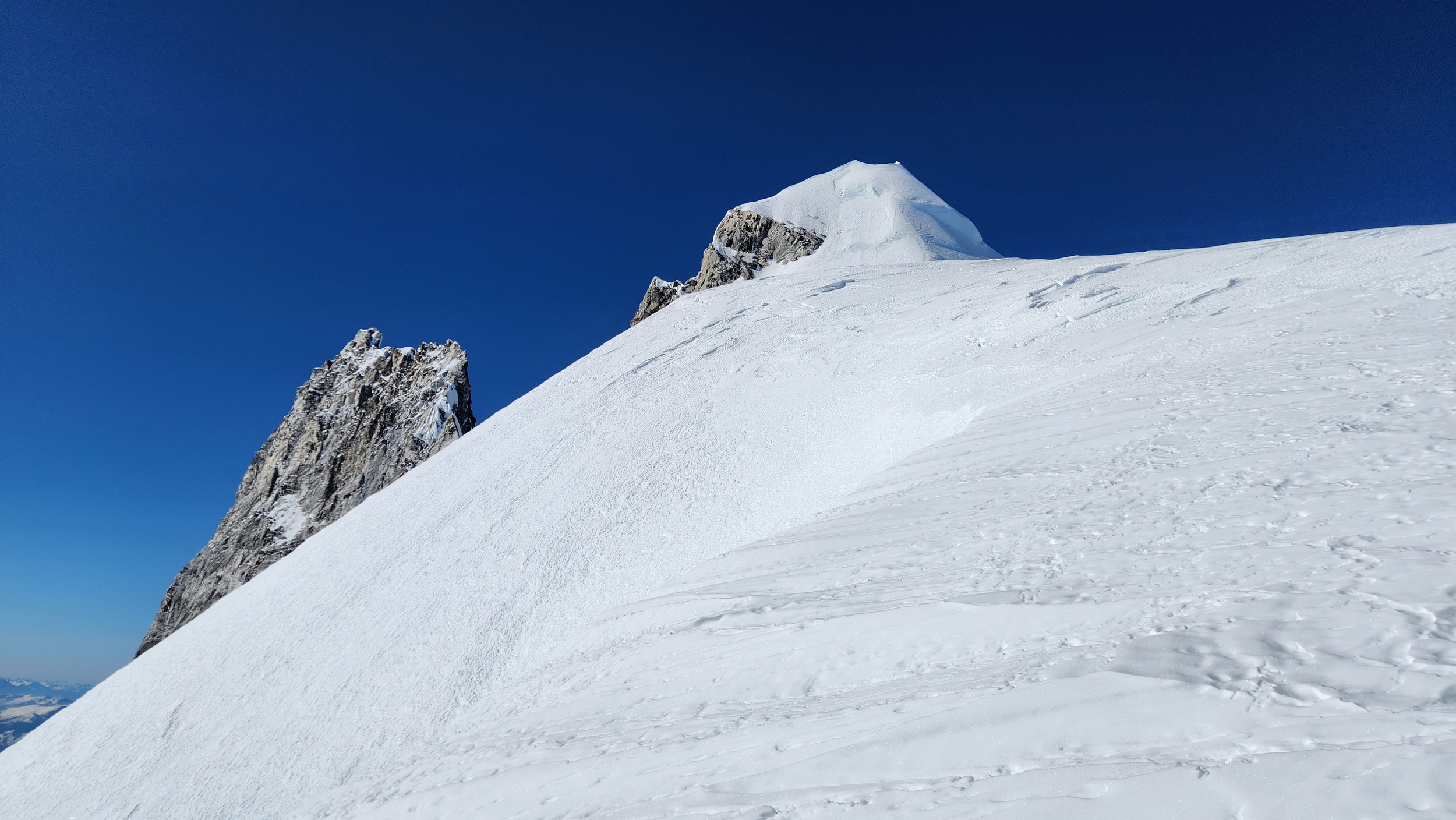
We regrouped at the top of the right gully as it looked improbably to continue traversing right and the ridge crest was an easy climb less than 1 pitch above us, but we were unsure how the remaining ridge crest would be to complete the traverse to the summit, which we knew was still off to our right. So Sarah setup an anchor and we made a short rappel into the narrow but deep notch further right which was the top of the amphitheater we climbed to the left of down lower. Thankfully after a 50 foot rappel or so, we found a nice ledge system that traversed rightward around the final difficulty from the notch. Rounding the next corner we found lower angle ramp/blocky terrain for one final pitch that took us right to the summit, which we reached about 8pm.
One amazing thing I remember is hearing voices on the summit while we were still climbing just below the left hand gully. I was shocked that someone else would have summitted the same day we were on the mountain. I would not find out until a couple months later though this team was none other than Langdon, who had spent over a month on a bike and climb of Mount Waddington, doing the climb from Ellensburg totally human powered. It just so happened that after his long bike ride to Tatla Lake, and a week of bushwhacking they made their summit bid the same day as ours. You can see his incredible report about their even more incredible journey here. Makes our 3 day smash and grab of Waddington seems too easy!
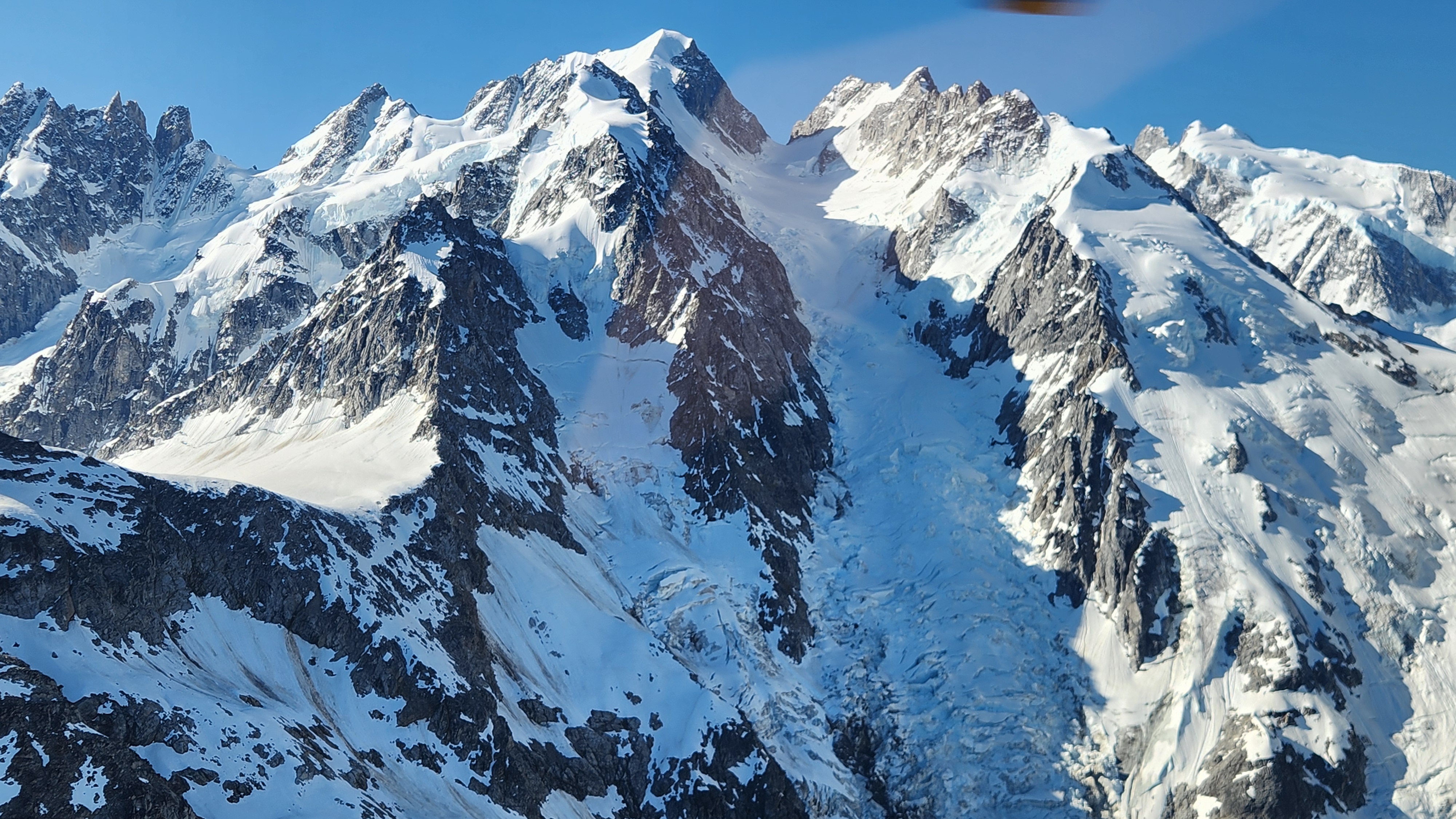
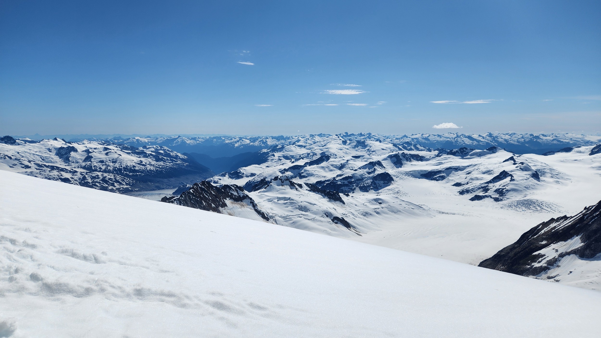
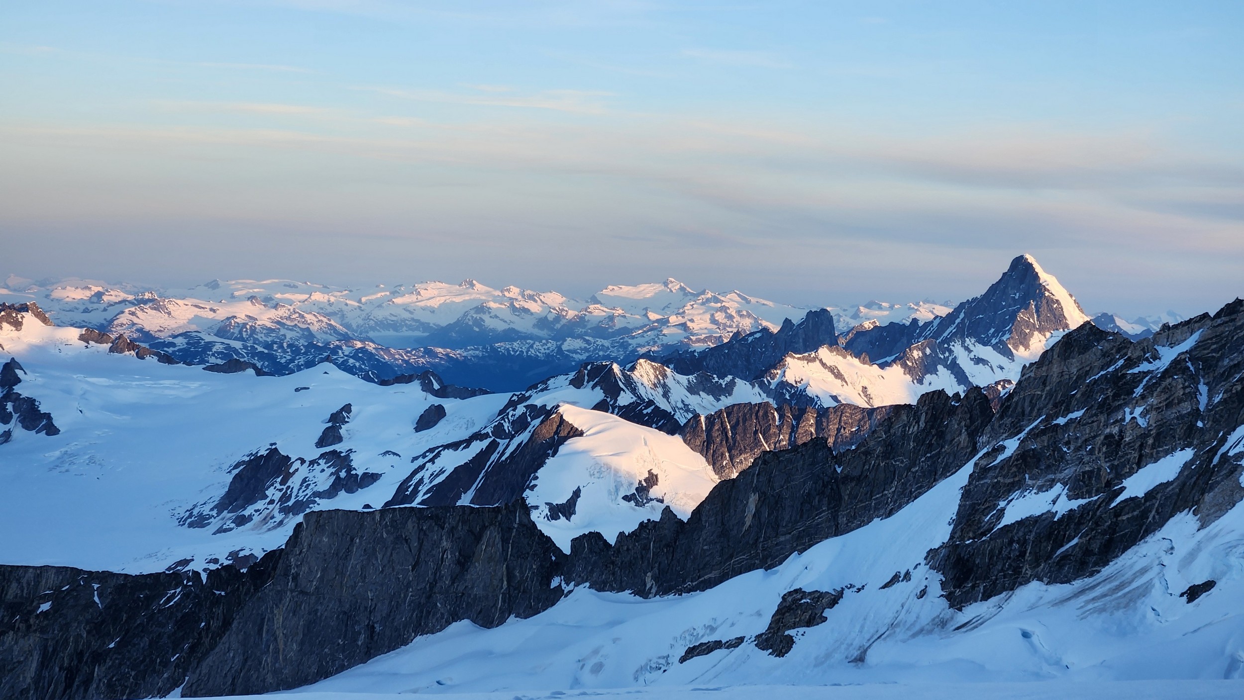
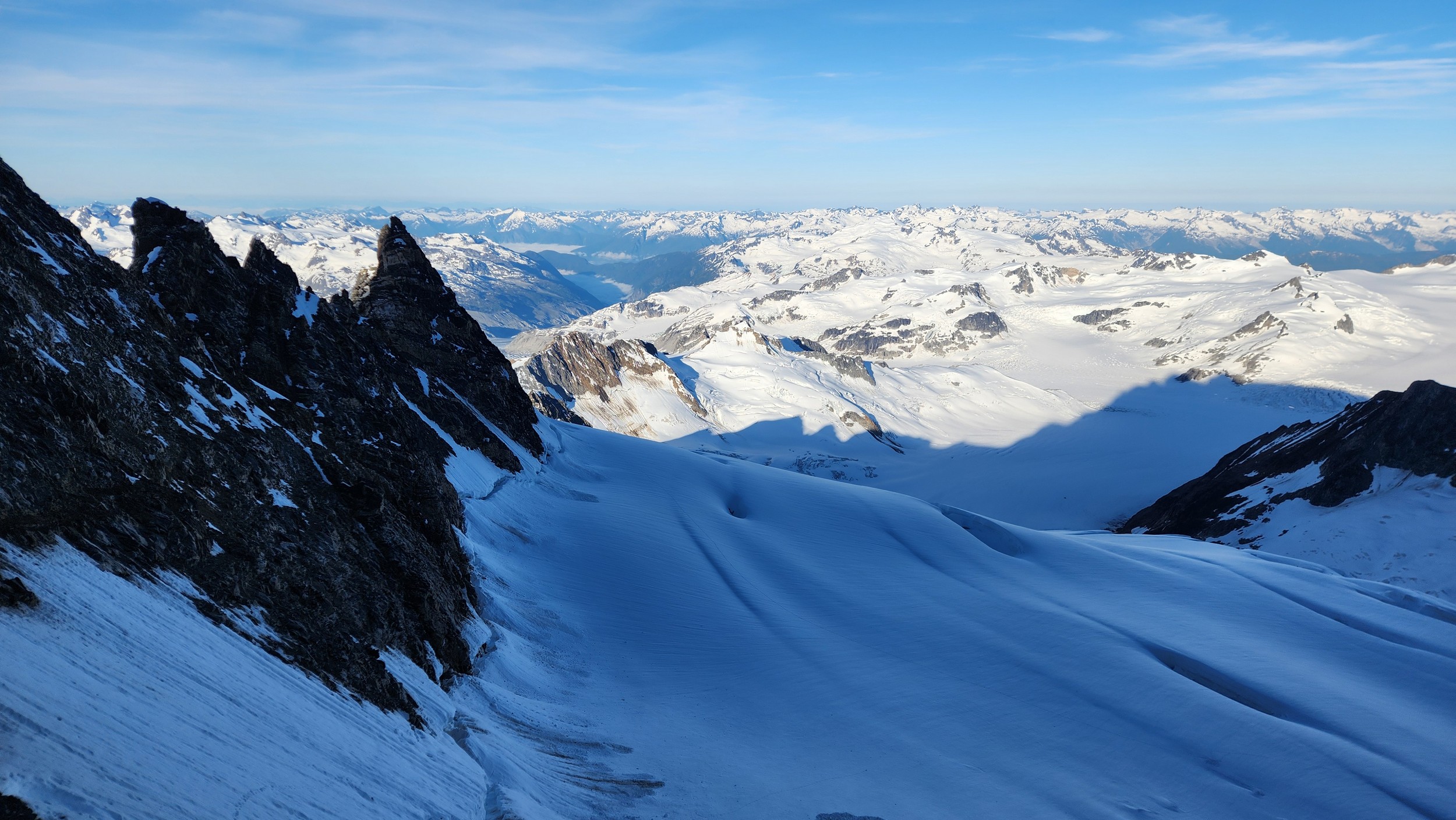
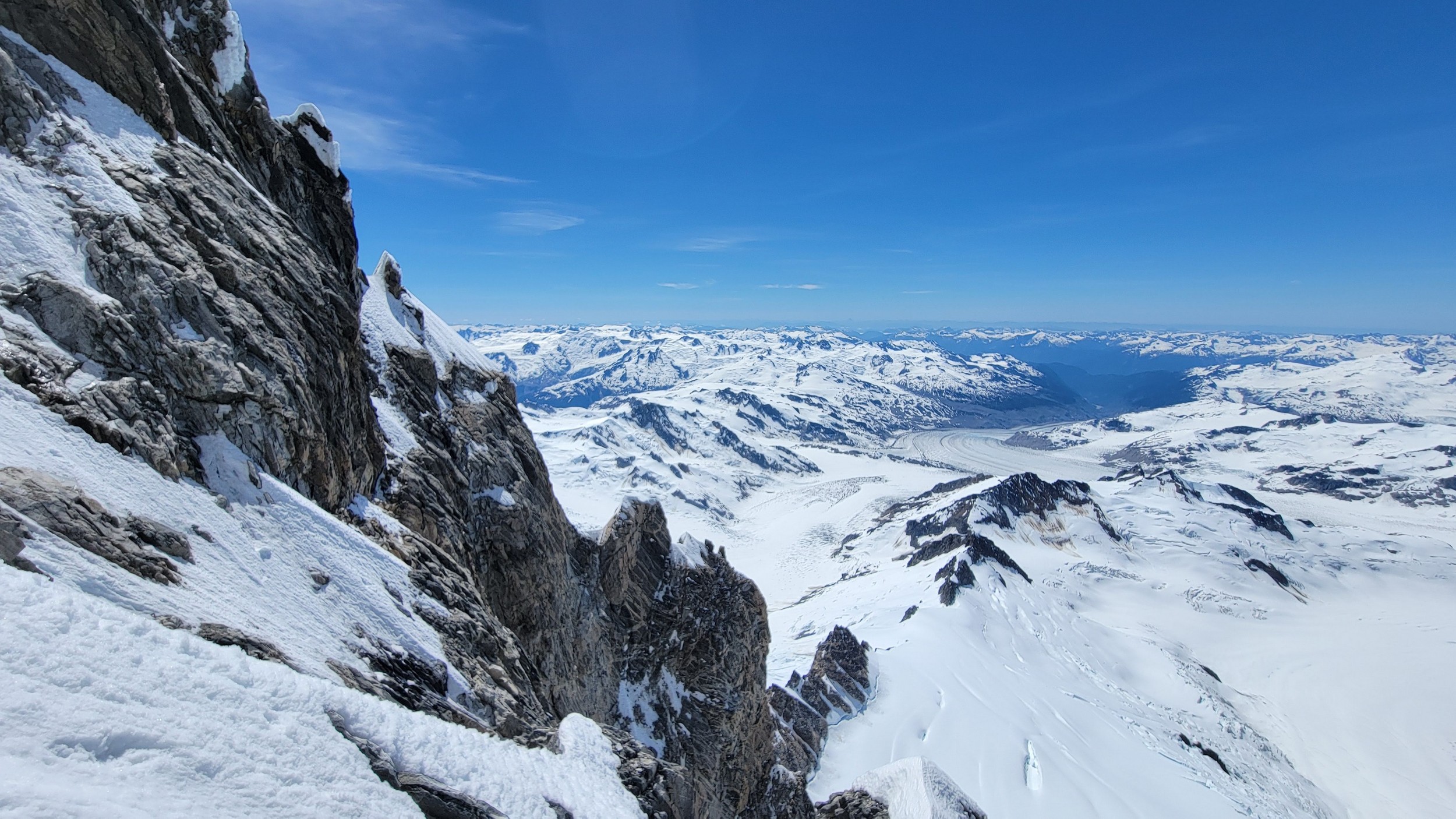
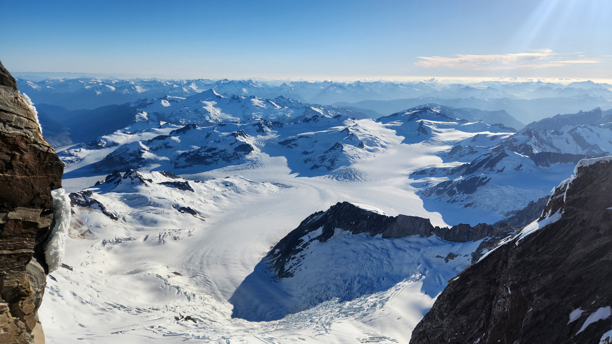
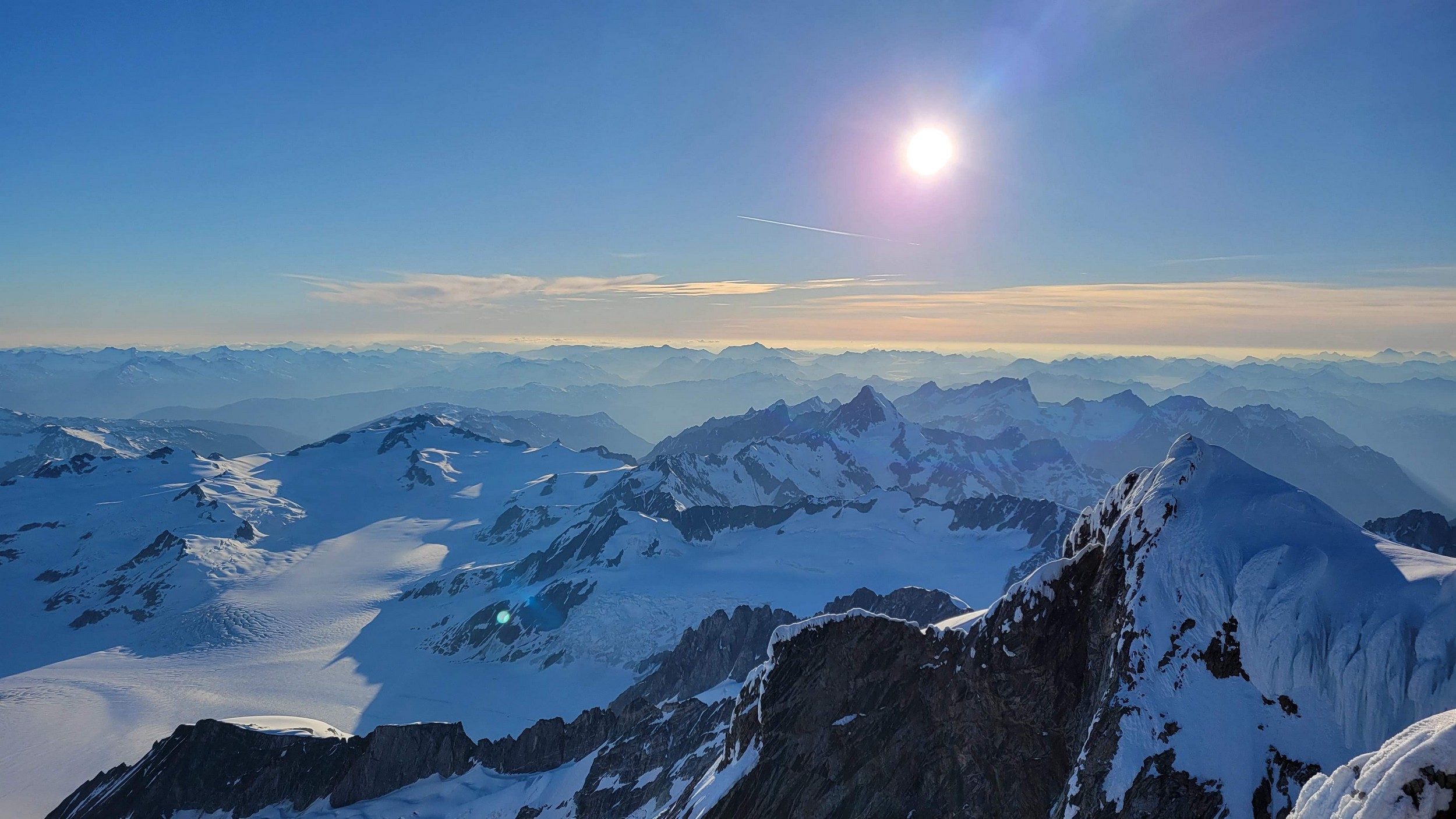
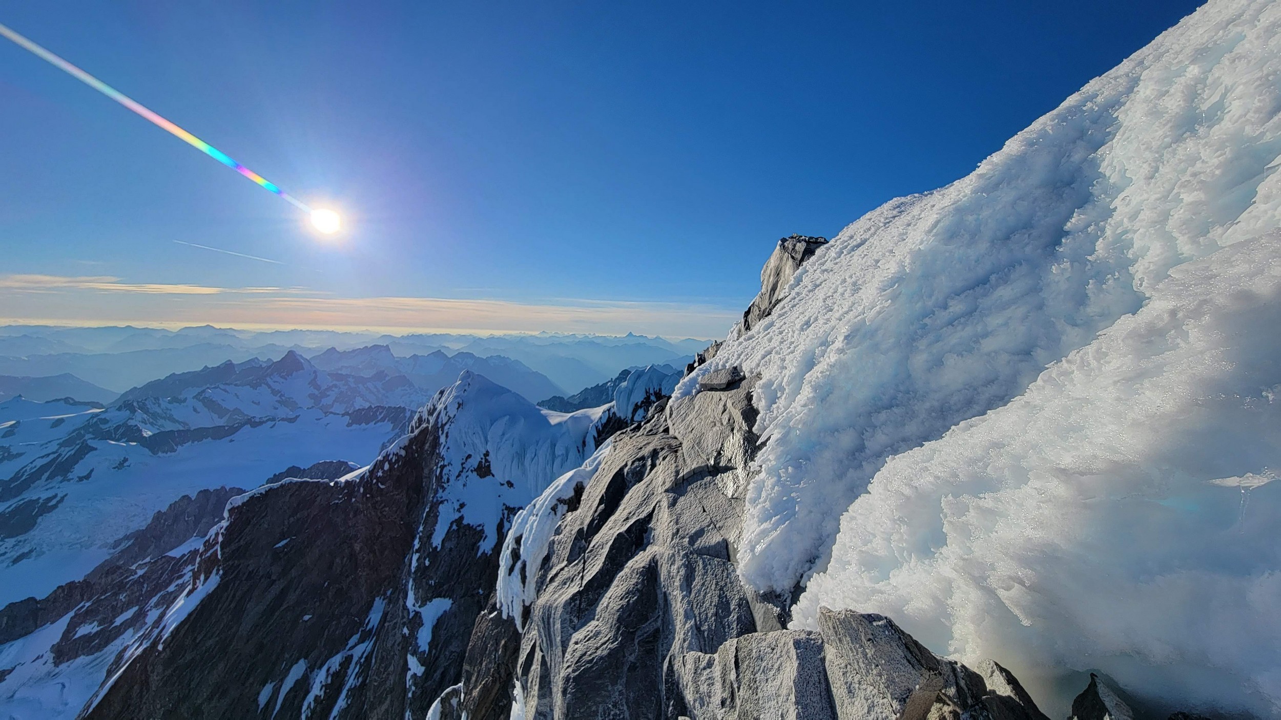
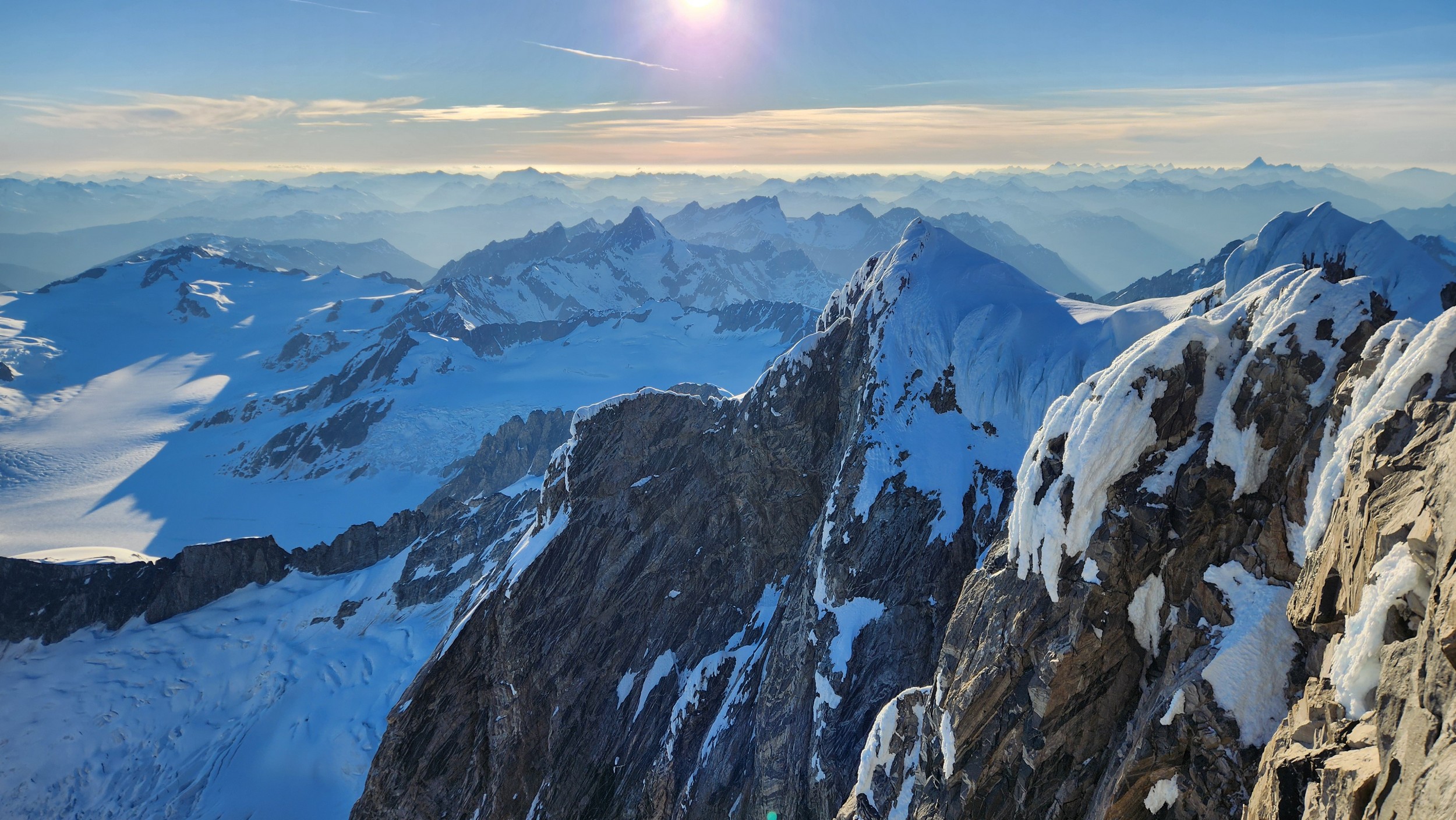
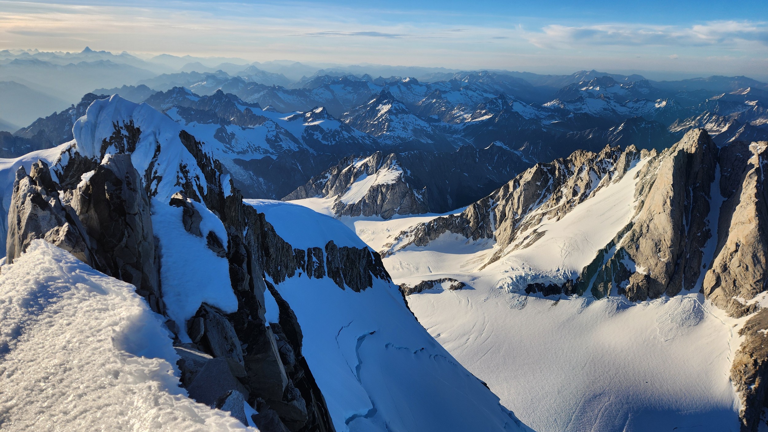
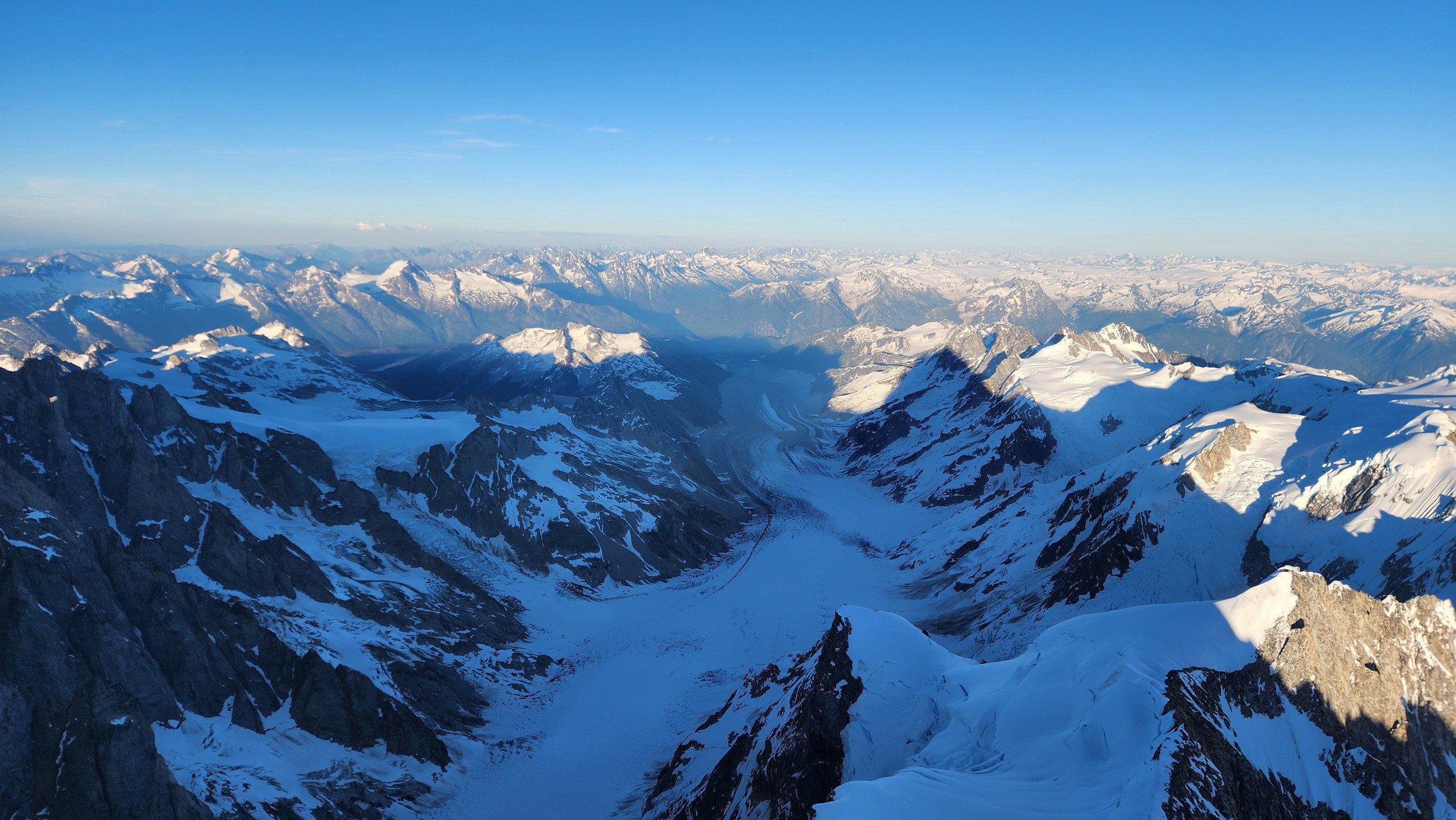
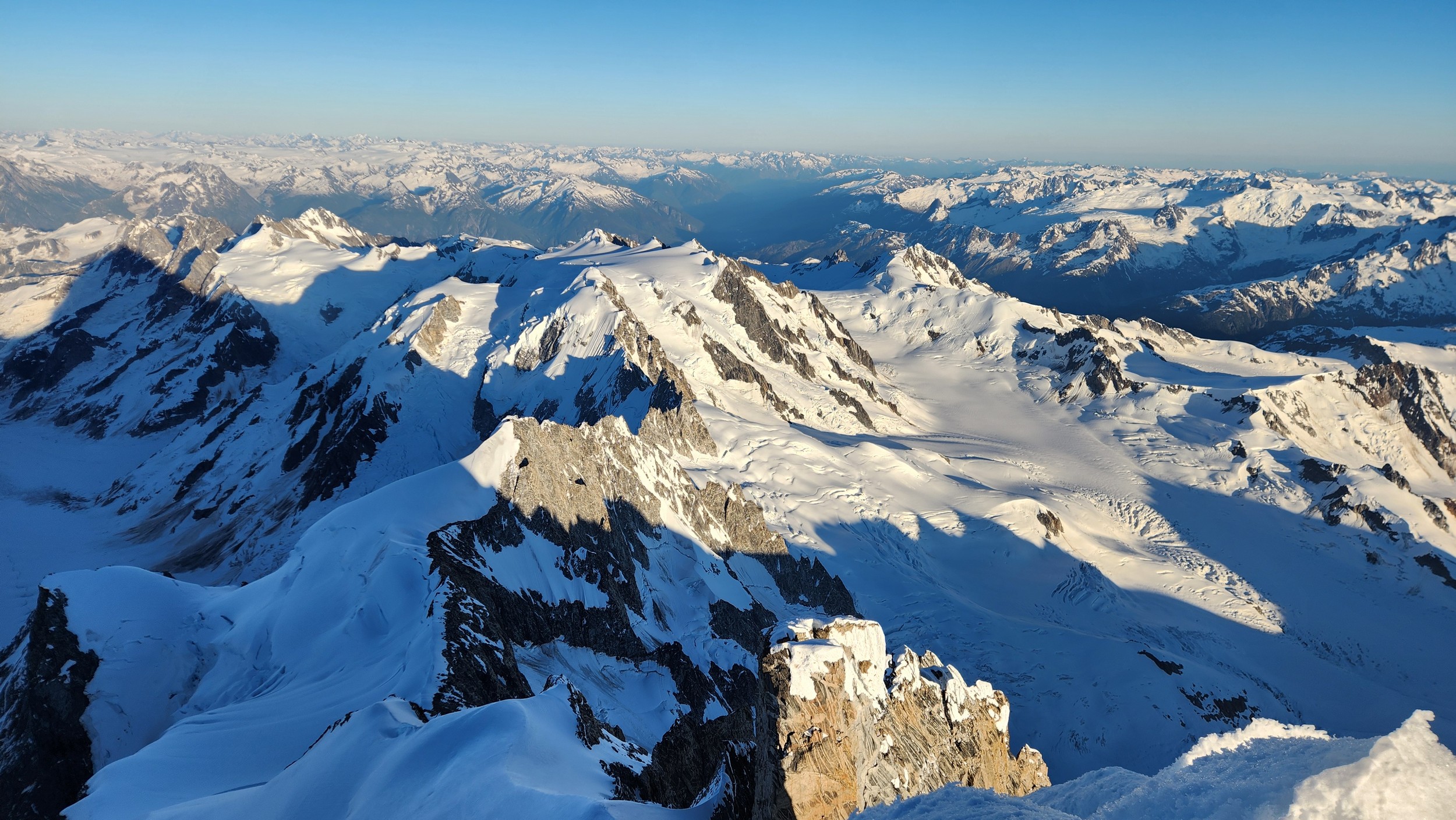
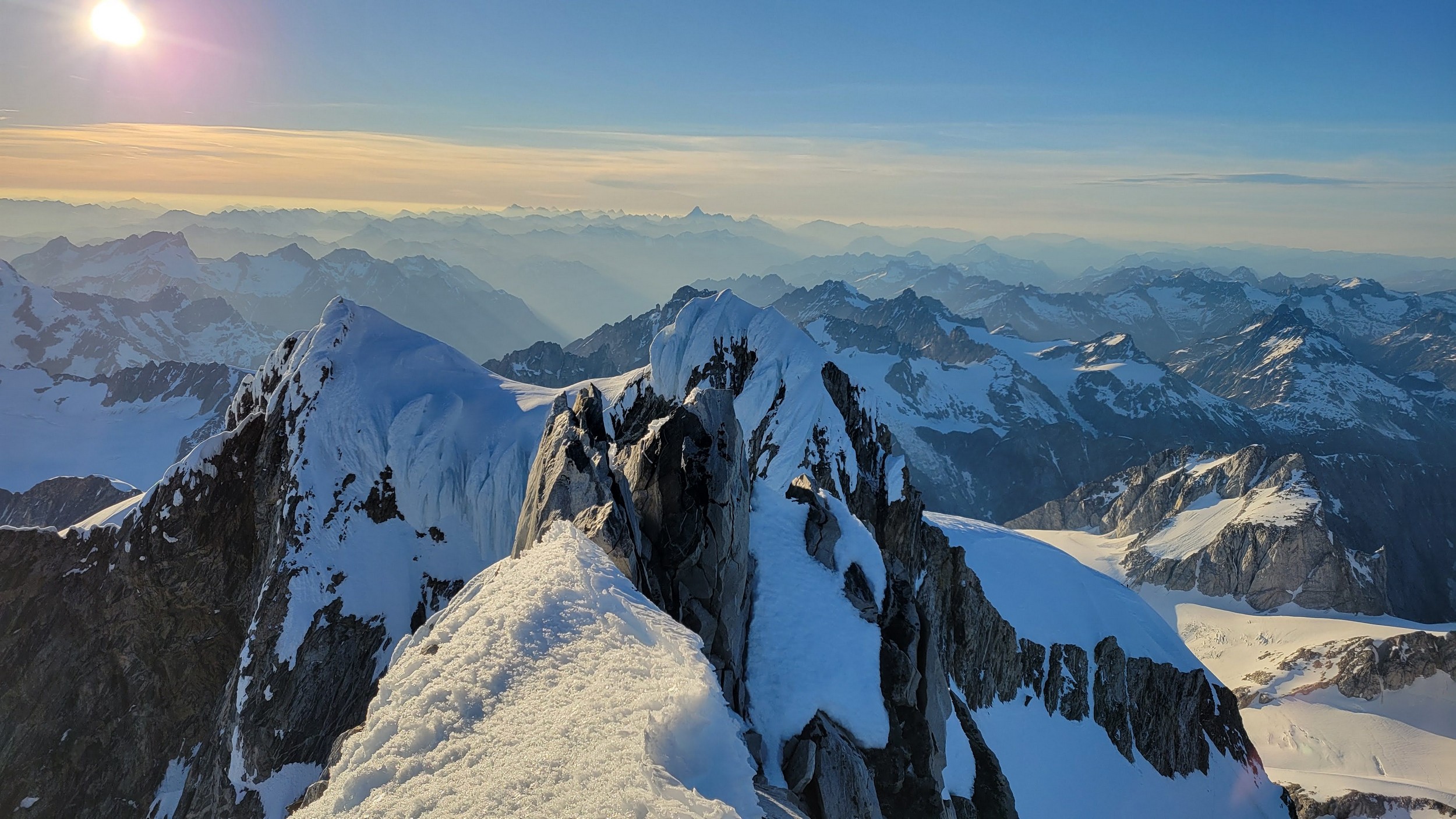
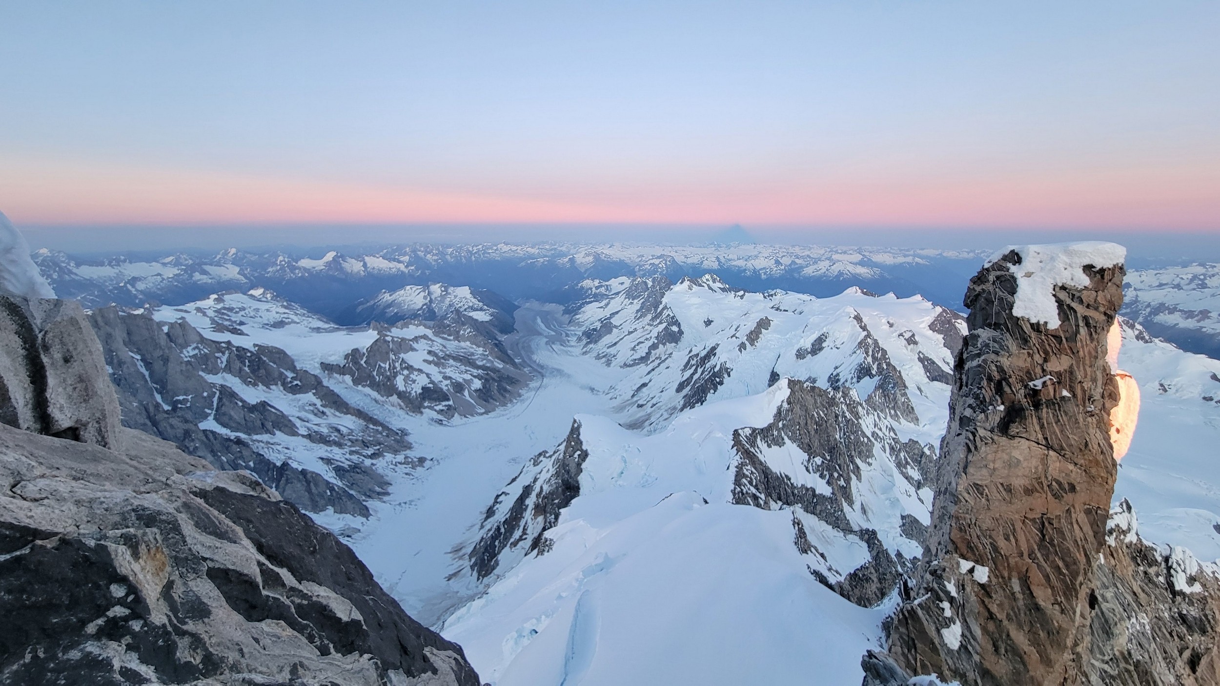
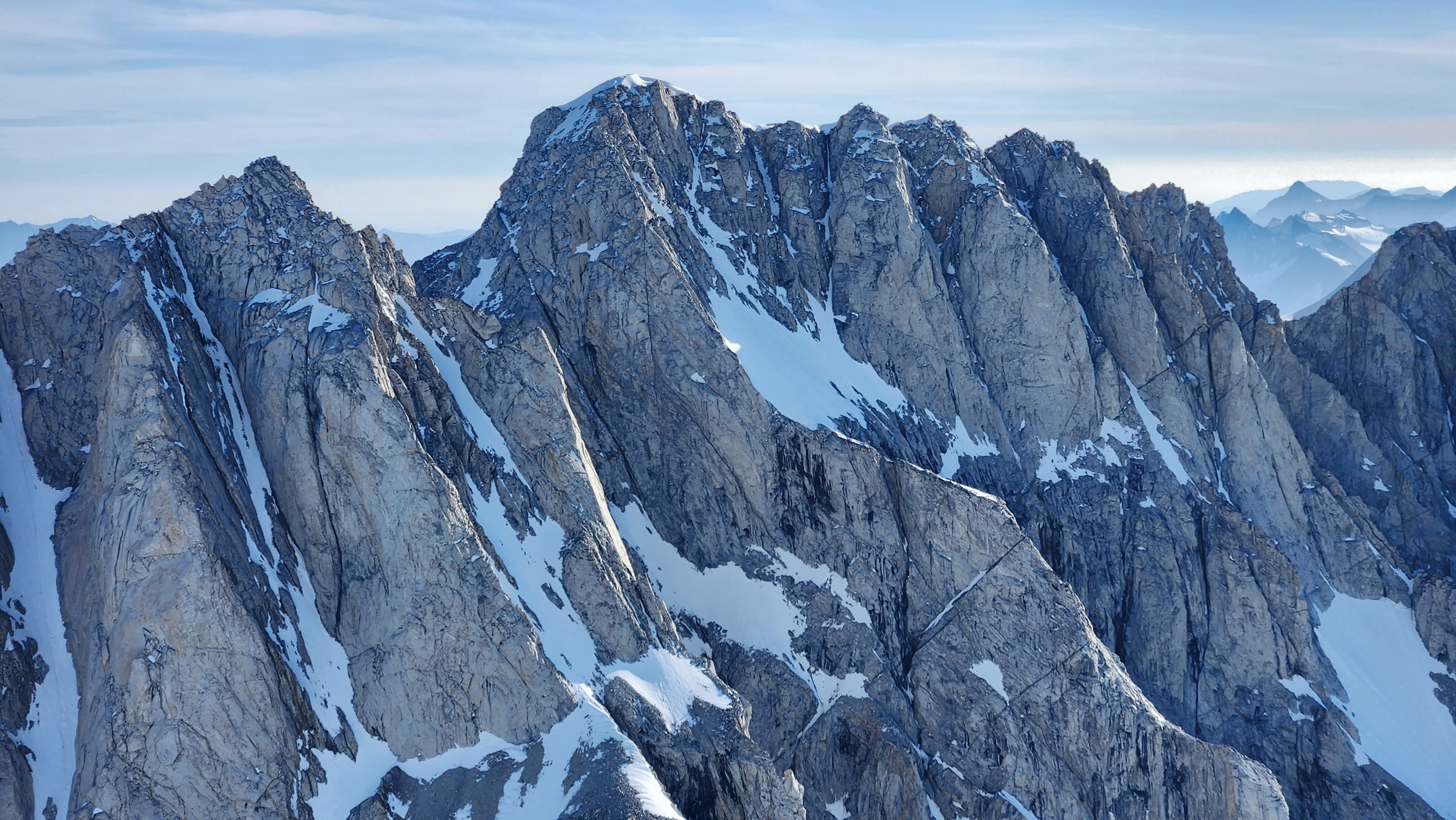
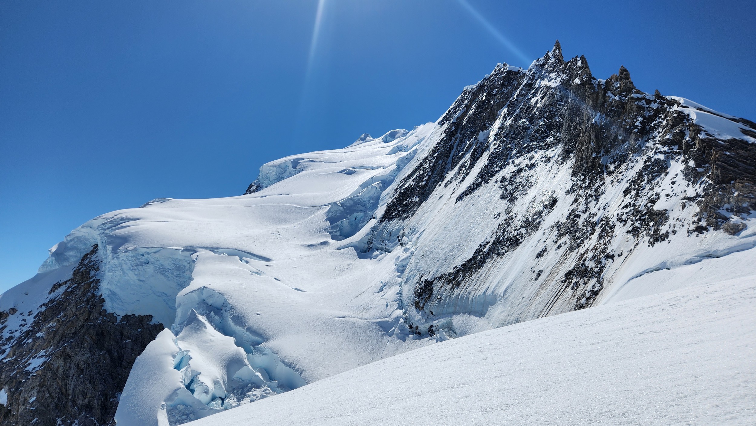
I had a range of emotions once we were on the summit. A combination of excitement, hippieness and relief. I had been trying to climb this mountain for many years, and had even driven up to the White Saddle air ranch in 2019 and camped out on their lawn for nearly a week in the rain without ever flying in due to the awful weather. Sarah and I knew we couldn't stay long as we were going to have a long blind descent as darkness was setting in, but we made the most of the 15 minutes we stayed. The views were awe inspiring, with dozens of peaks that looked like the north cascades on steroids. The one thing that stood out the most was the Tooth, a narrow and imposing spire along the spine of Mount Waddington that we were unable to appreciate from the west or at any point on route.
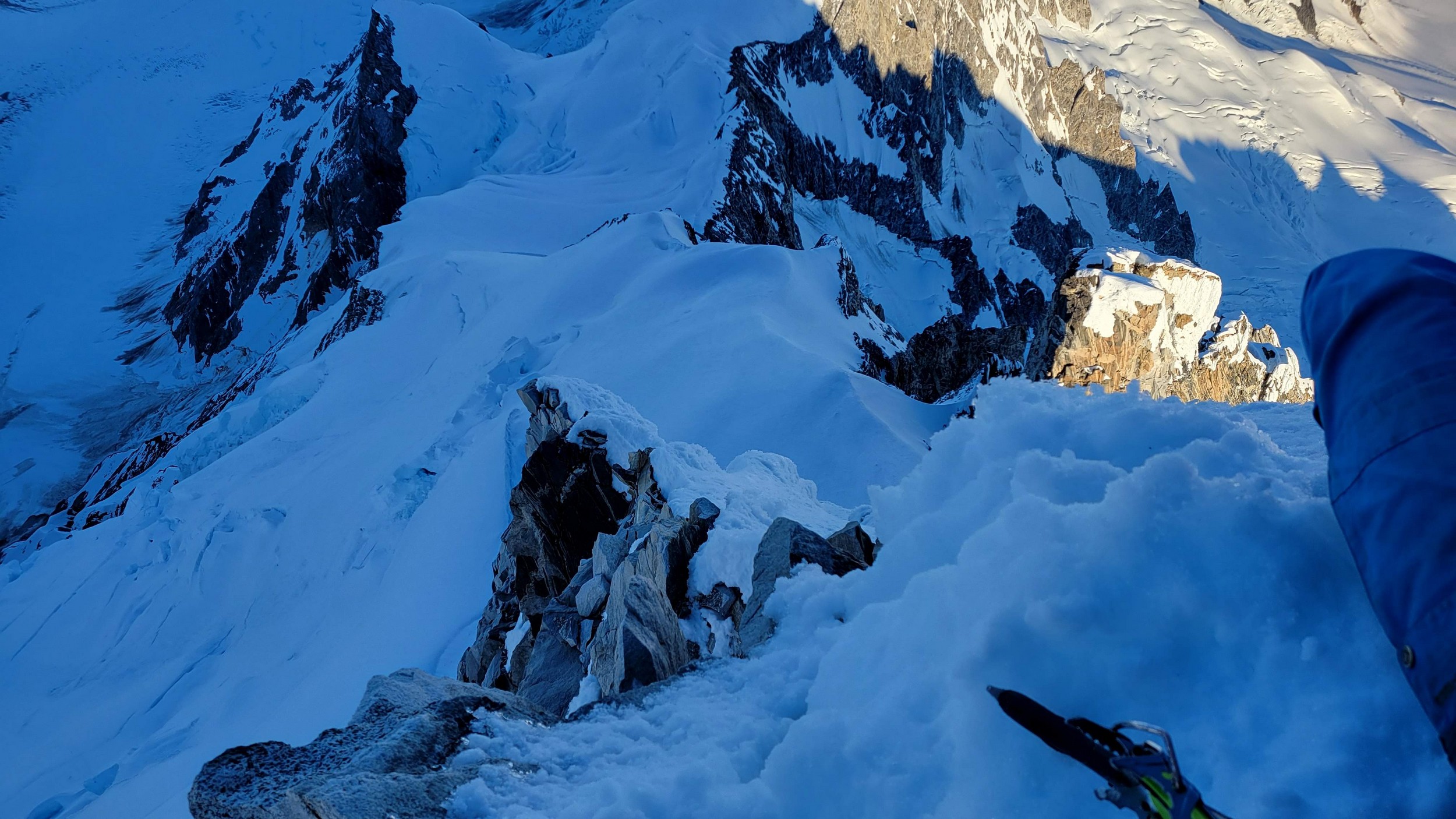
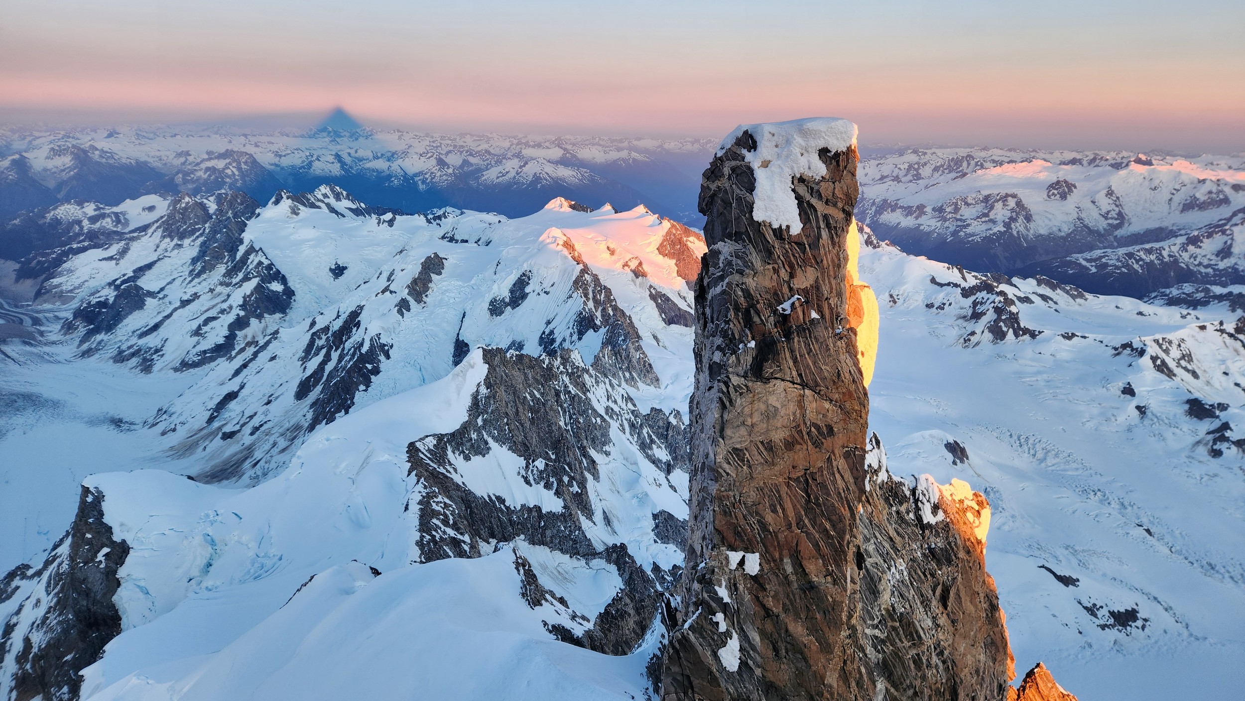
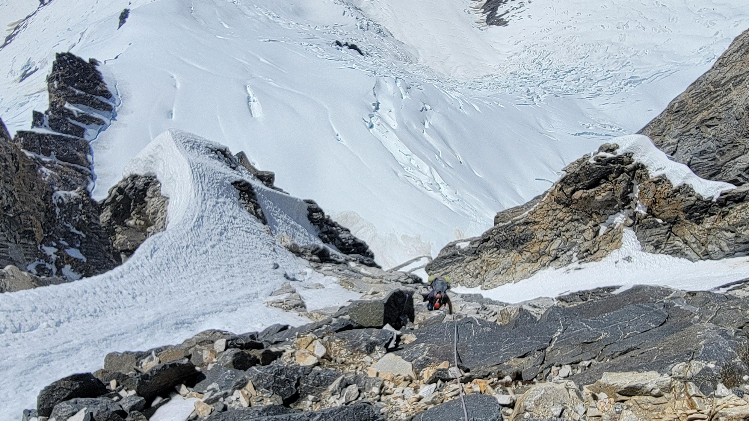
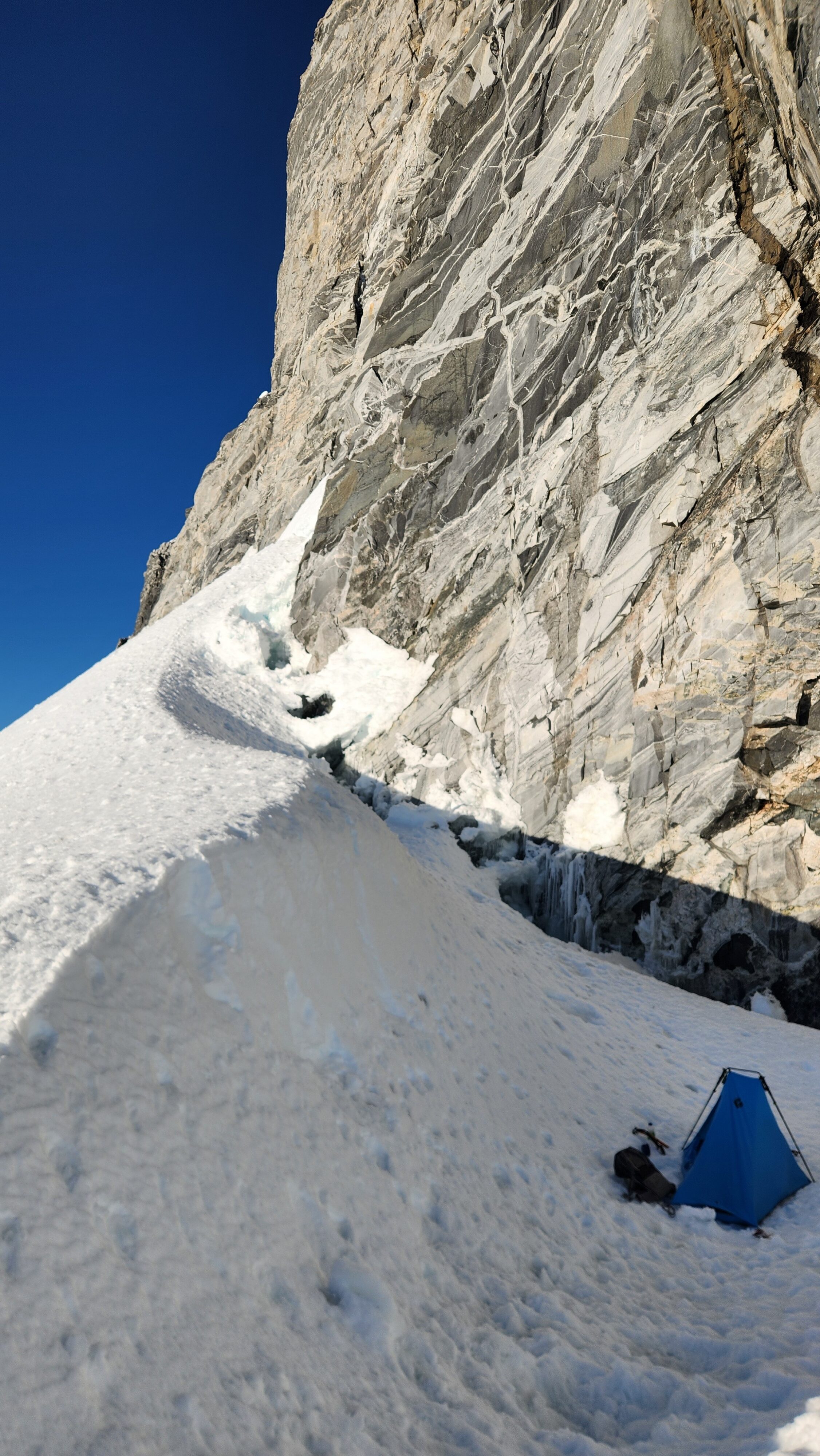
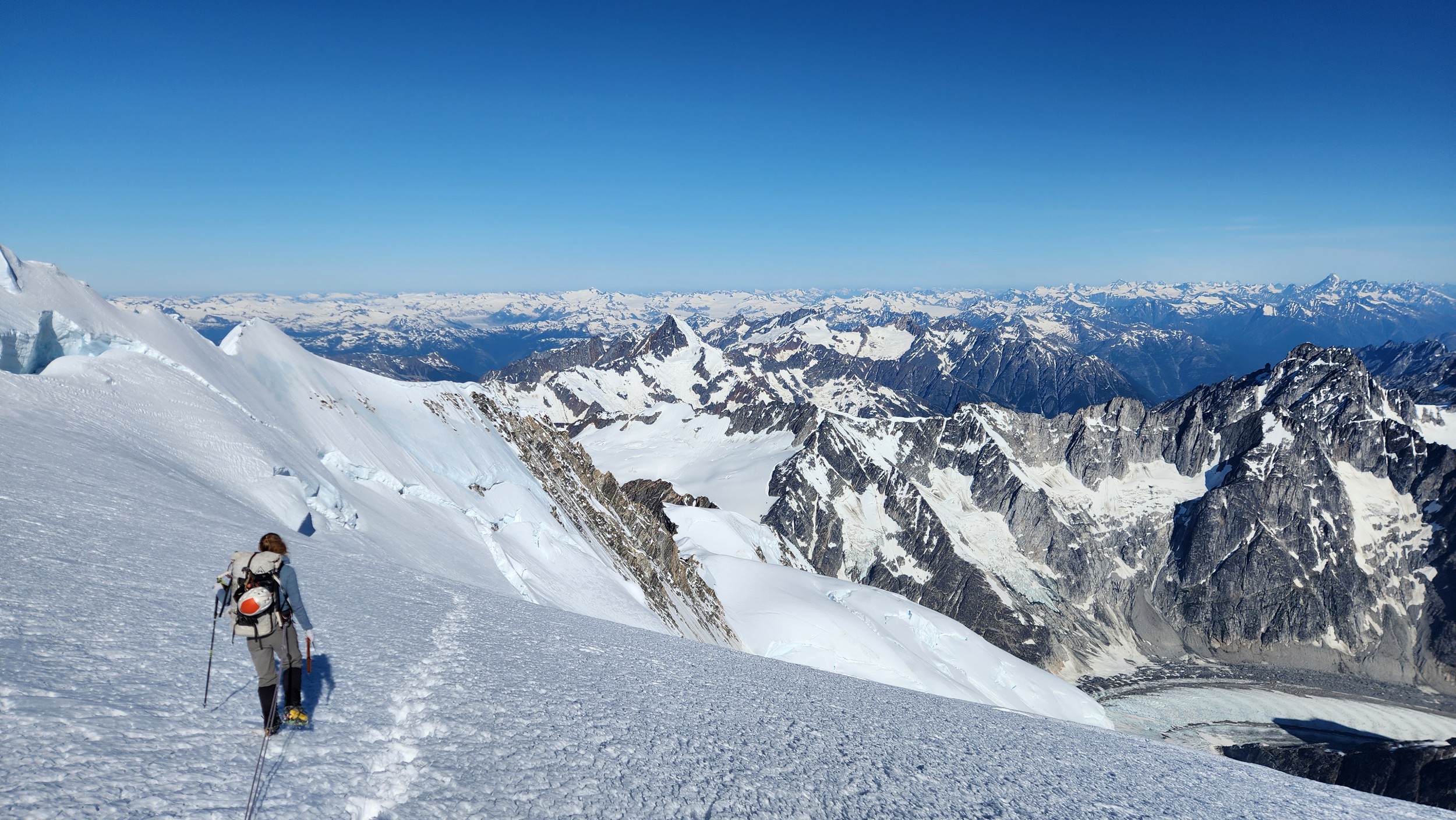
We started rapping down the standard route NE gully. Luckily since Langdon had just been on the summit a few hours prior, we had footprints in the snow to follow. We made something like 7-8 rappels down the ridge towards the Tooth, then once we reached the notch we turned skiers left and continued rapping as it got totally dark. We ended up descending route 169A in the Waddington guide. We really struggled to find anchors on this part of the descent in the dark and ended up leaving a few pieces. On top of that, it was an awfully loose pile of crap with not much in the way of climbable features, and I would not recommend this route as a bypass for the full chimney route that begins further south. Finally, by about 2am we finished the last rappel over the large bergschrund and onto the Stroll and by some miracle, Sarah found a flat spot to pitch the tent just a few steps away right at the base of a large cliff. I was too exhausted and beat to eat anything and since I was already dry heaving on those final couple rappels I already lost any appetite. We went right to sleep.
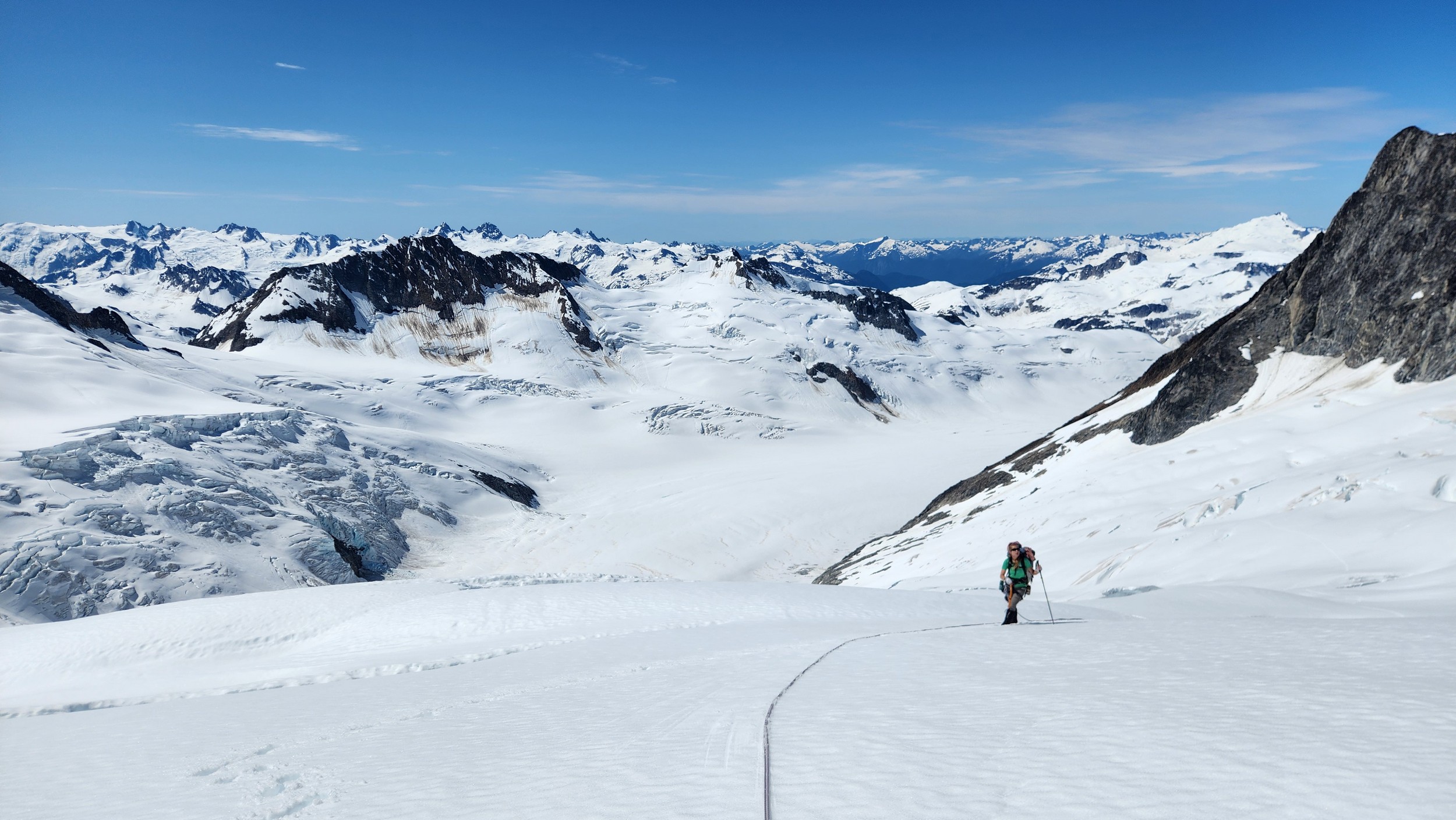
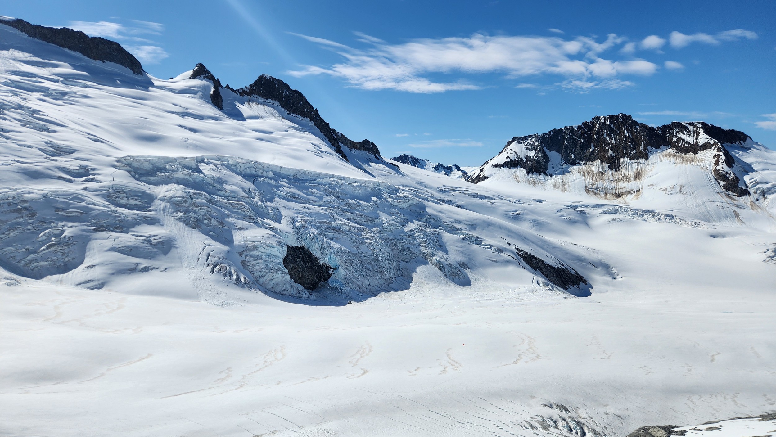
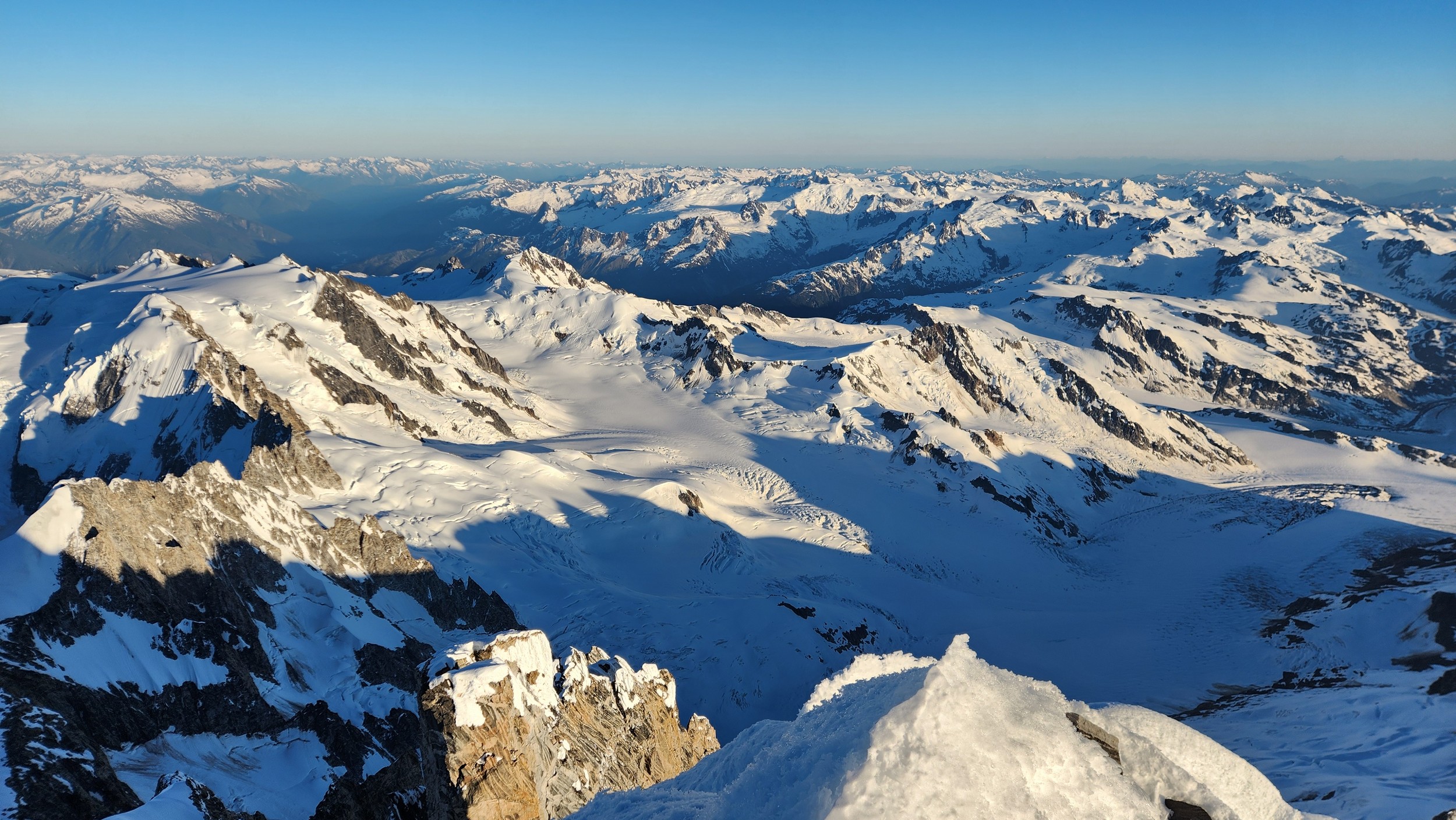
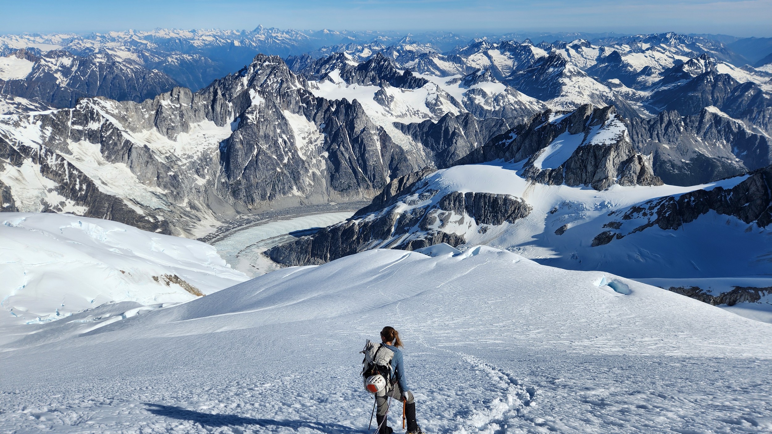
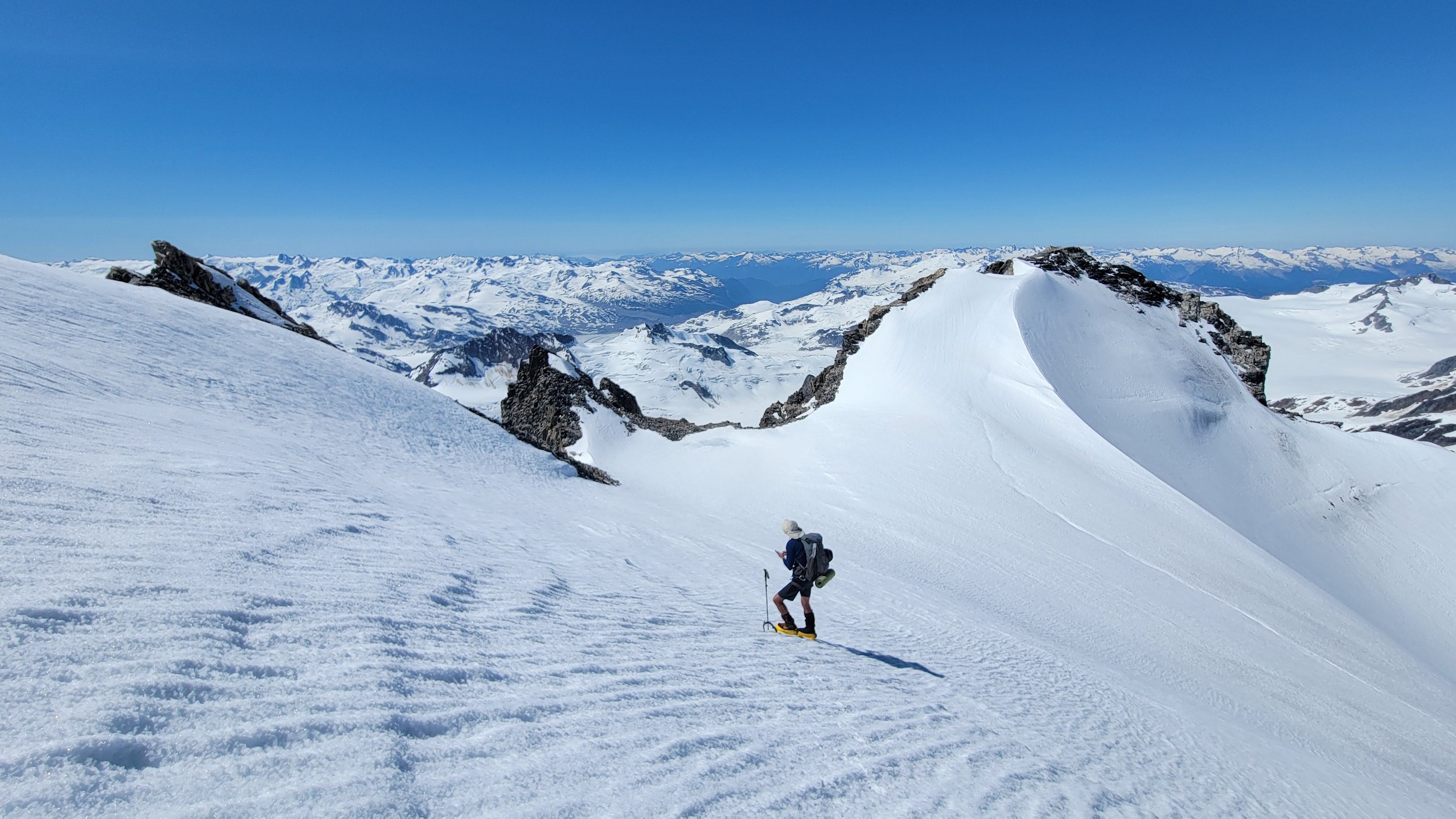
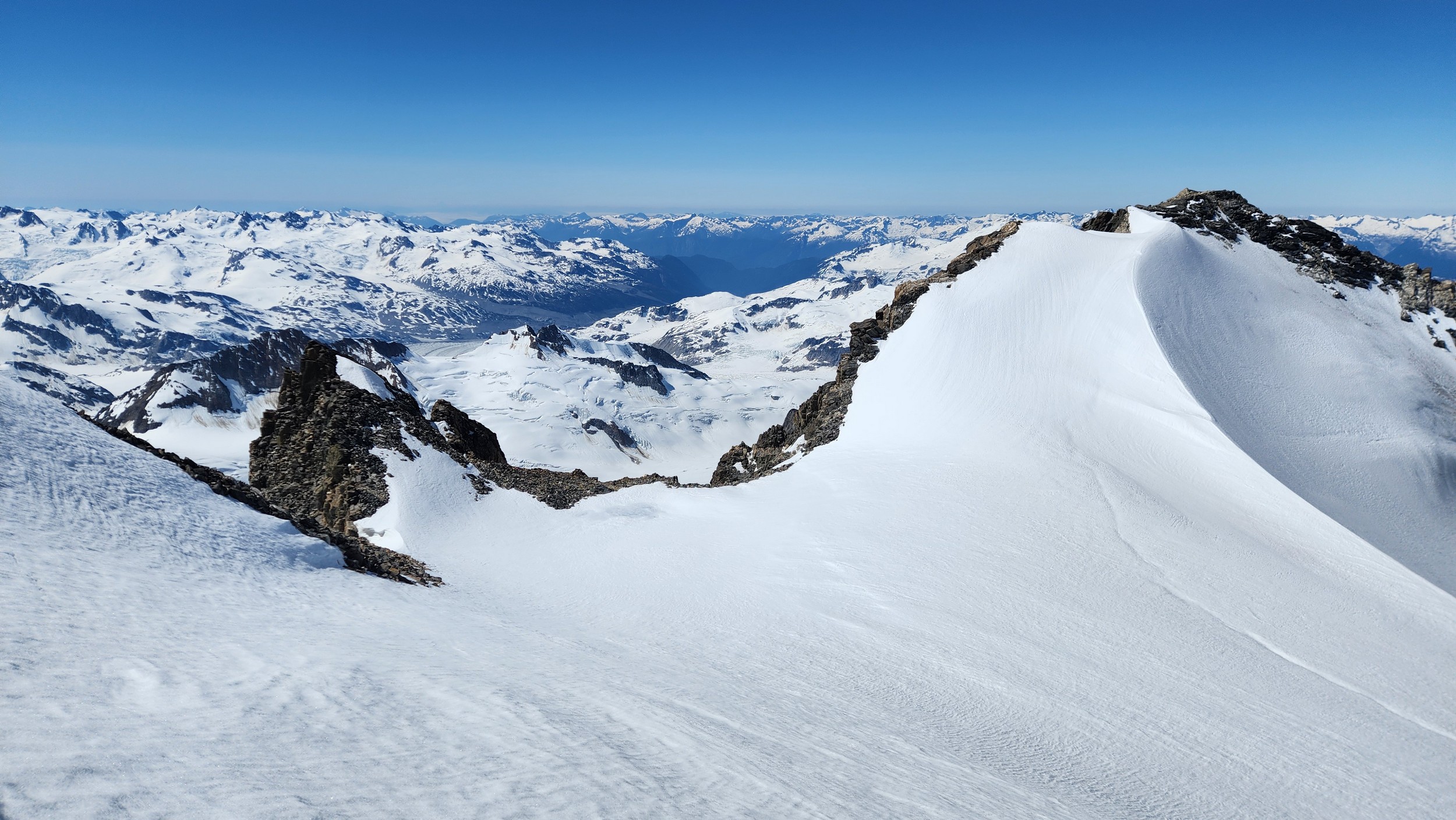
The sky transitioned to light after just a few hours and by 7am I had already climbed out to look to the east and get a good look around. We still had a decent ways to get back to our base camp as we needed to traverse the Stroll north and up to the Angel Shoulder. That part ended up being pretty easy as we were able to just follow footsteps from Langdon's descent. We reascended about 400 feet, then crossed the shoulder and started down the upper Angel Glacier and we saw their camp on Combatant col as we made our way down the Angel Glacier. Instead of following their tracks to the right and down the steep snow directly to the col (via a route called The Tunnel), we continued all the way down the Angel Glacier in a northwest direction to where it starts curving to the right. We then had to make two large crevasse crossings on serviceable snow bridges before reascending a couple hundred feet westward towards Councillor Peak. We jumped one last crevasse before reaching the top of the couloir that would drop us back down onto the Dais Glacier (route 190 in the Waddington guide). Descending this couloir was actually really straightforward plunge stepping. The unfortunate part was the snow on the Dais became quite sloppy in the afternoon as we made our way back down to our base camp, so it took longer than we had hoped and we were told we'd need to wait until the following morning for our helicopter pickup. Not an issue though as the weather was still great and we had plenty of food and drinks stored at the base camp. A gorgeous afternoon of lounging around the tent was had and by 7am the next morning we were picked up and back at White Saddle 45 minutes later. Overall an insanely great success, and one I will never forget.
Map
-
{{#owner}}
-
{{#url}}
{{#avatarSrc}}
{{name}} {{/url}} {{^url}} {{#avatar}} {{& avatar}} {{/avatar}} {{name}} {{/url}} - {{/owner}} {{#created}}
- {{created}} {{/created}}